Property Record
616 E Walnut Ave, Dalton, GA 30721

Property Detail
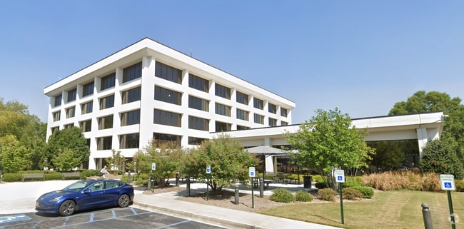
616 E Walnut Ave
12-256-09-000
E WALNUT & HARRIS ST (PLANT 61)
Commercialnec
Whitfield
B and X Area of moderate flood hazard, usually the area between the limits of the 100-year and 500-year floods.
Georgia
2025
18 AC
2025
Georgia Northwest
001200
Other Market Areas
38,016 SF
Dalton, GA
NEARBY LISTINGS FOR SALE OR LEASE
-
-
-
No Photo
-
View all Dalton listings for sale on LoopNet.com
DEMOGRAPHICS near 616 E Walnut Ave
1 mile
3 mile
5 mile
2025 Total Population
6,278
42,488
64,922
2030 Population
6,442
43,513
66,450
Pop Growth 2025-2030
+ 2.61%
+ 2.41%
+ 2.35%
Average Age
35
37
38
2025 Total Households
2,046
14,317
22,432
HH Growth 2025-2030
+ 2.59%
+ 2.51%
+ 2.42%
Median Household Inc
$52,215
$53,349
$55,992
Avg Household Size
3.00
2.90
2.80
2025 Avg HH Vehicles
2.00
2.00
2.00
Median Home Value
$194,573
$221,433
$232,256
Median Year Built
1978
1981
1984
Nearby Places
Map Layers
Map Styles
 Street
 Aerial
Transit
 Traffic
 Biking
Places
Listings with unknown addresses are not visible on the map
- Restaurants
- Banks
- Shops
- Fitness
- Groceries
PUBLIC TRANSPORTATION
AIRPORT
Lovell Field
Drive
Walk
Distance
Lovell Field
41 min
30.0 mi
Freight Ports
Georgia Ports - Savannah
Drive
Walk
Distance
Georgia Ports - Savannah
378 min
337.6 mi
Nearby Properties
Address
Land Use
TOTAL SIZE
Lot Size
Zoning
Address
Land Use
TOTAL SIZE
Lot Size
Zoning
34,320 SF
13.50 AC
Address
Land Use
TOTAL SIZE
Lot Size
Zoning
54,546 SF
128.30 AC
Address
Land Use
TOTAL SIZE
Lot Size
Zoning
500,075 SF
11.48 AC
M2
Address
Land Use
TOTAL SIZE
Lot Size
Zoning
39,664 SF
27.50 AC
C-2
Address
Land Use
TOTAL SIZE
Lot Size
Zoning
784,920 SF
56.60 AC
M-2
Address
Land Use
TOTAL SIZE
Lot Size
Zoning
123,430 SF
51.17 AC
Address
Land Use
TOTAL SIZE
Lot Size
Zoning
346,476 SF
31.41 AC
Address
Land Use
TOTAL SIZE
Lot Size
Zoning
1,183,067 SF
48.97 AC
M2
Address
Land Use
TOTAL SIZE
Lot Size
Zoning
133,712 SF
14.93 AC
R7
Address
Land Use
TOTAL SIZE
Lot Size
Zoning
193,716 SF
29.23 AC
Address
Land Use
TOTAL SIZE
Lot Size
Zoning
195,990 SF
60.25 AC
Address
Land Use
TOTAL SIZE
Lot Size
Zoning
664,020 SF
28.75 AC
M-2
Address
Land Use
TOTAL SIZE
Lot Size
Zoning
662,926 SF
67.28 AC
M2
Address
Land Use
TOTAL SIZE
Lot Size
Zoning
68,465 SF
0.71 AC
Address
Land Use
TOTAL SIZE
Lot Size
Zoning
100,084 SF
1.47 AC
Address
Land Use
TOTAL SIZE
Lot Size
Zoning
115,979 SF
10.60 AC
C2
Address
Land Use
TOTAL SIZE
Lot Size
Zoning
760,961 SF
24.63 AC
M2
Address
Land Use
TOTAL SIZE
Lot Size
Zoning
125,756 SF
7 AC
Address
Land Use
TOTAL SIZE
Lot Size
Zoning
150,772 SF
12.66 AC
C2
Address
Land Use
TOTAL SIZE
Lot Size
Zoning
84,200 SF
22.70 AC
Address
Land Use
TOTAL SIZE
Lot Size
Zoning
391,865 SF
17.51 AC
Address
Land Use
TOTAL SIZE
Lot Size
Zoning
219,744 SF
12.74 AC
M-2
Address
Land Use
TOTAL SIZE
Lot Size
Zoning
147,860 SF
11.86 AC
R-7
Address
Land Use
TOTAL SIZE
Lot Size
Zoning
184,747 SF
87.57 AC
Address
Land Use
TOTAL SIZE
Lot Size
Zoning
18,016 SF
27.65 AC
M-2
Address
Land Use
TOTAL SIZE
Lot Size
Zoning
55,020 SF
7.02 AC
Address
Land Use
TOTAL SIZE
Lot Size
Zoning
1,125,548 SF
24.22 AC
M2
Address
Land Use
TOTAL SIZE
Lot Size
Zoning
127,376 SF
5.64 AC
Address
Land Use
TOTAL SIZE
Lot Size
Zoning
283,000 SF
29.32 AC
The World's #1 Commercial Real Estate Marketplace
Connect with us
© 2026 CoStar Group
The information above has been obtained from sources believed reliable. While we do not doubt its accuracy we have not verified it and make no guarantee, warranty or representation about it. It is your responsibility to independently confirm its accuracy and completeness. Any projections, opinions, assumptions, or estimates used are for example only and do not represent the current or future performance of the property. The value of this transaction to you depends on tax and other factors which should be evaluated by your tax, financial, and legal advisors. You and your advisors should conduct a careful, independent investigation of the property to determine to your satisfaction the suitability of the property for your needs.