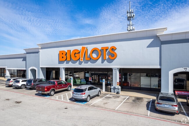
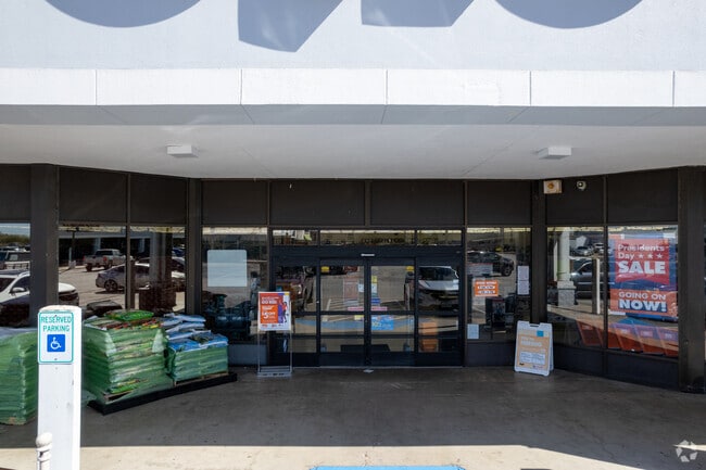
Property Record
6160 Highway 6 N, Houston, TX 77084

Save to a Folder
{{folder.Name}}
{{folder.ListingIds.length}} Properties
{{folder.ListingIds.length}} Property
Create a New Folder
Property Detail
6160 Highway 6 N
1144850000002
RES B B1 B2 B3 & B4 & RES A HEARTHSTONE CORNERS SHOP CENTER PAR R/P COLONIES COMMERCIAL SEC 1
Regionalshoppingcenterormallwithanchorstore
HARRIS
B and X Area of moderate flood hazard, usually the area between the limits of the 100-year and 500-year floods.
Texas
2025
16.34 AC
2025
Addicks
540602
Houston
215,153 SF
Houston-Pasadena-The Woodlands, TX
NEARBY LISTINGS FOR SALE OR LEASE
DEMOGRAPHICS near 6160 Highway 6 N
1 mile
3 mile
5 mile
2025 Total Population
22,108
137,255
308,123
2030 Population
23,397
144,618
325,491
Pop Growth 2025-2030
+ 5.83%
+ 5.36%
+ 5.64%
Average Age
36
38
37
2025 Total Households
7,798
45,928
101,640
HH Growth 2025-2030
+ 6.09%
+ 5.59%
+ 5.81%
Median Household Inc
$82,662
$82,751
$88,013
Avg Household Size
2.80
2.90
3.00
2025 Avg HH Vehicles
2.00
2.00
2.00
Median Home Value
$262,545
$268,963
$281,853
Median Year Built
1993
1989
1998
Nearby Places
Map Layers
Map Styles
 Street
 Aerial
Layers
 Traffic
 Biking
Places
Listings with unknown addresses are not visible on the map
- Restaurants
- Banks
- Shops
- Fitness
- Groceries
PUBLIC TRANSPORTATION
AIRPORT
George Bush Intcntl/Houston
Drive
Walk
Distance
George Bush Intcntl/Houston
37 min
29.3 mi
William P Hobby
Drive
Walk
Distance
William P Hobby
53 min
38.5 mi
Freight Ports
Port of Houston
Drive
Walk
Distance
Port of Houston
1 min
24.3 mi
SALE & LEASE HISTORY
LISTING DATE
SALE/LEASE

Sep 25, 2016
For Lease
Mar 09, 2021
For Lease
Jul 18, 2017
For Lease
Nearby Properties
Address
Land Use
TOTAL SIZE
Lot Size
Zoning
Address
Land Use
TOTAL SIZE
Lot Size
Zoning
697,158 SF
Address
Land Use
TOTAL SIZE
Lot Size
Zoning
386,642 SF
14.45 AC
Address
Land Use
TOTAL SIZE
Lot Size
Zoning
120.78 AC
Address
Land Use
TOTAL SIZE
Lot Size
Zoning
358,713 SF
19.91 AC
Address
Land Use
TOTAL SIZE
Lot Size
Zoning
320,084 SF
8.01 AC
Address
Land Use
TOTAL SIZE
Lot Size
Zoning
387,245 SF
18.18 AC
Address
Land Use
TOTAL SIZE
Lot Size
Zoning
408,144 SF
26.13 AC
Address
Land Use
TOTAL SIZE
Lot Size
Zoning
418,572 SF
24.76 AC
Address
Land Use
TOTAL SIZE
Lot Size
Zoning
392,185 SF
30.73 AC
Address
Land Use
TOTAL SIZE
Lot Size
Zoning
491,051 SF
50 AC
Address
Land Use
TOTAL SIZE
Lot Size
Zoning
388,223 SF
14.99 AC
Address
Land Use
TOTAL SIZE
Lot Size
Zoning
363,896 SF
21.69 AC
Address
Land Use
TOTAL SIZE
Lot Size
Zoning
412,250 SF
45.79 AC
Address
Land Use
TOTAL SIZE
Lot Size
Zoning
112,440 SF
8.02 AC
Address
Land Use
TOTAL SIZE
Lot Size
Zoning
301,102 SF
12.58 AC
Address
Land Use
TOTAL SIZE
Lot Size
Zoning
493,233 SF
25.82 AC
Address
Land Use
TOTAL SIZE
Lot Size
Zoning
232,717 SF
10.21 AC
Address
Land Use
TOTAL SIZE
Lot Size
Zoning
292,466 SF
12.18 AC
Address
Land Use
TOTAL SIZE
Lot Size
Zoning
312,939 SF
22.80 AC
Address
Land Use
TOTAL SIZE
Lot Size
Zoning
351,468 SF
16.05 AC
Address
Land Use
TOTAL SIZE
Lot Size
Zoning
300,000 SF
20.07 AC
Address
Land Use
TOTAL SIZE
Lot Size
Zoning
250,178 SF
Address
Land Use
TOTAL SIZE
Lot Size
Zoning
147,900 SF
5.76 AC
Address
Land Use
TOTAL SIZE
Lot Size
Zoning
198,510 SF
17.13 AC
Address
Land Use
TOTAL SIZE
Lot Size
Zoning
150,570 SF
18.16 AC
Address
Land Use
TOTAL SIZE
Lot Size
Zoning
207,282 SF
8.96 AC
Address
Land Use
TOTAL SIZE
Lot Size
Zoning
516,943 SF
61.56 AC
Address
Land Use
TOTAL SIZE
Lot Size
Zoning
116,997 SF
10.82 AC
Address
Land Use
TOTAL SIZE
Lot Size
Zoning
257,816 SF
10.43 AC
The World's #1 Commercial Real Estate Marketplace
Connect with us
© 2026 CoStar Group
The information above has been obtained from sources believed reliable. While we do not doubt its accuracy we have not verified it and make no guarantee, warranty or representation about it. It is your responsibility to independently confirm its accuracy and completeness. Any projections, opinions, assumptions, or estimates used are for example only and do not represent the current or future performance of the property. The value of this transaction to you depends on tax and other factors which should be evaluated by your tax, financial, and legal advisors. You and your advisors should conduct a careful, independent investigation of the property to determine to your satisfaction the suitability of the property for your needs.