Property Record
6161 Hillside Ave, Indianapolis, IN 46220
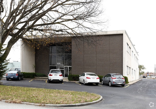


This Property Is For Sale
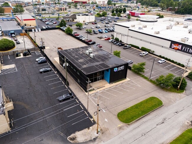
NEARBY LISTINGS FOR SALE OR LEASE
Property Detail
6161 Hillside Ave
49-07-06-128-002.000-801
PT NE1/4 NE1/4 S6 T16 R4 BEG 287S & 282.14W OFNE COR; W370.54 S100 E370.54 N100 TO BEG0.851AC
Officebuilding
Marion
X
Indiana
18097C0151G
0.85 AC
2023
Uptown
2024
Indianapolis
321300
Indianapolis-Carmel-Anderson, IN
11,396 SF
DEMOGRAPHICS near 6161 Hillside Ave
1 Mile
3 Mile
5 Mile
2024 Total Population
10,924
74,092
222,497
2029 Population
10,702
73,246
222,321
Pop Growth 2024-2029
(2.03%)
(1.14%)
(0.08%)
Average Age
39
40
38
2024 Total Households
5,510
33,343
97,527
HH Growth 2024-2029
(2.25%)
(1.27%)
(0.19%)
Median Household Inc
$92,247
$86,944
$61,731
Avg Household Size
1.90
2.10
2.20
2024 Avg HH Vehicles
2.00
2.00
2.00
Median Home Value
$262,272
$296,344
$252,936
Median Year Built
1956
1958
1965
Nearby Places
Map Layers
Map Styles
 Street
 Aerial
- Restaurants
- Banks
- Shops
- Fitness
- Groceries
PUBLIC TRANSPORTATION
COMMUTER RAIL
DRIVE
WALK
Distance
18 min
9.4 mi
AIRPORT
Indianapolis International
DRIVE
WALK
Distance
Indianapolis International
40 min
22.4 mi
Nearby Properties
Address
Land Use
TOTAL SIZE
Lot Size
Zoning
Address
Land Use
TOTAL SIZE
Lot Size
Zoning
4,146 SF
45.91 AC
ZO01
Address
Land Use
TOTAL SIZE
Lot Size
Zoning
8,157 SF
113.93 AC
ZO01
Address
Land Use
TOTAL SIZE
Lot Size
Zoning
143,890 SF
37.81 AC
ZO01
Address
Land Use
TOTAL SIZE
Lot Size
Zoning
50,698 SF
13.58 AC
Address
Land Use
TOTAL SIZE
Lot Size
Zoning
866 SF
14.33 AC
ZO01
Address
Land Use
TOTAL SIZE
Lot Size
Zoning
76,657 SF
9.45 AC
ZO01
Address
Land Use
TOTAL SIZE
Lot Size
Zoning
272,688 SF
14.60 AC
ZO01
Address
Land Use
TOTAL SIZE
Lot Size
Zoning
2,156 SF
0.46 AC
ZO01
Address
Land Use
TOTAL SIZE
Lot Size
Zoning
2,142 SF
9.91 AC
ZO01
Address
Land Use
TOTAL SIZE
Lot Size
Zoning
2.81 AC
ZO01
Address
Land Use
TOTAL SIZE
Lot Size
Zoning
13,789 SF
3.93 AC
ZO01
Address
Land Use
TOTAL SIZE
Lot Size
Zoning
2,313 SF
35.45 AC
ZO01
Address
Land Use
TOTAL SIZE
Lot Size
Zoning
29,662 SF
17.96 AC
ZO01
Address
Land Use
TOTAL SIZE
Lot Size
Zoning
1,080 SF
19.24 AC
Address
Land Use
TOTAL SIZE
Lot Size
Zoning
98,790 SF
0.18 AC
ZO01
Address
Land Use
TOTAL SIZE
Lot Size
Zoning
5,670 SF
25.69 AC
Address
Land Use
TOTAL SIZE
Lot Size
Zoning
81,511 SF
13.55 AC
Address
Land Use
TOTAL SIZE
Lot Size
Zoning
170,049 SF
12.74 AC
ZO01
Address
Land Use
TOTAL SIZE
Lot Size
Zoning
80,072 SF
32.54 AC
Address
Land Use
TOTAL SIZE
Lot Size
Zoning
1,903 SF
20.77 AC
ZO01
Address
Land Use
TOTAL SIZE
Lot Size
Zoning
9,930 SF
9.10 AC
ZO01
Address
Land Use
TOTAL SIZE
Lot Size
Zoning
2,044 SF
16.53 AC
ZO01
Address
Land Use
TOTAL SIZE
Lot Size
Zoning
7,740 SF
2.04 AC
ZO01
Address
Land Use
TOTAL SIZE
Lot Size
Zoning
63,490 SF
29.07 AC
ZO01
Address
Land Use
TOTAL SIZE
Lot Size
Zoning
2,951 SF
15.45 AC
ZO01
Address
Land Use
TOTAL SIZE
Lot Size
Zoning
17,469 SF
0.87 AC
ZO01
Address
Land Use
TOTAL SIZE
Lot Size
Zoning
46,320 SF
14.93 AC
ZO01
Address
Land Use
TOTAL SIZE
Lot Size
Zoning
66,953 SF
10.87 AC
ZO01
Address
Land Use
TOTAL SIZE
Lot Size
Zoning
17,621 SF
3.20 AC
ZO01
Address
Land Use
TOTAL SIZE
Lot Size
Zoning
1,551 SF
1.23 AC
ZO01
The World's #1 Commercial Real Estate Marketplace
Connect with us
© 2025 CoStar Group
The information above has been obtained from sources believed reliable. While we do not doubt its accuracy we have not verified it and make no guarantee, warranty or representation about it. It is your responsibility to independently confirm its accuracy and completeness. Any projections, opinions, assumptions, or estimates used are for example only and do not represent the current or future performance of the property. The value of this transaction to you depends on tax and other factors which should be evaluated by your tax, financial, and legal advisors. You and your advisors should conduct a careful, independent investigation of the property to determine to your satisfaction the suitability of the property for your needs.