Property Record
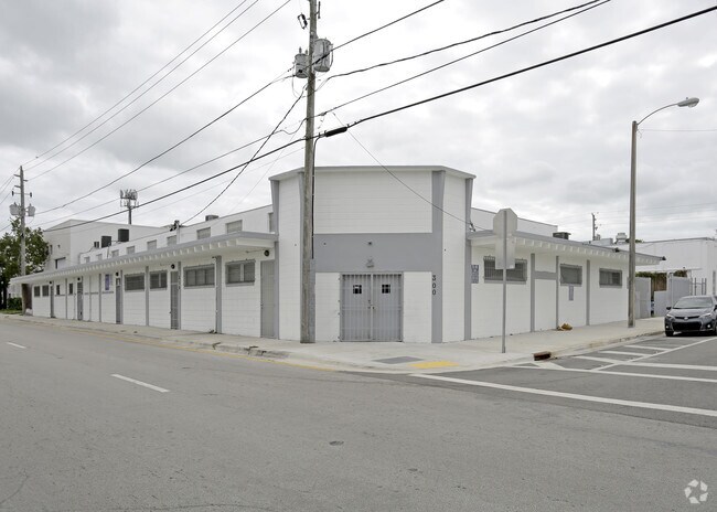
300 Ne 62Nd St, Miami, FL 33138


NEARBY LISTINGS FOR SALE OR LEASE
Property Detail
300 Ne 62Nd St
Miami-Miami Beach-Kendall, FL
Pierces Div - Lemon City
01-3218-015-0770
PIERCES DIV - LEMON CITY PB B-43 & PB 2-21 N1/2 OF LOTS 8 & 9 BLK 18 LESS N7.5FT FOR R/W LOT SIZE 13397 SQ FT OR 20338-3254 0302 1 COC 23753-2819 09 2005 1
Storemultistory
Miami/Dade
X
Florida
12086C0304L
8,9
2024
0.31 AC
2025
East Miami
002004
South Florida
10,141 SF
DEMOGRAPHICS near 300 Ne 62Nd St
1 Mile
3 Mile
5 Mile
2024 Total Population
24,564
181,834
580,048
2029 Population
24,373
181,063
576,564
Pop Growth 2024-2029
(0.78%)
(0.42%)
(0.60%)
Average Age
41
39
41
2024 Total Households
9,977
72,436
239,820
HH Growth 2024-2029
(0.91%)
(0.35%)
(0.44%)
Median Household Inc
$39,876
$47,966
$51,439
Avg Household Size
2.30
2.40
2.30
2024 Avg HH Vehicles
1.00
1.00
1.00
Median Home Value
$497,293
$404,875
$394,894
Median Year Built
1972
1974
1973
Nearby Places
Map Layers
Map Styles
 Street
 Aerial
- Restaurants
- Banks
- Shops
- Fitness
- Groceries
PUBLIC TRANSPORTATION
COMMUTER RAIL
Allapattah (Metrorail Green Line - Miami-Dade Transit (Metrorail/Metromover))
DRIVE
WALK
Distance
Allapattah (Metrorail Green Line - Miami-Dade Transit (Metrorail/Metromover))
7 min
3.4 mi
Earlington Heights (Metrorail Green Line - Miami-Dade Transit (Metrorail/Metromover))
DRIVE
WALK
Distance
Earlington Heights (Metrorail Green Line - Miami-Dade Transit (Metrorail/Metromover))
6 min
3.7 mi
AIRPORT
Miami International
DRIVE
WALK
Distance
Miami International
22 min
10.7 mi
Fort Lauderdale/Hollywood International
DRIVE
WALK
Distance
Fort Lauderdale/Hollywood International
28 min
19.9 mi
Freight Ports
Port of Miami
DRIVE
WALK
Distance
Port of Miami
14 min
5.7 mi
Nearby Properties
Address
Land Use
TOTAL SIZE
Lot Size
Zoning
Address
Land Use
TOTAL SIZE
Lot Size
Zoning
16.13 AC
6100
Address
Land Use
TOTAL SIZE
Lot Size
Zoning
1,938,271 SF
6.62 AC
6402
Address
Land Use
TOTAL SIZE
Lot Size
Zoning
1,075,124 SF
1.61 AC
6405
Address
Land Use
TOTAL SIZE
Lot Size
Zoning
256,089 SF
20.35 AC
7600
Address
Land Use
TOTAL SIZE
Lot Size
Zoning
585,775 SF
1.86 AC
6101
Address
Land Use
TOTAL SIZE
Lot Size
Zoning
868,860 SF
2.14 AC
6402
Address
Land Use
TOTAL SIZE
Lot Size
Zoning
615,785 SF
3.81 AC
4604
Address
Land Use
TOTAL SIZE
Lot Size
Zoning
790,139 SF
1.80 AC
6110
Address
Land Use
TOTAL SIZE
Lot Size
Zoning
570,694 SF
1.37 AC
4604
Address
Land Use
TOTAL SIZE
Lot Size
Zoning
566,165 SF
2.09 AC
6101
Address
Land Use
TOTAL SIZE
Lot Size
Zoning
701,056 SF
1.58 AC
6402
Address
Land Use
TOTAL SIZE
Lot Size
Zoning
600,250 SF
2.03 AC
6402
Address
Land Use
TOTAL SIZE
Lot Size
Zoning
627,685 SF
2.06 AC
6100
Address
Land Use
TOTAL SIZE
Lot Size
Zoning
519,775 SF
2.27 AC
6100
Address
Land Use
TOTAL SIZE
Lot Size
Zoning
669,245 SF
0.69 AC
6600
Address
Land Use
TOTAL SIZE
Lot Size
Zoning
768,663 SF
2.85 AC
4600
Address
Land Use
TOTAL SIZE
Lot Size
Zoning
737,810 SF
1.05 AC
6600
Address
Land Use
TOTAL SIZE
Lot Size
Zoning
595,100 SF
0.92 AC
4604
Address
Land Use
TOTAL SIZE
Lot Size
Zoning
428,154 SF
1.39 AC
6101
Address
Land Use
TOTAL SIZE
Lot Size
Zoning
221,570 SF
1.79 AC
6100
Address
Land Use
TOTAL SIZE
Lot Size
Zoning
596,081 SF
4.33 AC
9600
Address
Land Use
TOTAL SIZE
Lot Size
Zoning
264,272 SF
2.18 AC
6110
Address
Land Use
TOTAL SIZE
Lot Size
Zoning
545,562 SF
1.71 AC
6110
Address
Land Use
TOTAL SIZE
Lot Size
Zoning
469,492 SF
2.06 AC
4604
Address
Land Use
TOTAL SIZE
Lot Size
Zoning
567,884 SF
4.51 AC
4000
Address
Land Use
TOTAL SIZE
Lot Size
Zoning
505,007 SF
1.99 AC
4604
Address
Land Use
TOTAL SIZE
Lot Size
Zoning
473,168 SF
3.27 AC
6405
Address
Land Use
TOTAL SIZE
Lot Size
Zoning
303,688 SF
1.01 AC
6100
Address
Land Use
TOTAL SIZE
Lot Size
Zoning
499,370 SF
1.45 AC
7000
The World's #1 Commercial Real Estate Marketplace
Connect with us
© 2026 CoStar Group
The information above has been obtained from sources believed reliable. While we do not doubt its accuracy we have not verified it and make no guarantee, warranty or representation about it. It is your responsibility to independently confirm its accuracy and completeness. Any projections, opinions, assumptions, or estimates used are for example only and do not represent the current or future performance of the property. The value of this transaction to you depends on tax and other factors which should be evaluated by your tax, financial, and legal advisors. You and your advisors should conduct a careful, independent investigation of the property to determine to your satisfaction the suitability of the property for your needs.