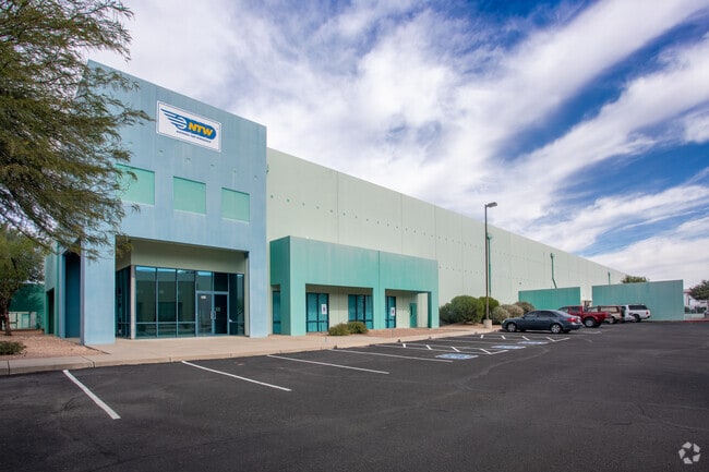
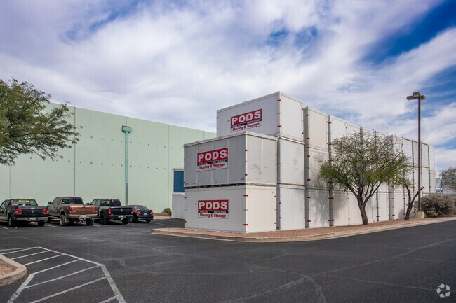
Property Record
6161 S Palo Verde Rd, Tucson, AZ 85706
NEARBY LISTINGS FOR SALE OR LEASE
Property Detail
6161 S Palo Verde Rd
Tucson, AZ
Tucson International Business Center
140-29-052C
TUCSON INTERNATIONAL BUSINESS CENTER E268.11 W790 N384 LOT 43
Warehouse
Pima
X
Arizona
04019C2293L
43
2025
4.96 AC
2025
SW Tucson/Airport
004115
Tucson
128,941 SF
DEMOGRAPHICS near 6161 S Palo Verde Rd
1 Mile
3 Mile
5 Mile
2024 Total Population
11,314
52,450
145,715
2029 Population
11,746
54,130
150,199
Pop Growth 2024-2029
+ 3.82%
+ 3.20%
+ 3.08%
Average Age
33
34
35
2024 Total Households
3,700
17,379
49,980
HH Growth 2024-2029
+ 3.76%
+ 3.18%
+ 3.07%
Median Household Inc
$45,896
$48,923
$46,394
Avg Household Size
3.00
2.90
2.80
2024 Avg HH Vehicles
2.00
2.00
2.00
Median Home Value
$134,634
$159,061
$153,203
Median Year Built
1983
1986
1978
Nearby Places
Map Layers
Map Styles
 Street
 Aerial
- Restaurants
- Banks
- Shops
- Fitness
- Groceries
PUBLIC TRANSPORTATION
AIRPORT
Tucson International
DRIVE
WALK
Distance
Tucson International
7 min
2.8 mi
SALE & LEASE HISTORY
LISTING DATE
SALE/LEASE

Sep 24, 2016
For Lease
Dec 15, 2022
For Lease
Nearby Properties
Address
Land Use
TOTAL SIZE
Lot Size
Zoning
Address
Land Use
TOTAL SIZE
Lot Size
Zoning
152,116 SF
17.35 AC
I1
Address
Land Use
TOTAL SIZE
Lot Size
Zoning
806,459 SF
180.96 AC
R1
Address
Land Use
TOTAL SIZE
Lot Size
Zoning
1,207,845 SF
78.85 AC
Address
Land Use
TOTAL SIZE
Lot Size
Zoning
544,787 SF
84.11 AC
CI1
Address
Land Use
TOTAL SIZE
Lot Size
Zoning
1,042,346 SF
751.86 AC
Address
Land Use
TOTAL SIZE
Lot Size
Zoning
41,791 SF
24.86 AC
Address
Land Use
TOTAL SIZE
Lot Size
Zoning
1,037,850 SF
618.47 AC
CI2
Address
Land Use
TOTAL SIZE
Lot Size
Zoning
297,624 SF
36.54 AC
R2
Address
Land Use
TOTAL SIZE
Lot Size
Zoning
413,807 SF
514.76 AC
CI2
Address
Land Use
TOTAL SIZE
Lot Size
Zoning
298,989 SF
21.76 AC
Address
Land Use
TOTAL SIZE
Lot Size
Zoning
220,812 SF
193.24 AC
R1
Address
Land Use
TOTAL SIZE
Lot Size
Zoning
229,320 SF
25.85 AC
Address
Land Use
TOTAL SIZE
Lot Size
Zoning
183,196 SF
36.82 AC
R2
Address
Land Use
TOTAL SIZE
Lot Size
Zoning
1,285,663 SF
45.73 AC
CI1
Address
Land Use
TOTAL SIZE
Lot Size
Zoning
302,444 SF
17 AC
I1
Address
Land Use
TOTAL SIZE
Lot Size
Zoning
213,200 SF
38.40 AC
Address
Land Use
TOTAL SIZE
Lot Size
Zoning
141,501 SF
10.33 AC
I1
Address
Land Use
TOTAL SIZE
Lot Size
Zoning
246,576 SF
203.92 AC
CI1
Address
Land Use
TOTAL SIZE
Lot Size
Zoning
134,776 SF
15.07 AC
I1
Address
Land Use
TOTAL SIZE
Lot Size
Zoning
157,271 SF
25.24 AC
CR3
Address
Land Use
TOTAL SIZE
Lot Size
Zoning
259,279 SF
15 AC
Address
Land Use
TOTAL SIZE
Lot Size
Zoning
33.99 AC
CI1
Address
Land Use
TOTAL SIZE
Lot Size
Zoning
30,000 SF
4.34 AC
I1
Address
Land Use
TOTAL SIZE
Lot Size
Zoning
244,889 SF
15.03 AC
I1
Address
Land Use
TOTAL SIZE
Lot Size
Zoning
14,838 SF
43.80 AC
TH
Address
Land Use
TOTAL SIZE
Lot Size
Zoning
99,032 SF
6.76 AC
Address
Land Use
TOTAL SIZE
Lot Size
Zoning
442,886 SF
118.41 AC
MU
Address
Land Use
TOTAL SIZE
Lot Size
Zoning
136,235 SF
8.46 AC
CI1
Address
Land Use
TOTAL SIZE
Lot Size
Zoning
858,288 SF
111.53 AC
Address
Land Use
TOTAL SIZE
Lot Size
Zoning
83,529 SF
23 AC
PI
The World's #1 Commercial Real Estate Marketplace
Connect with us
© 2025 CoStar Group
The information above has been obtained from sources believed reliable. While we do not doubt its accuracy we have not verified it and make no guarantee, warranty or representation about it. It is your responsibility to independently confirm its accuracy and completeness. Any projections, opinions, assumptions, or estimates used are for example only and do not represent the current or future performance of the property. The value of this transaction to you depends on tax and other factors which should be evaluated by your tax, financial, and legal advisors. You and your advisors should conduct a careful, independent investigation of the property to determine to your satisfaction the suitability of the property for your needs.