Property Record
6168 S Cloverdale Rd, Boise, ID 83709
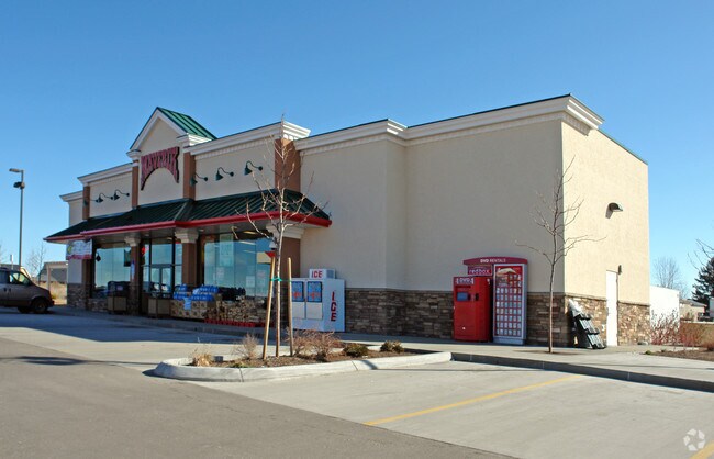

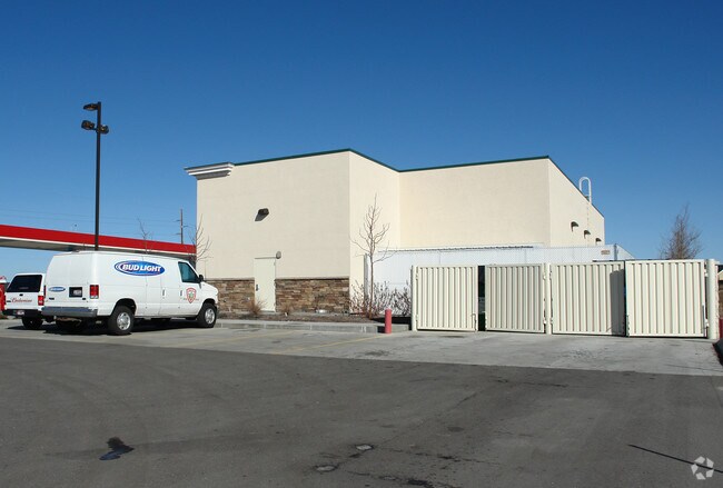

Property Detail
6168 S Cloverdale Rd
R5120006835
PAR#6835 @ SW COR LOT 3 BLK 8 LA GRANGE SUB R/S 8065 EXC R/W #6833-B
Commercialnec
Ada
C1
Idaho
B and X Area of moderate flood hazard, usually the area between the limits of the 100-year and 500-year floods.
3
2024
2.55 AC
2025
Southwest Boise
002225
Boise City/Nampa
4,337 SF
Boise City, ID
NEARBY LISTINGS FOR SALE OR LEASE
-
-
View all Boise listings for sale on LoopNet.com
DEMOGRAPHICS near 6168 S Cloverdale Rd
1 mile
3 mile
5 mile
2025 Total Population
10,043
59,964
122,556
2030 Population
10,596
63,103
129,175
Pop Growth 2025-2030
+ 5.51%
+ 5.23%
+ 5.40%
Average Age
39
39
40
2025 Total Households
3,534
20,709
42,594
HH Growth 2025-2030
+ 5.77%
+ 5.59%
+ 5.81%
Median Household Inc
$97,196
$107,939
$101,523
Avg Household Size
2.80
2.90
2.80
2025 Avg HH Vehicles
2.00
2.00
2.00
Median Home Value
$491,962
$528,535
$511,285
Median Year Built
2008
2006
2004
Nearby Places
Map Layers
Map Styles
 Street
 Aerial
Transit
 Traffic
 Biking
Places
Listings with unknown addresses are not visible on the map
- Restaurants
- Banks
- Shops
- Fitness
- Groceries
PUBLIC TRANSPORTATION
AIRPORT
Boise Air Trml/Gowen Field
Drive
Walk
Distance
Boise Air Trml/Gowen Field
27 min
10.0 mi
Freight Ports
Port of Portland
Drive
Walk
Distance
Port of Portland
475 min
429.0 mi
Nearby Properties
Address
Land Use
TOTAL SIZE
Lot Size
Zoning
Address
Land Use
TOTAL SIZE
Lot Size
Zoning
176,788 SF
16.07 AC
C-G
Address
Land Use
TOTAL SIZE
Lot Size
Zoning
164,981 SF
7.47 AC
R20
Address
Land Use
TOTAL SIZE
Lot Size
Zoning
118,953 SF
4.37 AC
C-G
Address
Land Use
TOTAL SIZE
Lot Size
Zoning
114,155 SF
5.61 AC
C-G
Address
Land Use
TOTAL SIZE
Lot Size
Zoning
35,250 SF
2.79 AC
C-G
Address
Land Use
TOTAL SIZE
Lot Size
Zoning
77,559 SF
11.94 AC
C-G
Address
Land Use
TOTAL SIZE
Lot Size
Zoning
60,029 SF
3.92 AC
C-G
Address
Land Use
TOTAL SIZE
Lot Size
Zoning
87,220 SF
5.27 AC
L-OD/DA
Address
Land Use
TOTAL SIZE
Lot Size
Zoning
70,332 SF
4.06 AC
C-G
Address
Land Use
TOTAL SIZE
Lot Size
Zoning
96,462 SF
7.06 AC
C-G
Address
Land Use
TOTAL SIZE
Lot Size
Zoning
168,000 SF
121.75 AC
RUT
Address
Land Use
TOTAL SIZE
Lot Size
Zoning
70,014 SF
4.51 AC
C-G
Address
Land Use
TOTAL SIZE
Lot Size
Zoning
71,625 SF
2.99 AC
C-G
Address
Land Use
TOTAL SIZE
Lot Size
Zoning
64,533 SF
2.28 AC
C-C
Address
Land Use
TOTAL SIZE
Lot Size
Zoning
87,080 SF
2.77 AC
R-15
Address
Land Use
TOTAL SIZE
Lot Size
Zoning
47,058 SF
3.93 AC
C-G
Address
Land Use
TOTAL SIZE
Lot Size
Zoning
47,901 SF
3.17 AC
R-15
Address
Land Use
TOTAL SIZE
Lot Size
Zoning
58,142 SF
6.48 AC
C-C
Address
Land Use
TOTAL SIZE
Lot Size
Zoning
121,203 SF
5.56 AC
LO
Address
Land Use
TOTAL SIZE
Lot Size
Zoning
35,443 SF
3.12 AC
C-C
Address
Land Use
TOTAL SIZE
Lot Size
Zoning
16,268 SF
2.27 AC
C-N
Address
Land Use
TOTAL SIZE
Lot Size
Zoning
30,480 SF
3.21 AC
C-G
Address
Land Use
TOTAL SIZE
Lot Size
Zoning
30,183 SF
2.69 AC
C-C
Address
Land Use
TOTAL SIZE
Lot Size
Zoning
20,624 SF
2.18 AC
C-G
Address
Land Use
TOTAL SIZE
Lot Size
Zoning
72,744 SF
3.86 AC
C-C
Address
Land Use
TOTAL SIZE
Lot Size
Zoning
22,764 SF
2.44 AC
C-G
Address
Land Use
TOTAL SIZE
Lot Size
Zoning
17,175 SF
2.96 AC
C1
Address
Land Use
TOTAL SIZE
Lot Size
Zoning
22,023 SF
2.03 AC
C-G
Address
Land Use
TOTAL SIZE
Lot Size
Zoning
35,857 SF
3.23 AC
C-G
Address
Land Use
TOTAL SIZE
Lot Size
Zoning
25,424 SF
2.48 AC
C-G
The World's #1 Commercial Real Estate Marketplace
Connect with us
© 2026 CoStar Group
The information above has been obtained from sources believed reliable. While we do not doubt its accuracy we have not verified it and make no guarantee, warranty or representation about it. It is your responsibility to independently confirm its accuracy and completeness. Any projections, opinions, assumptions, or estimates used are for example only and do not represent the current or future performance of the property. The value of this transaction to you depends on tax and other factors which should be evaluated by your tax, financial, and legal advisors. You and your advisors should conduct a careful, independent investigation of the property to determine to your satisfaction the suitability of the property for your needs.