Property Record
617 E 171St St S, Glenpool, OK 74033
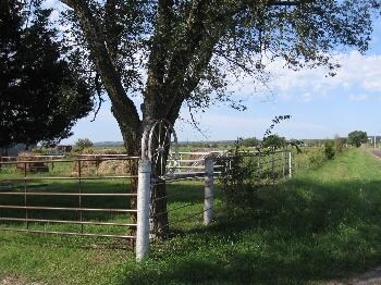

Property Detail
617 E 171St St S
97225-72-25-56010
SW SE LESS BEG 125E SWC SW SE TH N165 E264 S165 W264 POB & LESS N/2 NW SW SE & LESS BEG SECR SW SE TH W329.50 N1321.84 E329.50 S1321.92 POB & LESS BEG 329.50W SECR SW SE TH W490.33 N389.82 E223.35 N601.52 W67.13 N330.44 E332.03 S1321.84 POB SEC 25 17
Residentialacreage
Tulsa
AG
Oklahoma
B and X Area of moderate flood hazard, usually the area between the limits of the 100-year and 500-year floods.
13.56 AC
2025
South
2025
Tulsa
007705
Tulsa, OK
1,824 SF
NEARBY LISTINGS FOR SALE OR LEASE
DEMOGRAPHICS near 617 E 171St St S
1 mile
3 mile
5 mile
2025 Total Population
655
8,239
32,678
2030 Population
694
8,542
34,095
Pop Growth 2025-2030
+ 5.95%
+ 3.68%
+ 4.34%
Average Age
39
36
37
2025 Total Households
233
2,799
11,273
HH Growth 2025-2030
+ 6.01%
+ 3.79%
+ 4.40%
Median Household Inc
$126,250
$88,688
$99,798
Avg Household Size
2.80
2.90
2.90
2025 Avg HH Vehicles
3.00
2.00
2.00
Median Home Value
$327,907
$263,221
$291,651
Median Year Built
2007
2000
2003
Nearby Places
Map Layers
Map Styles
 Street
 Aerial
Layers
 Traffic
 Biking
Places
Listings with unknown addresses are not visible on the map
- Restaurants
- Banks
- Shops
- Fitness
- Groceries
PUBLIC TRANSPORTATION
AIRPORT
Tulsa International
Drive
Walk
Distance
Tulsa International
38 min
27.6 mi
Freight Ports
Tulsa Port Of Catoosa
Drive
Walk
Distance
Tulsa Port Of Catoosa
47 min
36.3 mi
Nearby Properties
Address
Land Use
TOTAL SIZE
Lot Size
Zoning
Address
Land Use
TOTAL SIZE
Lot Size
Zoning
49,735 SF
14.35 AC
CG
Address
Land Use
TOTAL SIZE
Lot Size
Zoning
116,016 SF
54.80 AC
CG
Address
Land Use
TOTAL SIZE
Lot Size
Zoning
28,761 SF
9.71 AC
RS1
Address
Land Use
TOTAL SIZE
Lot Size
Zoning
6,702 SF
3.63 AC
AG
Address
Land Use
TOTAL SIZE
Lot Size
Zoning
18,560 SF
10.28 AC
AG
Address
Land Use
TOTAL SIZE
Lot Size
Zoning
38,476 SF
18.68 AC
CG
Address
Land Use
TOTAL SIZE
Lot Size
Zoning
68,298 SF
28.61 AC
CG
Address
Land Use
TOTAL SIZE
Lot Size
Zoning
18,078 SF
14.73 AC
IL
Address
Land Use
TOTAL SIZE
Lot Size
Zoning
22.20 AC
AG
Address
Land Use
TOTAL SIZE
Lot Size
Zoning
15,097 SF
4.43 AC
RE
Address
Land Use
TOTAL SIZE
Lot Size
Zoning
5,920 SF
7.67 AC
AG
Address
Land Use
TOTAL SIZE
Lot Size
Zoning
33,128 SF
1.83 AC
RM2
Address
Land Use
TOTAL SIZE
Lot Size
Zoning
107,943 SF
8.49 AC
PUD
Address
Land Use
TOTAL SIZE
Lot Size
Zoning
9,950 SF
4.76 AC
RS2
Address
Land Use
TOTAL SIZE
Lot Size
Zoning
197,644 SF
32.39 AC
IL
Address
Land Use
TOTAL SIZE
Lot Size
Zoning
6.76 AC
AG
Address
Land Use
TOTAL SIZE
Lot Size
Zoning
6,288 SF
0.54 AC
Address
Land Use
TOTAL SIZE
Lot Size
Zoning
5,654 SF
0.52 AC
Address
Land Use
TOTAL SIZE
Lot Size
Zoning
7,340 SF
0.24 AC
RS3
Address
Land Use
TOTAL SIZE
Lot Size
Zoning
840 SF
10.43 AC
AG
Address
Land Use
TOTAL SIZE
Lot Size
Zoning
6,589 SF
5 AC
AG
Address
Land Use
TOTAL SIZE
Lot Size
Zoning
5,800 SF
1.86 AC
CS
Address
Land Use
TOTAL SIZE
Lot Size
Zoning
108,000 SF
8.81 AC
AG
Address
Land Use
TOTAL SIZE
Lot Size
Zoning
72,456 SF
3.77 AC
RM2
Address
Land Use
TOTAL SIZE
Lot Size
Zoning
30,160 SF
2.74 AC
CS
Address
Land Use
TOTAL SIZE
Lot Size
Zoning
83,598 SF
19.93 AC
IL
Address
Land Use
TOTAL SIZE
Lot Size
Zoning
58,200 SF
9.26 AC
CN
Address
Land Use
TOTAL SIZE
Lot Size
Zoning
27,000 SF
2.20 AC
CS
The World's #1 Commercial Real Estate Marketplace
Connect with us
© 2026 CoStar Group
The information above has been obtained from sources believed reliable. While we do not doubt its accuracy we have not verified it and make no guarantee, warranty or representation about it. It is your responsibility to independently confirm its accuracy and completeness. Any projections, opinions, assumptions, or estimates used are for example only and do not represent the current or future performance of the property. The value of this transaction to you depends on tax and other factors which should be evaluated by your tax, financial, and legal advisors. You and your advisors should conduct a careful, independent investigation of the property to determine to your satisfaction the suitability of the property for your needs.