Property Record
617 E Walnut St, Garland, TX 75040

Property Detail
617 E Walnut St
Dallas-Fort Worth-Arlington, TX
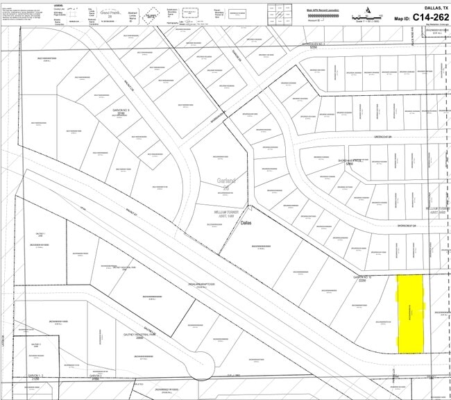
GARVON 10 BLK E EAST 87.76FT LT 8 ACS 0.55 CALC INT200900269030 DD09152009 CO-DC 2225000500801 2CG22250005
26222500050080100
DALLAS
Industrialacreage
Texas
Z125
8
B and X Area of moderate flood hazard, usually the area between the limits of the 100-year and 500-year floods.
0.55 AC
0
Garland
2025
Dallas/Ft Worth
018105
NEARBY LISTINGS FOR SALE OR LEASE
DEMOGRAPHICS near 617 E Walnut St
1 mile
3 mile
5 mile
2025 Total Population
13,776
120,792
299,719
2030 Population
14,191
123,725
307,694
Pop Growth 2025-2030
+ 3.01%
+ 2.43%
+ 2.66%
Average Age
36
38
38
2025 Total Households
4,063
38,258
100,319
HH Growth 2025-2030
+ 2.98%
+ 2.45%
+ 2.69%
Median Household Inc
$68,792
$77,607
$78,041
Avg Household Size
3.30
3.10
2.90
2025 Avg HH Vehicles
2.00
2.00
2.00
Median Home Value
$231,136
$272,634
$297,673
Median Year Built
1972
1976
1979
Nearby Places
Map Layers
Map Styles
 Street
 Aerial
Layers
 Traffic
 Biking
Places
Listings with unknown addresses are not visible on the map
- Restaurants
- Banks
- Shops
- Fitness
- Groceries
PUBLIC TRANSPORTATION
AIRPORT
Dallas Love Field
Drive
Walk
Distance
Dallas Love Field
36 min
18.8 mi
Dallas-Fort Worth International
Drive
Walk
Distance
Dallas-Fort Worth International
43 min
30.7 mi
Nearby Properties
Address
Land Use
TOTAL SIZE
Lot Size
Zoning
Address
Land Use
TOTAL SIZE
Lot Size
Zoning
650,164 SF
66.57 AC
Z02
Address
Land Use
TOTAL SIZE
Lot Size
Zoning
310,382 SF
11.78 AC
Z148
Address
Land Use
TOTAL SIZE
Lot Size
Zoning
181,854 SF
14.51 AC
Z239
Address
Land Use
TOTAL SIZE
Lot Size
Zoning
261,164 SF
32.58 AC
Address
Land Use
TOTAL SIZE
Lot Size
Zoning
342,658 SF
4.94 AC
Z239
Address
Land Use
TOTAL SIZE
Lot Size
Zoning
331,684 SF
9.80 AC
Z148
Address
Land Use
TOTAL SIZE
Lot Size
Zoning
403,206 SF
4 AC
Z239
Address
Land Use
TOTAL SIZE
Lot Size
Zoning
107,686 SF
30.09 AC
Z386
Address
Land Use
TOTAL SIZE
Lot Size
Zoning
65,595 SF
19.22 AC
Z239
Address
Land Use
TOTAL SIZE
Lot Size
Zoning
187,440 SF
1.68 AC
Z25
Address
Land Use
TOTAL SIZE
Lot Size
Zoning
77,102 SF
27.47 AC
Z144
Address
Land Use
TOTAL SIZE
Lot Size
Zoning
198,488 SF
10.17 AC
Z239
Address
Land Use
TOTAL SIZE
Lot Size
Zoning
473,201 SF
13.32 AC
Address
Land Use
TOTAL SIZE
Lot Size
Zoning
163,965 SF
12.09 AC
Z239
Address
Land Use
TOTAL SIZE
Lot Size
Zoning
180,320 SF
10.66 AC
Z160
Address
Land Use
TOTAL SIZE
Lot Size
Zoning
331,200 SF
15.96 AC
Z144
Address
Land Use
TOTAL SIZE
Lot Size
Zoning
0.12 AC
Z63
Address
Land Use
TOTAL SIZE
Lot Size
Zoning
168,537 SF
2 AC
Address
Land Use
TOTAL SIZE
Lot Size
Zoning
138,865 SF
11.38 AC
Z239
Address
Land Use
TOTAL SIZE
Lot Size
Zoning
139,133 SF
3.34 AC
Z239
Address
Land Use
TOTAL SIZE
Lot Size
Zoning
111,948 SF
9.92 AC
Z239
Address
Land Use
TOTAL SIZE
Lot Size
Zoning
133,249 SF
9.71 AC
Z239
Address
Land Use
TOTAL SIZE
Lot Size
Zoning
59,546 SF
60.69 AC
Z390
Address
Land Use
TOTAL SIZE
Lot Size
Zoning
65,917 SF
7.99 AC
Z239
Address
Land Use
TOTAL SIZE
Lot Size
Zoning
143,474 SF
5.41 AC
Z239
Address
Land Use
TOTAL SIZE
Lot Size
Zoning
177,739 SF
11.10 AC
Z390
Address
Land Use
TOTAL SIZE
Lot Size
Zoning
117,036 SF
11.89 AC
Z239
Address
Land Use
TOTAL SIZE
Lot Size
Zoning
145,203 SF
12.86 AC
Z239
Address
Land Use
TOTAL SIZE
Lot Size
Zoning
156,000 SF
2 AC
Address
Land Use
TOTAL SIZE
Lot Size
Zoning
228,800 SF
10.49 AC
Z144
The World's #1 Commercial Real Estate Marketplace
Connect with us
© 2026 CoStar Group
The information above has been obtained from sources believed reliable. While we do not doubt its accuracy we have not verified it and make no guarantee, warranty or representation about it. It is your responsibility to independently confirm its accuracy and completeness. Any projections, opinions, assumptions, or estimates used are for example only and do not represent the current or future performance of the property. The value of this transaction to you depends on tax and other factors which should be evaluated by your tax, financial, and legal advisors. You and your advisors should conduct a careful, independent investigation of the property to determine to your satisfaction the suitability of the property for your needs.