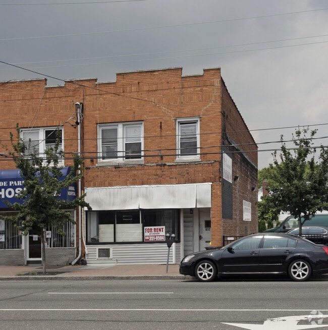
Property Record
617 Jericho Tpke, Syosset, NY 11791
NEARBY LISTINGS FOR SALE OR LEASE
Property Detail
617 Jericho Tpke
2227-08-042-00-0038-0
TOWN #2 SCH DIST 005
Storebuilding
Nassau
X
New York
36059C0205G
38
2025
0.05 AC
2025
Western Nassau
303000
Long Island (New York)
3,552 SF
Nassau County-Suffolk County, NY
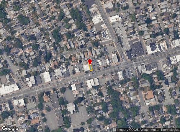
DEMOGRAPHICS near 617 Jericho Tpke
1 mile
3 mile
5 mile
2024 Total Population
32,052
244,382
698,720
2029 Population
31,184
234,717
670,035
Pop Growth 2024-2029
(2.71%)
(3.95%)
(4.11%)
Average Age
42
43
42
2024 Total Households
10,357
81,184
226,571
HH Growth 2024-2029
(2.88%)
(4.14%)
(4.33%)
Median Household Inc
$139,304
$118,631
$110,307
Avg Household Size
3.10
2.90
3.00
2024 Avg HH Vehicles
2.00
2.00
2.00
Median Home Value
$743,946
$704,522
$696,883
Median Year Built
1948
1952
1951
Nearby Places
Map Layers
Map Styles
 Street
 Aerial
Transit
 Traffic
 Biking
Places
Listings with unknown addresses are not visible on the map
- Restaurants
- Banks
- Shops
- Fitness
- Groceries
PUBLIC TRANSPORTATION
TRANSIT/SUBWAY
New Hyde Park Station (Port Jefferson Branch - Long Island Rail Road)
Drive
Walk
Distance
New Hyde Park Station (Port Jefferson Branch - Long Island Rail Road)
1 min
13 min
0.5 mi
COMMUTER RAIL
New Hyde Park Station (Port Jefferson Branch - Long Island Rail Road)
Drive
Walk
Distance
New Hyde Park Station (Port Jefferson Branch - Long Island Rail Road)
1 min
10 min
0.5 mi
Stewart Manor Station (Hempstead Branch - Long Island Rail Road)
Drive
Walk
Distance
Stewart Manor Station (Hempstead Branch - Long Island Rail Road)
3 min
20 min
1.1 mi
AIRPORT
John F Kennedy International
Drive
Walk
Distance
John F Kennedy International
19 min
11.0 mi
LaGuardia
Drive
Walk
Distance
LaGuardia
22 min
12.8 mi
Westchester County
Drive
Walk
Distance
Westchester County
51 min
34.3 mi
Freight Ports
NY - Red Hook Container Terminal
Drive
Walk
Distance
NY - Red Hook Container Terminal
34 min
20.9 mi
Nearby Properties
Address
Land Use
TOTAL SIZE
Lot Size
Zoning
Address
Land Use
TOTAL SIZE
Lot Size
Zoning
97.07 AC
R3-2
Address
Land Use
TOTAL SIZE
Lot Size
Zoning
97.07 AC
R3-2
Address
Land Use
TOTAL SIZE
Lot Size
Zoning
97.07 AC
R3-2
Address
Land Use
TOTAL SIZE
Lot Size
Zoning
97.07 AC
R3-2
Address
Land Use
TOTAL SIZE
Lot Size
Zoning
97.07 AC
R3-2
Address
Land Use
TOTAL SIZE
Lot Size
Zoning
97.07 AC
R3-2
Address
Land Use
TOTAL SIZE
Lot Size
Zoning
97.07 AC
R3-2
Address
Land Use
TOTAL SIZE
Lot Size
Zoning
97.07 AC
R3-2
Address
Land Use
TOTAL SIZE
Lot Size
Zoning
97.07 AC
R3-2
Address
Land Use
TOTAL SIZE
Lot Size
Zoning
97.07 AC
R3-2
Address
Land Use
TOTAL SIZE
Lot Size
Zoning
97.07 AC
R3-2
Address
Land Use
TOTAL SIZE
Lot Size
Zoning
97.07 AC
R3-2
Address
Land Use
TOTAL SIZE
Lot Size
Zoning
97.07 AC
R3-2
Address
Land Use
TOTAL SIZE
Lot Size
Zoning
97.07 AC
R3-2
Address
Land Use
TOTAL SIZE
Lot Size
Zoning
97.07 AC
R3-2
Address
Land Use
TOTAL SIZE
Lot Size
Zoning
97.07 AC
R3-2
Address
Land Use
TOTAL SIZE
Lot Size
Zoning
97.07 AC
R3-2
Address
Land Use
TOTAL SIZE
Lot Size
Zoning
97.07 AC
R3-2
Address
Land Use
TOTAL SIZE
Lot Size
Zoning
97.07 AC
R3-2
Address
Land Use
TOTAL SIZE
Lot Size
Zoning
97.07 AC
R3-2
Address
Land Use
TOTAL SIZE
Lot Size
Zoning
97.07 AC
R3-2
Address
Land Use
TOTAL SIZE
Lot Size
Zoning
97.07 AC
R3-2
Address
Land Use
TOTAL SIZE
Lot Size
Zoning
97.07 AC
R3-2
Address
Land Use
TOTAL SIZE
Lot Size
Zoning
97.07 AC
R3-2
Address
Land Use
TOTAL SIZE
Lot Size
Zoning
97.07 AC
R3-2
Address
Land Use
TOTAL SIZE
Lot Size
Zoning
97.07 AC
R3-2
Address
Land Use
TOTAL SIZE
Lot Size
Zoning
97.07 AC
R3-2
Address
Land Use
TOTAL SIZE
Lot Size
Zoning
97.07 AC
R3-2
Address
Land Use
TOTAL SIZE
Lot Size
Zoning
97.07 AC
R3-2
Address
Land Use
TOTAL SIZE
Lot Size
Zoning
97.07 AC
R3-2
The World's #1 Commercial Real Estate Marketplace
Connect with us
© 2026 CoStar Group
The information above has been obtained from sources believed reliable. While we do not doubt its accuracy we have not verified it and make no guarantee, warranty or representation about it. It is your responsibility to independently confirm its accuracy and completeness. Any projections, opinions, assumptions, or estimates used are for example only and do not represent the current or future performance of the property. The value of this transaction to you depends on tax and other factors which should be evaluated by your tax, financial, and legal advisors. You and your advisors should conduct a careful, independent investigation of the property to determine to your satisfaction the suitability of the property for your needs.