Property Record
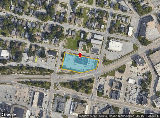
617 Mynster St, Council Bluffs, IA 51503

NEARBY LISTINGS FOR SALE OR LEASE
Property Detail
617 Mynster St
Omaha-Council Bluffs, NE-IA
Bayliss First Add
7544-25-388-001
BAYLISS 1ST ADD LTS 9 THRU 13 BLK 3 EXC CITY & AUD SUB LTS 14-15-16 BLK 3 BAYLISS 1ST & O/L~1MYNSTER ADD LTS A THRU C & PT LTS D THRU G EXCEPT CITY
Medicalbuilding
Pottawattamie
AH
Iowa
31055C0275H
9,10
2025
1.50 AC
2025
Downtown Council Bluffs
030900
Omaha/Council Bluffs
11,805 SF
DEMOGRAPHICS near 617 Mynster St
1 Mile
3 Mile
5 Mile
2024 Total Population
13,006
54,284
101,477
2029 Population
13,048
53,944
102,073
Pop Growth 2024-2029
+ 0.32%
(0.63%)
+ 0.59%
Average Age
39
40
39
2024 Total Households
5,483
21,983
41,003
HH Growth 2024-2029
+ 0.31%
(0.65%)
+ 0.80%
Median Household Inc
$46,628
$58,087
$58,392
Avg Household Size
2.30
2.30
2.30
2024 Avg HH Vehicles
2.00
2.00
2.00
Median Home Value
$141,948
$153,468
$170,023
Median Year Built
1947
1958
1962
Nearby Places
Map Layers
Map Styles
 Street
 Aerial
- Restaurants
- Banks
- Shops
- Fitness
- Groceries
PUBLIC TRANSPORTATION
COMMUTER RAIL
Omaha Amtrak Station (California Zephyr - Amtrak)
DRIVE
WALK
Distance
Omaha Amtrak Station (California Zephyr - Amtrak)
11 min
4.8 mi
Omaha Amtrak Station (California Zephyr - Amtrak)
DRIVE
WALK
Distance
Omaha Amtrak Station (California Zephyr - Amtrak)
12 min
5.0 mi
AIRPORT
Eppley Airfield
DRIVE
WALK
Distance
Eppley Airfield
18 min
7.6 mi
Freight Ports
Tulsa Port Of Catoosa
DRIVE
WALK
Distance
Tulsa Port Of Catoosa
459 min
415.1 mi
Nearby Properties
Address
Land Use
TOTAL SIZE
Lot Size
Zoning
Address
Land Use
TOTAL SIZE
Lot Size
Zoning
185.50 AC
A-2
Address
Land Use
TOTAL SIZE
Lot Size
Zoning
62.66 AC
P-C
Address
Land Use
TOTAL SIZE
Lot Size
Zoning
52.44 AC
I-2
Address
Land Use
TOTAL SIZE
Lot Size
Zoning
16.18 AC
P-C
Address
Land Use
TOTAL SIZE
Lot Size
Zoning
11.85 AC
R-3
Address
Land Use
TOTAL SIZE
Lot Size
Zoning
42.97 AC
I-2
Address
Land Use
TOTAL SIZE
Lot Size
Zoning
16.87 AC
P-C
Address
Land Use
TOTAL SIZE
Lot Size
Zoning
17.49 AC
R-3
Address
Land Use
TOTAL SIZE
Lot Size
Zoning
68.36 AC
R-1M
Address
Land Use
TOTAL SIZE
Lot Size
Zoning
98,202 SF
17.88 AC
P-C
Address
Land Use
TOTAL SIZE
Lot Size
Zoning
2.91 AC
A-P
Address
Land Use
TOTAL SIZE
Lot Size
Zoning
17.40 AC
A-P
Address
Land Use
TOTAL SIZE
Lot Size
Zoning
0.89 AC
P-C
Address
Land Use
TOTAL SIZE
Lot Size
Zoning
37.25 AC
I-2
Address
Land Use
TOTAL SIZE
Lot Size
Zoning
4,216 SF
17.29 AC
R-4
Address
Land Use
TOTAL SIZE
Lot Size
Zoning
14 AC
I-2
Address
Land Use
TOTAL SIZE
Lot Size
Zoning
3,552 SF
18.50 AC
I-2
Address
Land Use
TOTAL SIZE
Lot Size
Zoning
30.64 AC
R-1
Address
Land Use
TOTAL SIZE
Lot Size
Zoning
8.34 AC
R-3
Address
Land Use
TOTAL SIZE
Lot Size
Zoning
1.99 AC
C-3
Address
Land Use
TOTAL SIZE
Lot Size
Zoning
21.72 AC
I-2
Address
Land Use
TOTAL SIZE
Lot Size
Zoning
14.54 AC
P-C
Address
Land Use
TOTAL SIZE
Lot Size
Zoning
21.91 AC
P-C
Address
Land Use
TOTAL SIZE
Lot Size
Zoning
18.68 AC
C-2
Address
Land Use
TOTAL SIZE
Lot Size
Zoning
124,128 SF
15.62 AC
I-2
Address
Land Use
TOTAL SIZE
Lot Size
Zoning
18.41 AC
R-3
Address
Land Use
TOTAL SIZE
Lot Size
Zoning
6.46 AC
R-3
Address
Land Use
TOTAL SIZE
Lot Size
Zoning
9.06 AC
R-3
Address
Land Use
TOTAL SIZE
Lot Size
Zoning
14.24 AC
I-2
Address
Land Use
TOTAL SIZE
Lot Size
Zoning
4.48 AC
R-4
The World's #1 Commercial Real Estate Marketplace
Connect with us
© 2025 CoStar Group
The information above has been obtained from sources believed reliable. While we do not doubt its accuracy we have not verified it and make no guarantee, warranty or representation about it. It is your responsibility to independently confirm its accuracy and completeness. Any projections, opinions, assumptions, or estimates used are for example only and do not represent the current or future performance of the property. The value of this transaction to you depends on tax and other factors which should be evaluated by your tax, financial, and legal advisors. You and your advisors should conduct a careful, independent investigation of the property to determine to your satisfaction the suitability of the property for your needs.