Property Record
617 Stokes Rd, Medford, NJ 08055
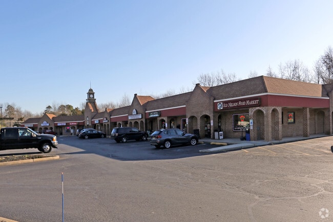

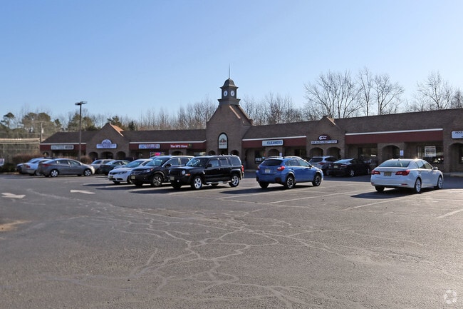
Property Detail
617 Stokes Rd
20-04802-0000-00002
Burlington
Regionalshoppingcenterormallwithanchorstore
New Jersey
CC
2
B and X Area of moderate flood hazard, usually the area between the limits of the 100-year and 500-year floods.
3.50 AC
2024
South Burlington County
2025
Philadelphia
703801
Philadelphia-Camden-Wilmington, PA-NJ-DE-MD
18,184 SF
NEARBY LISTINGS FOR SALE OR LEASE
DEMOGRAPHICS near 617 Stokes Rd
1 mile
3 mile
5 mile
2025 Total Population
3,720
28,139
62,265
2030 Population
3,808
28,953
64,074
Pop Growth 2025-2030
+ 2.37%
+ 2.89%
+ 2.91%
Average Age
42
43
43
2025 Total Households
1,323
10,264
23,534
HH Growth 2025-2030
+ 2.49%
+ 3.01%
+ 3.00%
Median Household Inc
$152,976
$153,967
$135,736
Avg Household Size
2.80
2.70
2.60
2025 Avg HH Vehicles
2.00
2.00
2.00
Median Home Value
$445,525
$488,754
$463,358
Median Year Built
1967
1978
1983
Nearby Places
Map Layers
Map Styles
 Street
 Aerial
Layers
 Traffic
 Biking
Places
Listings with unknown addresses are not visible on the map
- Restaurants
- Banks
- Shops
- Fitness
- Groceries
PUBLIC TRANSPORTATION
AIRPORT
Philadelphia International
Drive
Walk
Distance
Philadelphia International
46 min
31.1 mi
Trenton Mercer
Drive
Walk
Distance
Trenton Mercer
53 min
36.4 mi
Atlantic City International
Drive
Walk
Distance
Atlantic City International
72 min
38.7 mi
SALE & LEASE HISTORY
LISTING DATE
SALE/LEASE

Jun 24, 2025
For Sale
Jan 05, 2017
For Lease
Nearby Properties
Address
Land Use
TOTAL SIZE
Lot Size
Zoning
Address
Land Use
TOTAL SIZE
Lot Size
Zoning
103.84 AC
PPE
Address
Land Use
TOTAL SIZE
Lot Size
Zoning
62.20 AC
GMN
Address
Land Use
TOTAL SIZE
Lot Size
Zoning
13,636 SF
23 AC
HC-1
Address
Land Use
TOTAL SIZE
Lot Size
Zoning
49.38 AC
PPE
Address
Land Use
TOTAL SIZE
Lot Size
Zoning
10,000 SF
10.80 AC
RD-1
Address
Land Use
TOTAL SIZE
Lot Size
Zoning
22.74 AC
HC-1
Address
Land Use
TOTAL SIZE
Lot Size
Zoning
75,619 SF
57.38 AC
PPE
Address
Land Use
TOTAL SIZE
Lot Size
Zoning
67,096 SF
128.02 AC
PPE
Address
Land Use
TOTAL SIZE
Lot Size
Zoning
86.30 AC
PPE
Address
Land Use
TOTAL SIZE
Lot Size
Zoning
112,436 SF
9.88 AC
PPE
Address
Land Use
TOTAL SIZE
Lot Size
Zoning
23.70 AC
HM
Address
Land Use
TOTAL SIZE
Lot Size
Zoning
69,630 SF
10.69 AC
HC-2
Address
Land Use
TOTAL SIZE
Lot Size
Zoning
48,439 SF
17.54 AC
PPE
Address
Land Use
TOTAL SIZE
Lot Size
Zoning
19.40 AC
PPE
Address
Land Use
TOTAL SIZE
Lot Size
Zoning
23,402 SF
2.42 AC
RHO
Address
Land Use
TOTAL SIZE
Lot Size
Zoning
37.51 AC
CC
Address
Land Use
TOTAL SIZE
Lot Size
Zoning
727.21 AC
PPE
Address
Land Use
TOTAL SIZE
Lot Size
Zoning
11.14 AC
CC
Address
Land Use
TOTAL SIZE
Lot Size
Zoning
71,364 SF
13.50 AC
HC-1
Address
Land Use
TOTAL SIZE
Lot Size
Zoning
62,030 SF
42.56 AC
GMN
Address
Land Use
TOTAL SIZE
Lot Size
Zoning
55,746 SF
11.16 AC
HC-1
Address
Land Use
TOTAL SIZE
Lot Size
Zoning
67,508 SF
18.55 AC
LI
Address
Land Use
TOTAL SIZE
Lot Size
Zoning
1,525 SF
6.08 AC
HM
Address
Land Use
TOTAL SIZE
Lot Size
Zoning
157.02 AC
VRD
Address
Land Use
TOTAL SIZE
Lot Size
Zoning
72,268 SF
8.80 AC
HC-1
Address
Land Use
TOTAL SIZE
Lot Size
Zoning
1.64 AC
SGRA
Address
Land Use
TOTAL SIZE
Lot Size
Zoning
81.20 AC
RGD
Address
Land Use
TOTAL SIZE
Lot Size
Zoning
49,296 SF
4.90 AC
PPE
Address
Land Use
TOTAL SIZE
Lot Size
Zoning
17,194 SF
150.35 AC
GD
Address
Land Use
TOTAL SIZE
Lot Size
Zoning
16,107 SF
10.65 AC
GMS
The World's #1 Commercial Real Estate Marketplace
Connect with us
© 2026 CoStar Group
The information above has been obtained from sources believed reliable. While we do not doubt its accuracy we have not verified it and make no guarantee, warranty or representation about it. It is your responsibility to independently confirm its accuracy and completeness. Any projections, opinions, assumptions, or estimates used are for example only and do not represent the current or future performance of the property. The value of this transaction to you depends on tax and other factors which should be evaluated by your tax, financial, and legal advisors. You and your advisors should conduct a careful, independent investigation of the property to determine to your satisfaction the suitability of the property for your needs.