Property Record
6170 Sw 173Rd Ave, Beaverton, OR 97007

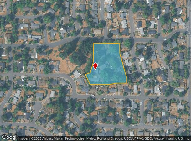
Property Detail
6170 Sw 173Rd Ave
Portland-Vancouver-Hillsboro, OR-WA
Plat 71-001
R0162530
PLAT 71-001, LOT 110, ACRES 2.24
Apartment
Washington
X
Oregon
41067C0526E
110
2024
2.24 AC
2026
Cooper Mountain-Aloha South
031816
Portland
6,250 SF
NEARBY LISTINGS FOR SALE OR LEASE
DEMOGRAPHICS near 6170 Sw 173Rd Ave
1 mile
3 mile
5 mile
2024 Total Population
19,842
142,146
324,554
2029 Population
19,861
143,397
326,754
Pop Growth 2024-2029
+ 0.10%
+ 0.88%
+ 0.68%
Average Age
39
39
39
2024 Total Households
6,950
53,547
126,494
HH Growth 2024-2029
+ 0.10%
+ 0.96%
+ 0.69%
Median Household Inc
$92,970
$84,500
$91,523
Avg Household Size
2.80
2.60
2.50
2024 Avg HH Vehicles
2.00
2.00
2.00
Median Home Value
$459,414
$468,190
$491,238
Median Year Built
1982
1986
1989
Nearby Places
Map Layers
Map Styles
 Street
 Aerial
Transit
 Traffic
 Biking
Places
Listings with unknown addresses are not visible on the map
- Restaurants
- Banks
- Shops
- Fitness
- Groceries
PUBLIC TRANSPORTATION
COMMUTER RAIL
Beaverton Transit Center (West Side Express) (Westside Express Service - Tri-County Metropolitan Transportation District of Oregon Rail (TriMet Rail))
Drive
Walk
Distance
Beaverton Transit Center (West Side Express) (Westside Express Service - Tri-County Metropolitan Transportation District of Oregon Rail (TriMet Rail))
8 min
3.5 mi
Hall/Nimbus (Westside Express Service - Tri-County Metropolitan Transportation District of Oregon Rail (TriMet Rail))
Drive
Walk
Distance
Hall/Nimbus (Westside Express Service - Tri-County Metropolitan Transportation District of Oregon Rail (TriMet Rail))
11 min
4.4 mi
AIRPORT
Portland International
Drive
Walk
Distance
Portland International
40 min
23.8 mi
Freight Ports
Port of Portland
Drive
Walk
Distance
Port of Portland
23 min
12.8 mi
Nearby Properties
Address
Land Use
TOTAL SIZE
Lot Size
Zoning
Address
Land Use
TOTAL SIZE
Lot Size
Zoning
0.05 AC
IND
Address
Land Use
TOTAL SIZE
Lot Size
Zoning
2,936,291 SF
72.49 AC
TO:EMP
Address
Land Use
TOTAL SIZE
Lot Size
Zoning
0.08 AC
IND
Address
Land Use
TOTAL SIZE
Lot Size
Zoning
58.68 AC
IND
Address
Land Use
TOTAL SIZE
Lot Size
Zoning
716,311 SF
75.07 AC
TO:EMP
Address
Land Use
TOTAL SIZE
Lot Size
Zoning
303,158 SF
18.18 AC
R10
Address
Land Use
TOTAL SIZE
Lot Size
Zoning
194.52 AC
R1
Address
Land Use
TOTAL SIZE
Lot Size
Zoning
1,031,421 SF
22.20 AC
SC-HDR
Address
Land Use
TOTAL SIZE
Lot Size
Zoning
461,858 SF
36.37 AC
CS
Address
Land Use
TOTAL SIZE
Lot Size
Zoning
37.66 AC
IND
Address
Land Use
TOTAL SIZE
Lot Size
Zoning
704,877 SF
18.72 AC
OI-NC
Address
Land Use
TOTAL SIZE
Lot Size
Zoning
8,967 SF
13.12 AC
GC
Address
Land Use
TOTAL SIZE
Lot Size
Zoning
281,695 SF
7.41 AC
SC-HDR
Address
Land Use
TOTAL SIZE
Lot Size
Zoning
44.66 AC
IND
Address
Land Use
TOTAL SIZE
Lot Size
Zoning
260,677 SF
16.86 AC
INST
Address
Land Use
TOTAL SIZE
Lot Size
Zoning
152,339 SF
28.70 AC
R1
Address
Land Use
TOTAL SIZE
Lot Size
Zoning
256,070 SF
32.39 AC
R7
Address
Land Use
TOTAL SIZE
Lot Size
Zoning
37.55 AC
IND
Address
Land Use
TOTAL SIZE
Lot Size
Zoning
214,045 SF
21.70 AC
R2
Address
Land Use
TOTAL SIZE
Lot Size
Zoning
8.12 AC
SFR-4.5
Address
Land Use
TOTAL SIZE
Lot Size
Zoning
18.15 AC
SC-E
Address
Land Use
TOTAL SIZE
Lot Size
Zoning
158,824 SF
20.71 AC
CC
Address
Land Use
TOTAL SIZE
Lot Size
Zoning
21.97 AC
R1
Address
Land Use
TOTAL SIZE
Lot Size
Zoning
423,095 SF
21.51 AC
R1
Address
Land Use
TOTAL SIZE
Lot Size
Zoning
159,473 SF
12.58 AC
RC-BC
Address
Land Use
TOTAL SIZE
Lot Size
Zoning
19.79 AC
R4
Address
Land Use
TOTAL SIZE
Lot Size
Zoning
20.98 AC
R5
Address
Land Use
TOTAL SIZE
Lot Size
Zoning
20.31 AC
R-25+
Address
Land Use
TOTAL SIZE
Lot Size
Zoning
Address
Land Use
TOTAL SIZE
Lot Size
Zoning
5.57 AC
MU-VTC
The World's #1 Commercial Real Estate Marketplace
Connect with us
© 2026 CoStar Group
The information above has been obtained from sources believed reliable. While we do not doubt its accuracy we have not verified it and make no guarantee, warranty or representation about it. It is your responsibility to independently confirm its accuracy and completeness. Any projections, opinions, assumptions, or estimates used are for example only and do not represent the current or future performance of the property. The value of this transaction to you depends on tax and other factors which should be evaluated by your tax, financial, and legal advisors. You and your advisors should conduct a careful, independent investigation of the property to determine to your satisfaction the suitability of the property for your needs.