Property Record
6173 State Highway 7, Oneonta, NY 13820
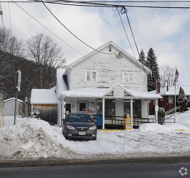

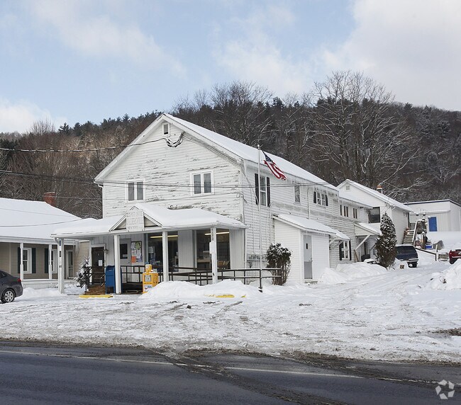
Property Detail
6173 State Highway 7
Oneonta, NY
990 0 0
364089-276-000-0002-013-000-0000
OTSEGO
Commercialofficeresidentialmixeduse
New York
B and X Area of moderate flood hazard, usually the area between the limits of the 100-year and 500-year floods.
13.000
2025
0.24 AC
2025
Otsego County
590500
Albany/Schenectady/Troy
3,769 SF
NEARBY LISTINGS FOR SALE OR LEASE
-
-
View all Oneonta listings for sale on LoopNet.com
DEMOGRAPHICS near 6173 State Highway 7
1 mile
3 mile
5 mile
2025 Total Population
304
2,498
17,998
2030 Population
309
2,499
18,049
Pop Growth 2025-2030
+ 1.64%
+ 0.04%
+ 0.28%
Average Age
47
46
36
2025 Total Households
131
1,053
5,303
HH Growth 2025-2030
+ 2.29%
+ 0.57%
(0.28%)
Median Household Inc
$74,463
$77,539
$68,349
Avg Household Size
2.10
2.20
2.10
2025 Avg HH Vehicles
2.00
2.00
2.00
Median Home Value
$217,647
$227,678
$195,888
Median Year Built
1973
1974
1952
Nearby Places
Map Layers
Map Styles
 Street
 Aerial
Layers
 Traffic
 Biking
Places
Listings with unknown addresses are not visible on the map
- Restaurants
- Banks
- Shops
- Fitness
- Groceries
Nearby Properties
Address
Land Use
TOTAL SIZE
Lot Size
Zoning
Address
Land Use
TOTAL SIZE
Lot Size
Zoning
69,894 SF
66.56 AC
Address
Land Use
TOTAL SIZE
Lot Size
Zoning
55,551 SF
6 AC
Address
Land Use
TOTAL SIZE
Lot Size
Zoning
8,340 SF
85.37 AC
Address
Land Use
TOTAL SIZE
Lot Size
Zoning
80,492 SF
9.32 AC
Address
Land Use
TOTAL SIZE
Lot Size
Zoning
49,162 SF
11.86 AC
Address
Land Use
TOTAL SIZE
Lot Size
Zoning
8,892 SF
4.76 AC
01
Address
Land Use
TOTAL SIZE
Lot Size
Zoning
36.43 AC
Address
Land Use
TOTAL SIZE
Lot Size
Zoning
51.03 AC
Address
Land Use
TOTAL SIZE
Lot Size
Zoning
7,500 SF
2.71 AC
Address
Land Use
TOTAL SIZE
Lot Size
Zoning
2,352 SF
0.73 AC
Address
Land Use
TOTAL SIZE
Lot Size
Zoning
54,214 SF
9.57 AC
Address
Land Use
TOTAL SIZE
Lot Size
Zoning
5,201 SF
237.24 AC
01
Address
Land Use
TOTAL SIZE
Lot Size
Zoning
15,000 SF
22.13 AC
Address
Land Use
TOTAL SIZE
Lot Size
Zoning
3,750 SF
10.14 AC
01
Address
Land Use
TOTAL SIZE
Lot Size
Zoning
28,056 SF
1.41 AC
Address
Land Use
TOTAL SIZE
Lot Size
Zoning
15,000 SF
1.22 AC
Address
Land Use
TOTAL SIZE
Lot Size
Zoning
6,540 SF
74.25 AC
Address
Land Use
TOTAL SIZE
Lot Size
Zoning
1,448 SF
2.19 AC
Address
Land Use
TOTAL SIZE
Lot Size
Zoning
804.16 AC
C5
Address
Land Use
TOTAL SIZE
Lot Size
Zoning
6,780 SF
1.09 AC
Address
Land Use
TOTAL SIZE
Lot Size
Zoning
Address
Land Use
TOTAL SIZE
Lot Size
Zoning
11,024 SF
7.10 AC
Address
Land Use
TOTAL SIZE
Lot Size
Zoning
5,810 SF
5.83 AC
C5
Address
Land Use
TOTAL SIZE
Lot Size
Zoning
128.77 AC
Address
Land Use
TOTAL SIZE
Lot Size
Zoning
6,600 SF
5.58 AC
Address
Land Use
TOTAL SIZE
Lot Size
Zoning
3,028 SF
0.88 AC
01
Address
Land Use
TOTAL SIZE
Lot Size
Zoning
3,264 SF
1.07 AC
Address
Land Use
TOTAL SIZE
Lot Size
Zoning
3,184 SF
1.07 AC
01
Address
Land Use
TOTAL SIZE
Lot Size
Zoning
6,404 SF
1.30 AC
Address
Land Use
TOTAL SIZE
Lot Size
Zoning
3,216 SF
0.39 AC
The World's #1 Commercial Real Estate Marketplace
Connect with us
© 2026 CoStar Group
The information above has been obtained from sources believed reliable. While we do not doubt its accuracy we have not verified it and make no guarantee, warranty or representation about it. It is your responsibility to independently confirm its accuracy and completeness. Any projections, opinions, assumptions, or estimates used are for example only and do not represent the current or future performance of the property. The value of this transaction to you depends on tax and other factors which should be evaluated by your tax, financial, and legal advisors. You and your advisors should conduct a careful, independent investigation of the property to determine to your satisfaction the suitability of the property for your needs.