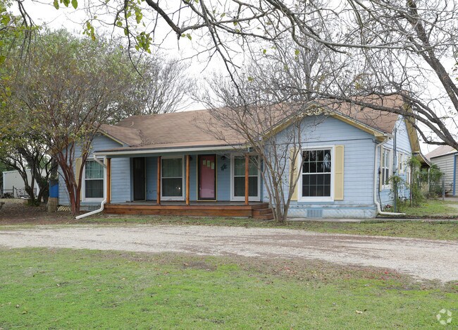
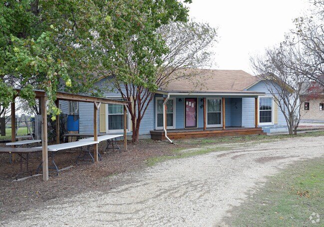
Property Record
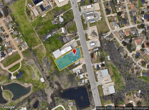
618 N Robinson Dr, Robinson, TX 76706
NEARBY LISTINGS FOR SALE OR LEASE
Property Detail
618 N Robinson Dr
Waco, TX
Ocampo C
44-003200-028601-2
Mclennan
Residentialnec
Texas
X
1.28 AC
48309C0575D
Other Market Areas
2,201 SF
DEMOGRAPHICS near 618 N Robinson Dr
1 Mile
3 Mile
5 Mile
2024 Total Population
3,995
25,267
84,173
2029 Population
4,187
26,807
89,371
Pop Growth 2024-2029
+ 4.81%
+ 6.09%
+ 6.18%
Average Age
39
36
34
2024 Total Households
1,403
9,650
31,421
HH Growth 2024-2029
+ 4.99%
+ 6.32%
+ 6.67%
Median Household Inc
$92,319
$58,989
$48,467
Avg Household Size
2.80
2.60
2.40
2024 Avg HH Vehicles
2.00
2.00
2.00
Median Home Value
$184,198
$162,143
$157,004
Median Year Built
1986
1988
1981
Nearby Places
- Restaurants
- Banks
- Shops
- Fitness
- Groceries
PUBLIC TRANSPORTATION
AIRPORT
Waco Regional
DRIVE
WALK
Distance
Waco Regional
24 min
12.8 mi
Freight Ports
Port of Houston
DRIVE
WALK
Distance
Port of Houston
214 min
187.0 mi
Nearby Properties
Address
Land Use
TOTAL SIZE
Lot Size
Zoning
Address
Land Use
TOTAL SIZE
Lot Size
Zoning
347,331 SF
50.71 AC
C2
Address
Land Use
TOTAL SIZE
Lot Size
Zoning
78.95 AC
Address
Land Use
TOTAL SIZE
Lot Size
Zoning
285,829 SF
17.35 AC
Address
Land Use
TOTAL SIZE
Lot Size
Zoning
255,615 SF
18.58 AC
Address
Land Use
TOTAL SIZE
Lot Size
Zoning
248,132 SF
11.51 AC
R3C
Address
Land Use
TOTAL SIZE
Lot Size
Zoning
289,245 SF
18.02 AC
C1
Address
Land Use
TOTAL SIZE
Lot Size
Zoning
263,557 SF
12 AC
Address
Land Use
TOTAL SIZE
Lot Size
Zoning
291,167 SF
13.61 AC
R
Address
Land Use
TOTAL SIZE
Lot Size
Zoning
674,900 SF
87.44 AC
M2
Address
Land Use
TOTAL SIZE
Lot Size
Zoning
106,633 SF
1.98 AC
C2
Address
Land Use
TOTAL SIZE
Lot Size
Zoning
34,723 SF
0.72 AC
Address
Land Use
TOTAL SIZE
Lot Size
Zoning
219,869 SF
11.13 AC
C2
Address
Land Use
TOTAL SIZE
Lot Size
Zoning
231,717 SF
21.97 AC
O2
Address
Land Use
TOTAL SIZE
Lot Size
Zoning
342,646 SF
63.20 AC
Address
Land Use
TOTAL SIZE
Lot Size
Zoning
70.76 AC
O2
Address
Land Use
TOTAL SIZE
Lot Size
Zoning
98,592 SF
15.16 AC
Address
Land Use
TOTAL SIZE
Lot Size
Zoning
200,028 SF
9.23 AC
PUD
Address
Land Use
TOTAL SIZE
Lot Size
Zoning
131,844 SF
22.84 AC
Address
Land Use
TOTAL SIZE
Lot Size
Zoning
142,734 SF
18.95 AC
R1B
Address
Land Use
TOTAL SIZE
Lot Size
Zoning
47,912 SF
7.20 AC
Address
Land Use
TOTAL SIZE
Lot Size
Zoning
203,812 SF
12.35 AC
R3C
Address
Land Use
TOTAL SIZE
Lot Size
Zoning
59,334 SF
0.59 AC
C2
Address
Land Use
TOTAL SIZE
Lot Size
Zoning
8,967 SF
174.04 AC
R1B
Address
Land Use
TOTAL SIZE
Lot Size
Zoning
74,786 SF
2.28 AC
C2
Address
Land Use
TOTAL SIZE
Lot Size
Zoning
12,658 SF
115.68 AC
M1
Address
Land Use
TOTAL SIZE
Lot Size
Zoning
400.45 AC
R
Address
Land Use
TOTAL SIZE
Lot Size
Zoning
75,720 SF
2.50 AC
Address
Land Use
TOTAL SIZE
Lot Size
Zoning
76,872 SF
2.14 AC
C2
Address
Land Use
TOTAL SIZE
Lot Size
Zoning
160,376 SF
17.27 AC
O2
Address
Land Use
TOTAL SIZE
Lot Size
Zoning
100,482 SF
4.50 AC
O2
The World's #1 Commercial Real Estate Marketplace
Connect with us
© 2025 CoStar Group
The information above has been obtained from sources believed reliable. While we do not doubt its accuracy we have not verified it and make no guarantee, warranty or representation about it. It is your responsibility to independently confirm its accuracy and completeness. Any projections, opinions, assumptions, or estimates used are for example only and do not represent the current or future performance of the property. The value of this transaction to you depends on tax and other factors which should be evaluated by your tax, financial, and legal advisors. You and your advisors should conduct a careful, independent investigation of the property to determine to your satisfaction the suitability of the property for your needs.