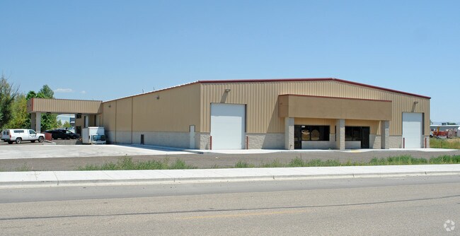
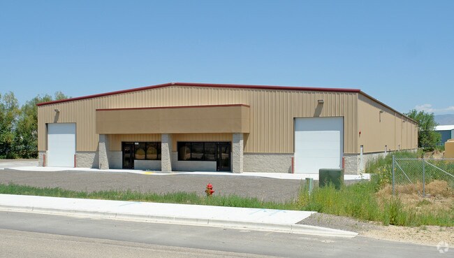
Property Record
6180 W Gowen Rd, Boise, ID 83709

Property Detail
6180 W Gowen Rd
R7334130005
LOTS 1-3 INC BLK 7 RANDALL ACRES SUB NO 2
Industrialgeneral
Ada
M3
Idaho
AE The base floodplain where base flood elevations are provided. AE Zones are now used on new format FIRMs instead of A1-A30 Zones.
1-3
2024
2.59 AC
2025
Airport
002100
Boise City/Nampa
20,000 SF
Boise City, ID
NEARBY LISTINGS FOR SALE OR LEASE
DEMOGRAPHICS near 6180 W Gowen Rd
1 mile
3 mile
5 mile
2024 Total Population
2,087
57,048
171,406
2029 Population
2,201
59,770
179,950
Pop Growth 2024-2029
+ 5.46%
+ 4.77%
+ 4.98%
Average Age
44
39
39
2024 Total Households
837
22,306
70,358
HH Growth 2024-2029
+ 5.73%
+ 5.18%
+ 5.48%
Median Household Inc
$97,136
$78,779
$77,857
Avg Household Size
2.50
2.50
2.30
2024 Avg HH Vehicles
2.00
2.00
2.00
Median Home Value
$452,602
$453,185
$472,180
Median Year Built
1978
1989
1990
Nearby Places
Map Layers
Map Styles
 Street
 Aerial
Transit
 Traffic
 Biking
Places
Listings with unknown addresses are not visible on the map
- Restaurants
- Banks
- Shops
- Fitness
- Groceries
PUBLIC TRANSPORTATION
AIRPORT
Boise Air Trml/Gowen Field
Drive
Walk
Distance
Boise Air Trml/Gowen Field
18 min
5.2 mi
Freight Ports
Port of Portland
Drive
Walk
Distance
Port of Portland
478 min
432.5 mi
SALE & LEASE HISTORY
LISTING DATE
SALE/LEASE

Dec 09, 2019
For Lease
Dec 09, 2019
For Sale
Nearby Properties
Address
Land Use
TOTAL SIZE
Lot Size
Zoning
Address
Land Use
TOTAL SIZE
Lot Size
Zoning
164,981 SF
7.47 AC
R20
Address
Land Use
TOTAL SIZE
Lot Size
Zoning
290,239 SF
4.73 AC
ZC-243
Address
Land Use
TOTAL SIZE
Lot Size
Zoning
173,766 SF
9.53 AC
L-OD
Address
Land Use
TOTAL SIZE
Lot Size
Zoning
91,740 SF
3.63 AC
C-4D
Address
Land Use
TOTAL SIZE
Lot Size
Zoning
164,141 SF
24.32 AC
M-1D
Address
Land Use
TOTAL SIZE
Lot Size
Zoning
93,112 SF
2.73 AC
C-2D
Address
Land Use
TOTAL SIZE
Lot Size
Zoning
218,215 SF
17.11 AC
C-4D
Address
Land Use
TOTAL SIZE
Lot Size
Zoning
130,560 SF
7.72 AC
R-2
Address
Land Use
TOTAL SIZE
Lot Size
Zoning
196,326 SF
M-1
Address
Land Use
TOTAL SIZE
Lot Size
Zoning
224,614 SF
9.89 AC
C-2D
Address
Land Use
TOTAL SIZE
Lot Size
Zoning
116,821 SF
6.19 AC
R-3D
Address
Land Use
TOTAL SIZE
Lot Size
Zoning
91,433 SF
3.54 AC
C-1D
Address
Land Use
TOTAL SIZE
Lot Size
Zoning
83,760 SF
6.45 AC
R-2
Address
Land Use
TOTAL SIZE
Lot Size
Zoning
137,395 SF
4.51 AC
C-2D
Address
Land Use
TOTAL SIZE
Lot Size
Zoning
98,120 SF
2.95 AC
C-2D
Address
Land Use
TOTAL SIZE
Lot Size
Zoning
91,785 SF
2.29 AC
C-3D
Address
Land Use
TOTAL SIZE
Lot Size
Zoning
102,196 SF
2.93 AC
C-1D
Address
Land Use
TOTAL SIZE
Lot Size
Zoning
118,408 SF
8 AC
M-1D
Address
Land Use
TOTAL SIZE
Lot Size
Zoning
78,060 SF
4.44 AC
R-3D
Address
Land Use
TOTAL SIZE
Lot Size
Zoning
60,280 SF
3.66 AC
C-4D
Address
Land Use
TOTAL SIZE
Lot Size
Zoning
83,284 SF
3.23 AC
C-3D
Address
Land Use
TOTAL SIZE
Lot Size
Zoning
78,219 SF
2.53 AC
L-OD
Address
Land Use
TOTAL SIZE
Lot Size
Zoning
87,194 SF
12.42 AC
M-1D
Address
Land Use
TOTAL SIZE
Lot Size
Zoning
136,607 SF
11.14 AC
C-3D
Address
Land Use
TOTAL SIZE
Lot Size
Zoning
60,760 SF
3.10 AC
L-OD
Address
Land Use
TOTAL SIZE
Lot Size
Zoning
50,275 SF
4.56 AC
R-2D
Address
Land Use
TOTAL SIZE
Lot Size
Zoning
164,000 SF
15.36 AC
ZC-243
Address
Land Use
TOTAL SIZE
Lot Size
Zoning
69,620 SF
6.22 AC
M-1D
Address
Land Use
TOTAL SIZE
Lot Size
Zoning
31,460 SF
12.64 AC
ZC-269
Address
Land Use
TOTAL SIZE
Lot Size
Zoning
153,264 SF
9.13 AC
C-2D
The World's #1 Commercial Real Estate Marketplace
Connect with us
© 2026 CoStar Group
The information above has been obtained from sources believed reliable. While we do not doubt its accuracy we have not verified it and make no guarantee, warranty or representation about it. It is your responsibility to independently confirm its accuracy and completeness. Any projections, opinions, assumptions, or estimates used are for example only and do not represent the current or future performance of the property. The value of this transaction to you depends on tax and other factors which should be evaluated by your tax, financial, and legal advisors. You and your advisors should conduct a careful, independent investigation of the property to determine to your satisfaction the suitability of the property for your needs.