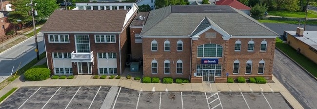
Property Record
6181 Mayfield Rd, Cleveland, OH 44124


NEARBY LISTINGS FOR SALE OR LEASE
Property Detail
6181 Mayfield Rd
Cleveland-Elyria, OH
Orchhts
861-17-017
3-24 ORCHHTS 0436 ALL
Officebuilding
Cuyahoga
X
Ohio
39035C0114E
436
2024
0.21 AC
2024
Northeast
172102
Cleveland
5,928 SF
DEMOGRAPHICS near 6181 Mayfield Rd
1 Mile
3 Mile
5 Mile
2024 Total Population
15,201
59,557
145,519
2029 Population
14,887
58,234
142,420
Pop Growth 2024-2029
(2.07%)
(2.22%)
(2.13%)
Average Age
40
45
43
2024 Total Households
7,010
27,290
61,838
HH Growth 2024-2029
(2.01%)
(2.25%)
(2.19%)
Median Household Inc
$65,338
$73,778
$74,476
Avg Household Size
2.10
2.10
2.20
2024 Avg HH Vehicles
2.00
2.00
2.00
Median Home Value
$165,699
$208,218
$200,101
Median Year Built
1960
1965
1960
Nearby Places
Map Layers
Map Styles
 Street
 Aerial
- Restaurants
- Banks
- Shops
- Fitness
- Groceries
PUBLIC TRANSPORTATION
AIRPORT
Cleveland-Hopkins International
DRIVE
WALK
Distance
Cleveland-Hopkins International
40 min
27.4 mi
SALE & LEASE HISTORY
LISTING DATE
SALE/LEASE

Feb 16, 2022
For Sale
Nearby Properties
Address
Land Use
TOTAL SIZE
Lot Size
Zoning
Address
Land Use
TOTAL SIZE
Lot Size
Zoning
1,089,649 SF
12.22 AC
U-8
Address
Land Use
TOTAL SIZE
Lot Size
Zoning
964,082 SF
40.67 AC
Address
Land Use
TOTAL SIZE
Lot Size
Zoning
650,536 SF
19.01 AC
U-3A
Address
Land Use
TOTAL SIZE
Lot Size
Zoning
379,326 SF
43.45 AC
CRG
Address
Land Use
TOTAL SIZE
Lot Size
Zoning
347,464 SF
11.64 AC
U-8
Address
Land Use
TOTAL SIZE
Lot Size
Zoning
229,833 SF
19.04 AC
U-3
Address
Land Use
TOTAL SIZE
Lot Size
Zoning
592,100 SF
27.58 AC
U-3B
Address
Land Use
TOTAL SIZE
Lot Size
Zoning
157,311 SF
8.95 AC
U-1A
Address
Land Use
TOTAL SIZE
Lot Size
Zoning
302,009 SF
6.62 AC
U-7A
Address
Land Use
TOTAL SIZE
Lot Size
Zoning
262,616 SF
65.48 AC
U-2
Address
Land Use
TOTAL SIZE
Lot Size
Zoning
384,659 SF
20.20 AC
U-4A
Address
Land Use
TOTAL SIZE
Lot Size
Zoning
106,995 SF
9.62 AC
CRG
Address
Land Use
TOTAL SIZE
Lot Size
Zoning
378,218 SF
29.34 AC
Address
Land Use
TOTAL SIZE
Lot Size
Zoning
421,649 SF
23.15 AC
U-5
Address
Land Use
TOTAL SIZE
Lot Size
Zoning
386,904 SF
8.33 AC
U-3B
Address
Land Use
TOTAL SIZE
Lot Size
Zoning
1,520,349 SF
20.39 AC
IR
Address
Land Use
TOTAL SIZE
Lot Size
Zoning
295,871 SF
108.05 AC
U-1
Address
Land Use
TOTAL SIZE
Lot Size
Zoning
294,215 SF
4.70 AC
U-3A
Address
Land Use
TOTAL SIZE
Lot Size
Zoning
190,745 SF
11.70 AC
U-3C
Address
Land Use
TOTAL SIZE
Lot Size
Zoning
346,762 SF
4.57 AC
U-3A
Address
Land Use
TOTAL SIZE
Lot Size
Zoning
304,615 SF
20.60 AC
U-7
Address
Land Use
TOTAL SIZE
Lot Size
Zoning
445,625 SF
35.92 AC
U-7
Address
Land Use
TOTAL SIZE
Lot Size
Zoning
274,614 SF
44.25 AC
U-1
Address
Land Use
TOTAL SIZE
Lot Size
Zoning
349,220 SF
20.03 AC
U-7
Address
Land Use
TOTAL SIZE
Lot Size
Zoning
6,754 SF
275.01 AC
U-1
Address
Land Use
TOTAL SIZE
Lot Size
Zoning
91,540 SF
14.35 AC
CRG
Address
Land Use
TOTAL SIZE
Lot Size
Zoning
484,769 SF
12.21 AC
U-3A
Address
Land Use
TOTAL SIZE
Lot Size
Zoning
224,140 SF
3.09 AC
U-8
Address
Land Use
TOTAL SIZE
Lot Size
Zoning
297,799 SF
4.18 AC
U-3
Address
Land Use
TOTAL SIZE
Lot Size
Zoning
71,850 SF
2.58 AC
U-8
The World's #1 Commercial Real Estate Marketplace
Connect with us
© 2025 CoStar Group
The information above has been obtained from sources believed reliable. While we do not doubt its accuracy we have not verified it and make no guarantee, warranty or representation about it. It is your responsibility to independently confirm its accuracy and completeness. Any projections, opinions, assumptions, or estimates used are for example only and do not represent the current or future performance of the property. The value of this transaction to you depends on tax and other factors which should be evaluated by your tax, financial, and legal advisors. You and your advisors should conduct a careful, independent investigation of the property to determine to your satisfaction the suitability of the property for your needs.