Property Record
6185 Brandt Pike, Dayton, OH 45424

NEARBY LISTINGS FOR SALE OR LEASE
Property Detail
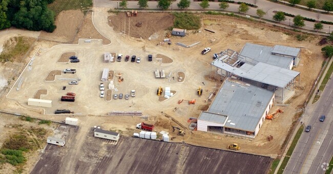
6185 Brandt Pike
Dayton, OH
Southpointe Crossing Sec 1
P70-03912-0141
1 SOUTHPOINTE CROSSING SECTION ONE EXEMPT
Parkplaygroundpicnicarea
Montgomery
2024
Ohio
2025
4 AC
100301
Northeast Central Dayton
3,510 SF
Cincinnati/Dayton
DEMOGRAPHICS near 6185 Brandt Pike
1 Mile
3 Mile
5 Mile
2024 Total Population
10,732
48,951
91,264
2029 Population
10,504
47,984
90,968
Pop Growth 2024-2029
(2.12%)
(1.98%)
(0.32%)
Average Age
39
40
39
2024 Total Households
4,130
19,397
37,039
HH Growth 2024-2029
(2.18%)
(2.04%)
(0.29%)
Median Household Inc
$67,234
$71,876
$61,162
Avg Household Size
2.50
2.50
2.40
2024 Avg HH Vehicles
2.00
2.00
2.00
Median Home Value
$149,218
$157,600
$157,860
Median Year Built
1966
1974
1974
Nearby Places
Map Layers
Map Styles
 Street
 Aerial
- Restaurants
- Banks
- Shops
- Fitness
- Groceries
PUBLIC TRANSPORTATION
AIRPORT
James M Cox Dayton International
DRIVE
WALK
Distance
James M Cox Dayton International
17 min
11.0 mi
Freight Ports
Port of Toledo
DRIVE
WALK
Distance
Port of Toledo
176 min
151.2 mi
Nearby Properties
Address
Land Use
TOTAL SIZE
Lot Size
Zoning
Address
Land Use
TOTAL SIZE
Lot Size
Zoning
4,800 SF
0.28 AC
Address
Land Use
TOTAL SIZE
Lot Size
Zoning
0.28 AC
Address
Land Use
TOTAL SIZE
Lot Size
Zoning
14.22 AC
Address
Land Use
TOTAL SIZE
Lot Size
Zoning
30.29 AC
Address
Land Use
TOTAL SIZE
Lot Size
Zoning
340,028 SF
37.51 AC
Address
Land Use
TOTAL SIZE
Lot Size
Zoning
74,330 SF
23.79 AC
Address
Land Use
TOTAL SIZE
Lot Size
Zoning
54,740 SF
8.01 AC
Address
Land Use
TOTAL SIZE
Lot Size
Zoning
23,980 SF
9.47 AC
Address
Land Use
TOTAL SIZE
Lot Size
Zoning
18,087 SF
19.69 AC
Address
Land Use
TOTAL SIZE
Lot Size
Zoning
51.78 AC
Address
Land Use
TOTAL SIZE
Lot Size
Zoning
3,903 SF
5.38 AC
Address
Land Use
TOTAL SIZE
Lot Size
Zoning
1,080 SF
30 AC
Address
Land Use
TOTAL SIZE
Lot Size
Zoning
207,442 SF
42.40 AC
Address
Land Use
TOTAL SIZE
Lot Size
Zoning
Address
Land Use
TOTAL SIZE
Lot Size
Zoning
21.53 AC
Address
Land Use
TOTAL SIZE
Lot Size
Zoning
10.25 AC
Address
Land Use
TOTAL SIZE
Lot Size
Zoning
13.47 AC
Address
Land Use
TOTAL SIZE
Lot Size
Zoning
67,094 SF
5.12 AC
Address
Land Use
TOTAL SIZE
Lot Size
Zoning
203,243 SF
24.41 AC
Address
Land Use
TOTAL SIZE
Lot Size
Zoning
66,042 SF
9.47 AC
Address
Land Use
TOTAL SIZE
Lot Size
Zoning
7,800 SF
19.49 AC
Address
Land Use
TOTAL SIZE
Lot Size
Zoning
173,672 SF
38.87 AC
Address
Land Use
TOTAL SIZE
Lot Size
Zoning
47,904 SF
2.25 AC
Address
Land Use
TOTAL SIZE
Lot Size
Zoning
16,778 SF
1.89 AC
Address
Land Use
TOTAL SIZE
Lot Size
Zoning
97,859 SF
7.67 AC
Address
Land Use
TOTAL SIZE
Lot Size
Zoning
37,742 SF
19.45 AC
Address
Land Use
TOTAL SIZE
Lot Size
Zoning
23,870 SF
14.27 AC
Address
Land Use
TOTAL SIZE
Lot Size
Zoning
66,610 SF
3.90 AC
Address
Land Use
TOTAL SIZE
Lot Size
Zoning
52,409 SF
18.24 AC
Address
Land Use
TOTAL SIZE
Lot Size
Zoning
4.68 AC
The World's #1 Commercial Real Estate Marketplace
Connect with us
© 2026 CoStar Group
The information above has been obtained from sources believed reliable. While we do not doubt its accuracy we have not verified it and make no guarantee, warranty or representation about it. It is your responsibility to independently confirm its accuracy and completeness. Any projections, opinions, assumptions, or estimates used are for example only and do not represent the current or future performance of the property. The value of this transaction to you depends on tax and other factors which should be evaluated by your tax, financial, and legal advisors. You and your advisors should conduct a careful, independent investigation of the property to determine to your satisfaction the suitability of the property for your needs.