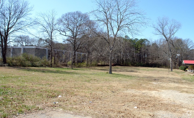
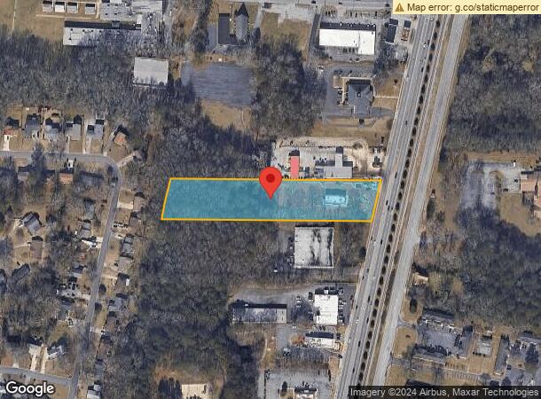
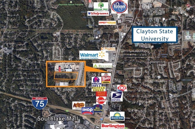
Property Record
6185 Jonesboro Rd, Morrow, GA 30260
NEARBY LISTINGS FOR SALE OR LEASE
Property Detail
6185 Jonesboro Rd
Atlanta-Sandy Springs-Roswell, GA
Plat Imperial Mgmt Corp
12-0143C-00B-008
COMMERCIAL
Restaurantdrivein
Clayton
X
Georgia
13063C0079F
143
2025
2.70 AC
2025
North Clayton/Airport
040418
Atlanta
2,059 SF
DEMOGRAPHICS near 6185 Jonesboro Rd
1 Mile
3 Mile
5 Mile
2024 Total Population
9,493
73,754
180,132
2029 Population
9,684
73,620
179,739
Pop Growth 2024-2029
+ 2.01%
(0.18%)
(0.22%)
Average Age
34
35
36
2024 Total Households
3,219
26,259
64,948
HH Growth 2024-2029
+ 3.20%
(0.01%)
(0.15%)
Median Household Inc
$44,789
$45,385
$46,997
Avg Household Size
2.70
2.70
2.70
2024 Avg HH Vehicles
2.00
2.00
2.00
Median Home Value
$156,745
$149,716
$160,231
Median Year Built
1977
1978
1984
Nearby Places
Map Layers
Map Styles
 Street
 Aerial
- Restaurants
- Banks
- Shops
- Fitness
- Groceries
PUBLIC TRANSPORTATION
AIRPORT
Hartsfield - Jackson Atlanta International
DRIVE
WALK
Distance
Hartsfield - Jackson Atlanta International
15 min
9.2 mi
Freight Ports
Georgia Ports - Savannah
DRIVE
WALK
Distance
Georgia Ports - Savannah
262 min
235.0 mi
SALE & LEASE HISTORY
LISTING DATE
SALE/LEASE

Sep 24, 2016
For Sale
Jan 22, 2018
For Sale
Nearby Properties
Address
Land Use
TOTAL SIZE
Lot Size
Zoning
Address
Land Use
TOTAL SIZE
Lot Size
Zoning
666,576 SF
63.38 AC
I
Address
Land Use
TOTAL SIZE
Lot Size
Zoning
518,648 SF
31.03 AC
MCD
Address
Land Use
TOTAL SIZE
Lot Size
Zoning
570,146 SF
42.33 AC
I
Address
Land Use
TOTAL SIZE
Lot Size
Zoning
42,671 SF
56.11 AC
I
Address
Land Use
TOTAL SIZE
Lot Size
Zoning
873,223 SF
60.88 AC
I
Address
Land Use
TOTAL SIZE
Lot Size
Zoning
596 SF
57.40 AC
RM
Address
Land Use
TOTAL SIZE
Lot Size
Zoning
217,289 SF
52.12 AC
OI
Address
Land Use
TOTAL SIZE
Lot Size
Zoning
25.16 AC
RM
Address
Land Use
TOTAL SIZE
Lot Size
Zoning
330 SF
33.30 AC
RM
Address
Land Use
TOTAL SIZE
Lot Size
Zoning
11.31 AC
RM
Address
Land Use
TOTAL SIZE
Lot Size
Zoning
250 SF
31.25 AC
RM
Address
Land Use
TOTAL SIZE
Lot Size
Zoning
200 SF
23.02 AC
RM
Address
Land Use
TOTAL SIZE
Lot Size
Zoning
707,780 SF
85.14 AC
MXI
Address
Land Use
TOTAL SIZE
Lot Size
Zoning
230 SF
27.09 AC
RM
Address
Land Use
TOTAL SIZE
Lot Size
Zoning
200,370 SF
23.81 AC
C
Address
Land Use
TOTAL SIZE
Lot Size
Zoning
351,207 SF
20 AC
HI
Address
Land Use
TOTAL SIZE
Lot Size
Zoning
105,260 SF
12.67 AC
C
Address
Land Use
TOTAL SIZE
Lot Size
Zoning
212,048 SF
110.06 AC
HI
Address
Land Use
TOTAL SIZE
Lot Size
Zoning
161,920 SF
14.26 AC
I
Address
Land Use
TOTAL SIZE
Lot Size
Zoning
365,298 SF
22.51 AC
I
Address
Land Use
TOTAL SIZE
Lot Size
Zoning
220,000 SF
54.68 AC
I
Address
Land Use
TOTAL SIZE
Lot Size
Zoning
252 SF
27.14 AC
RM
Address
Land Use
TOTAL SIZE
Lot Size
Zoning
308,683 SF
41.30 AC
C
Address
Land Use
TOTAL SIZE
Lot Size
Zoning
87,449 SF
14 AC
MC
Address
Land Use
TOTAL SIZE
Lot Size
Zoning
200 SF
20.23 AC
RM
Address
Land Use
TOTAL SIZE
Lot Size
Zoning
190 SF
21.66 AC
RM
Address
Land Use
TOTAL SIZE
Lot Size
Zoning
410 SF
35 AC
RM
Address
Land Use
TOTAL SIZE
Lot Size
Zoning
259,168 SF
29.08 AC
GB
Address
Land Use
TOTAL SIZE
Lot Size
Zoning
252 SF
23.62 AC
RM
Address
Land Use
TOTAL SIZE
Lot Size
Zoning
120 SF
26.48 AC
RM
The World's #1 Commercial Real Estate Marketplace
Connect with us
© 2025 CoStar Group
The information above has been obtained from sources believed reliable. While we do not doubt its accuracy we have not verified it and make no guarantee, warranty or representation about it. It is your responsibility to independently confirm its accuracy and completeness. Any projections, opinions, assumptions, or estimates used are for example only and do not represent the current or future performance of the property. The value of this transaction to you depends on tax and other factors which should be evaluated by your tax, financial, and legal advisors. You and your advisors should conduct a careful, independent investigation of the property to determine to your satisfaction the suitability of the property for your needs.