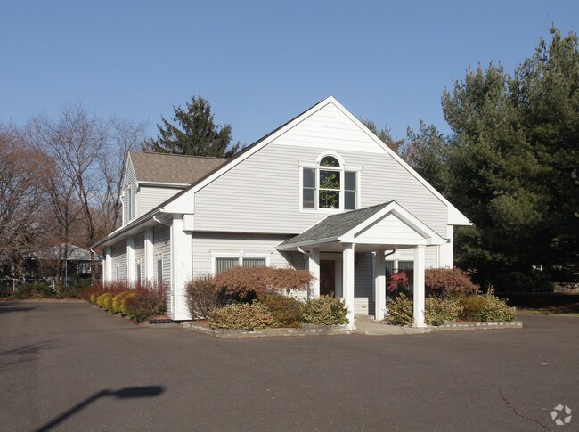
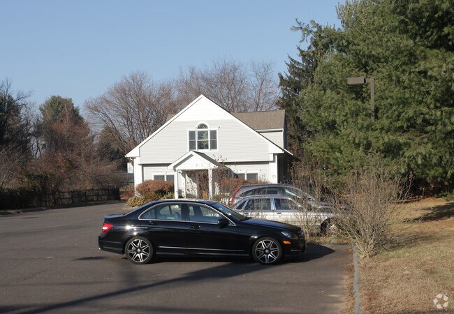
Property Record
617 Hazard Ave, Enfield, CT 06082

Property Detail
617 Hazard Ave
ENFI-000110-000000-000254
Capitol
Commercialofficeresidentialmixeduse
Connecticut
R33
254
B and X Area of moderate flood hazard, usually the area between the limits of the 100-year and 500-year floods.
1.18 AC
2025
Enfield
2025
Hartford
480900
Hartford-West Hartford-East Hartford, CT
NEARBY LISTINGS FOR SALE OR LEASE
-
-
View all Enfield listings for sale on LoopNet.com
DEMOGRAPHICS near 617 Hazard Ave
1 mile
3 mile
5 mile
2025 Total Population
4,065
15,018
63,344
2030 Population
4,146
15,322
64,604
Pop Growth 2025-2030
+ 1.99%
+ 2.02%
+ 1.99%
Average Age
43
44
43
2025 Total Households
1,346
5,793
24,692
HH Growth 2025-2030
+ 2.01%
+ 2.09%
+ 2.06%
Median Household Inc
$113,414
$103,798
$100,686
Avg Household Size
2.50
2.40
2.40
2025 Avg HH Vehicles
2.00
2.00
2.00
Median Home Value
$267,712
$295,309
$301,256
Median Year Built
1959
1966
1966
Nearby Places
Map Layers
Map Styles
 Street
 Aerial
Layers
 Traffic
 Biking
Places
Listings with unknown addresses are not visible on the map
- Restaurants
- Banks
- Shops
- Fitness
- Groceries
PUBLIC TRANSPORTATION
AIRPORT
Bradley International
Drive
Walk
Distance
Bradley International
28 min
11.9 mi
Freight Ports
Port of New Haven
Drive
Walk
Distance
Port of New Haven
82 min
60.8 mi
Nearby Properties
Address
Land Use
TOTAL SIZE
Lot Size
Zoning
Address
Land Use
TOTAL SIZE
Lot Size
Zoning
750,000 SF
405 AC
A-1
Address
Land Use
TOTAL SIZE
Lot Size
Zoning
226,545 SF
14 AC
A-1
Address
Land Use
TOTAL SIZE
Lot Size
Zoning
370.78 AC
R88
Address
Land Use
TOTAL SIZE
Lot Size
Zoning
283.30 AC
R88
Address
Land Use
TOTAL SIZE
Lot Size
Zoning
108.50 AC
A-1
Address
Land Use
TOTAL SIZE
Lot Size
Zoning
500,000 SF
71.20 AC
I-1
Address
Land Use
TOTAL SIZE
Lot Size
Zoning
121.07 AC
I-1
Address
Land Use
TOTAL SIZE
Lot Size
Zoning
49.16 AC
I-1
Address
Land Use
TOTAL SIZE
Lot Size
Zoning
36.97 AC
I-1
Address
Land Use
TOTAL SIZE
Lot Size
Zoning
211,256 SF
41.58 AC
R33
Address
Land Use
TOTAL SIZE
Lot Size
Zoning
121 AC
A-1
Address
Land Use
TOTAL SIZE
Lot Size
Zoning
1.87 AC
BP
Address
Land Use
TOTAL SIZE
Lot Size
Zoning
54.05 AC
I-1
Address
Land Use
TOTAL SIZE
Lot Size
Zoning
15.91 AC
R44
Address
Land Use
TOTAL SIZE
Lot Size
Zoning
104,111 SF
11.16 AC
I-1
Address
Land Use
TOTAL SIZE
Lot Size
Zoning
53,850 SF
8.12 AC
R33
Address
Land Use
TOTAL SIZE
Lot Size
Zoning
90,776 SF
23.48 AC
I-1
Address
Land Use
TOTAL SIZE
Lot Size
Zoning
169,680 SF
11.49 AC
I-1
Address
Land Use
TOTAL SIZE
Lot Size
Zoning
10.37 AC
BL
Address
Land Use
TOTAL SIZE
Lot Size
Zoning
47,756 SF
6.17 AC
R33
Address
Land Use
TOTAL SIZE
Lot Size
Zoning
24,630 SF
3.72 AC
BP
Address
Land Use
TOTAL SIZE
Lot Size
Zoning
101,440 SF
19.07 AC
I-1
Address
Land Use
TOTAL SIZE
Lot Size
Zoning
67.24 AC
R88
Address
Land Use
TOTAL SIZE
Lot Size
Zoning
55,752 SF
7.58 AC
I-1
Address
Land Use
TOTAL SIZE
Lot Size
Zoning
16,282 SF
11 AC
A-1
Address
Land Use
TOTAL SIZE
Lot Size
Zoning
2,746 SF
45.08 AC
R88
Address
Land Use
TOTAL SIZE
Lot Size
Zoning
18.66 AC
Address
Land Use
TOTAL SIZE
Lot Size
Zoning
6.25 AC
I-1
Address
Land Use
TOTAL SIZE
Lot Size
Zoning
5.80 AC
R44
Address
Land Use
TOTAL SIZE
Lot Size
Zoning
20,208 SF
2 AC
A-1
The World's #1 Commercial Real Estate Marketplace
Connect with us
© 2026 CoStar Group
The information above has been obtained from sources believed reliable. While we do not doubt its accuracy we have not verified it and make no guarantee, warranty or representation about it. It is your responsibility to independently confirm its accuracy and completeness. Any projections, opinions, assumptions, or estimates used are for example only and do not represent the current or future performance of the property. The value of this transaction to you depends on tax and other factors which should be evaluated by your tax, financial, and legal advisors. You and your advisors should conduct a careful, independent investigation of the property to determine to your satisfaction the suitability of the property for your needs.