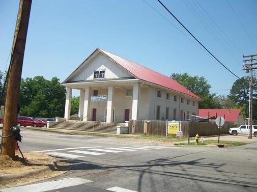
Property Record
619 N 20Th St, Van Buren, AR 72956


NEARBY LISTINGS FOR SALE OR LEASE
Property Detail
619 N 20Th St
Fort Smith, AR-OK
Fairmount
700-02576-000-C
PER DOC#2008004185 FILED 4/28/2008: LOTS 1, 2, 3, & 9, BLOCK 1, FAIRMOUNT ADDITION TO THE CITY OF VAN BUREN, ARKANSAS.
Religious
Crawford
X
Arkansas
05131C0030E
1-3,9
0
0.16 AC
2025
Crawford County
020301
Fort Smith
12,185 SF
DEMOGRAPHICS near 619 N 20Th St
1 Mile
3 Mile
5 Mile
2024 Total Population
7,834
27,270
58,055
2029 Population
8,211
28,313
59,841
Pop Growth 2024-2029
+ 4.81%
+ 3.82%
+ 3.08%
Average Age
39
39
38
2024 Total Households
3,141
10,317
21,461
HH Growth 2024-2029
+ 4.90%
+ 3.88%
+ 3.11%
Median Household Inc
$43,026
$49,702
$43,281
Avg Household Size
2.40
2.50
2.60
2024 Avg HH Vehicles
2.00
2.00
2.00
Median Home Value
$129,806
$143,316
$130,472
Median Year Built
1976
1985
1980
Nearby Places
Map Layers
Map Styles
 Street
 Aerial
- Restaurants
- Banks
- Shops
- Fitness
- Groceries
PUBLIC TRANSPORTATION
AIRPORT
Fort Smith Regional
DRIVE
WALK
Distance
Fort Smith Regional
19 min
10.5 mi
Freight Ports
Tulsa Port of Inola
DRIVE
WALK
Distance
Tulsa Port of Inola
137 min
112.2 mi
SALE & LEASE HISTORY
LISTING DATE
SALE/LEASE

Apr 12, 2018
For Sale
Nearby Properties
Address
Land Use
TOTAL SIZE
Lot Size
Zoning
Address
Land Use
TOTAL SIZE
Lot Size
Zoning
856,730 SF
78.67 AC
Address
Land Use
TOTAL SIZE
Lot Size
Zoning
59,938 SF
48.92 AC
Address
Land Use
TOTAL SIZE
Lot Size
Zoning
194,508 SF
19.02 AC
Address
Land Use
TOTAL SIZE
Lot Size
Zoning
154,830 SF
9.82 AC
Address
Land Use
TOTAL SIZE
Lot Size
Zoning
197,067 SF
17.34 AC
Address
Land Use
TOTAL SIZE
Lot Size
Zoning
581,085 SF
30.29 AC
Address
Land Use
TOTAL SIZE
Lot Size
Zoning
103,548 SF
4.78 AC
Address
Land Use
TOTAL SIZE
Lot Size
Zoning
138,756 SF
15.82 AC
Address
Land Use
TOTAL SIZE
Lot Size
Zoning
56,330 SF
12.75 AC
Address
Land Use
TOTAL SIZE
Lot Size
Zoning
213,730 SF
10.17 AC
Address
Land Use
TOTAL SIZE
Lot Size
Zoning
69,745 SF
6.82 AC
Address
Land Use
TOTAL SIZE
Lot Size
Zoning
70,901 SF
3.21 AC
Address
Land Use
TOTAL SIZE
Lot Size
Zoning
191,458 SF
16.19 AC
Address
Land Use
TOTAL SIZE
Lot Size
Zoning
99,116 SF
4.25 AC
Address
Land Use
TOTAL SIZE
Lot Size
Zoning
17,764 SF
7.51 AC
Address
Land Use
TOTAL SIZE
Lot Size
Zoning
102,973 SF
13.05 AC
Address
Land Use
TOTAL SIZE
Lot Size
Zoning
8,960 SF
1.12 AC
Address
Land Use
TOTAL SIZE
Lot Size
Zoning
233,541 SF
23.71 AC
Address
Land Use
TOTAL SIZE
Lot Size
Zoning
199,396 SF
11.68 AC
Address
Land Use
TOTAL SIZE
Lot Size
Zoning
52,341 SF
11.52 AC
Address
Land Use
TOTAL SIZE
Lot Size
Zoning
94,763 SF
11.29 AC
Address
Land Use
TOTAL SIZE
Lot Size
Zoning
11,189 SF
1.39 AC
Address
Land Use
TOTAL SIZE
Lot Size
Zoning
96,327 SF
6.06 AC
Address
Land Use
TOTAL SIZE
Lot Size
Zoning
51,884 SF
5 AC
Address
Land Use
TOTAL SIZE
Lot Size
Zoning
45,235 SF
13.03 AC
Address
Land Use
TOTAL SIZE
Lot Size
Zoning
37,247 SF
11.32 AC
Address
Land Use
TOTAL SIZE
Lot Size
Zoning
78,440 SF
30.76 AC
Address
Land Use
TOTAL SIZE
Lot Size
Zoning
37,597 SF
3.20 AC
Address
Land Use
TOTAL SIZE
Lot Size
Zoning
75,172 SF
8.74 AC
Address
Land Use
TOTAL SIZE
Lot Size
Zoning
186,250 SF
15.30 AC
The World's #1 Commercial Real Estate Marketplace
Connect with us
© 2026 CoStar Group
The information above has been obtained from sources believed reliable. While we do not doubt its accuracy we have not verified it and make no guarantee, warranty or representation about it. It is your responsibility to independently confirm its accuracy and completeness. Any projections, opinions, assumptions, or estimates used are for example only and do not represent the current or future performance of the property. The value of this transaction to you depends on tax and other factors which should be evaluated by your tax, financial, and legal advisors. You and your advisors should conduct a careful, independent investigation of the property to determine to your satisfaction the suitability of the property for your needs.