Property Record
619 Welshire Dr, La Crescent, MN 55947


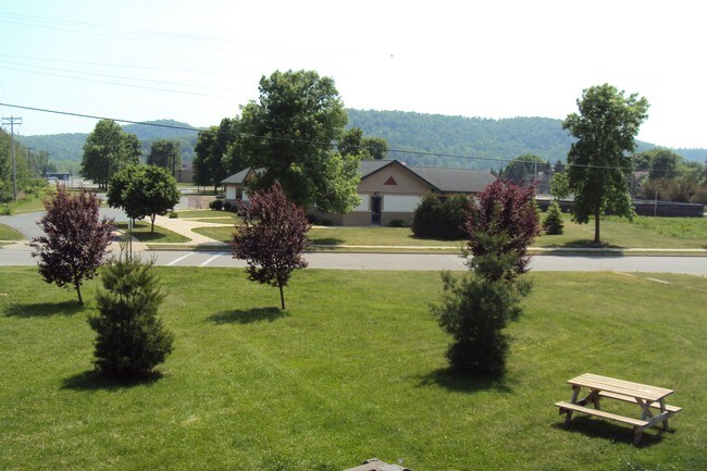
Property Detail
619 Welshire Dr
La Crosse-Onalaska, WI-MN
SECT-10 TWP-104 RANGE-004 FAYS GOLDEN ACRES LOT-003 BLOCK-004 DOC #230760 & #246989 DOC 258519; DOC 260086; DOC 291111
R-25.1116.000
Houston
Apartment
Minnesota
B and X Area of moderate flood hazard, usually the area between the limits of the 100-year and 500-year floods.
3
2025
0.29 AC
2025
Minnesota South Area
020100
Other Market Areas
4,140 SF
NEARBY LISTINGS FOR SALE OR LEASE
-
-
View all La Crescent listings for sale on LoopNet.com
DEMOGRAPHICS near 619 Welshire Dr
1 mile
3 mile
5 mile
2025 Total Population
3,652
6,498
51,312
2030 Population
3,582
6,385
51,346
Pop Growth 2025-2030
(1.92%)
(1.74%)
+ 0.07%
Average Age
43
43
38
2025 Total Households
1,614
2,835
21,738
HH Growth 2025-2030
(1.98%)
(1.76%)
+ 0.06%
Median Household Inc
$76,793
$77,889
$53,384
Avg Household Size
2.20
2.30
2.10
2025 Avg HH Vehicles
2.00
2.00
2.00
Median Home Value
$262,654
$286,727
$224,502
Median Year Built
1973
1973
1965
Nearby Places
Map Layers
Map Styles
 Street
 Aerial
Transit
 Traffic
 Biking
Places
Listings with unknown addresses are not visible on the map
- Restaurants
- Banks
- Shops
- Fitness
- Groceries
PUBLIC TRANSPORTATION
COMMUTER RAIL
Drive
Walk
Distance
17 min
7.0 mi
AIRPORT
La Crosse Regional
Drive
Walk
Distance
La Crosse Regional
15 min
7.5 mi
SALE & LEASE HISTORY
LISTING DATE
SALE/LEASE

Sep 27, 2017
For Sale
Nearby Properties
Address
Land Use
TOTAL SIZE
Lot Size
Zoning
Address
Land Use
TOTAL SIZE
Lot Size
Zoning
158,050 SF
44.85 AC
Address
Land Use
TOTAL SIZE
Lot Size
Zoning
131,552 SF
0.89 AC
Address
Land Use
TOTAL SIZE
Lot Size
Zoning
59,405 SF
5.64 AC
Address
Land Use
TOTAL SIZE
Lot Size
Zoning
5.79 AC
MZA
Address
Land Use
TOTAL SIZE
Lot Size
Zoning
73,056 SF
0.62 AC
Address
Land Use
TOTAL SIZE
Lot Size
Zoning
2.10 AC
MZA
Address
Land Use
TOTAL SIZE
Lot Size
Zoning
7.88 AC
IND
Address
Land Use
TOTAL SIZE
Lot Size
Zoning
64,480 SF
0.69 AC
MZA
Address
Land Use
TOTAL SIZE
Lot Size
Zoning
1.20 AC
MZA
Address
Land Use
TOTAL SIZE
Lot Size
Zoning
2.12 AC
MZA
Address
Land Use
TOTAL SIZE
Lot Size
Zoning
11,708 SF
5.70 AC
Address
Land Use
TOTAL SIZE
Lot Size
Zoning
0.78 AC
MZA
Address
Land Use
TOTAL SIZE
Lot Size
Zoning
27,000 SF
0.22 AC
MZA
Address
Land Use
TOTAL SIZE
Lot Size
Zoning
1.79 AC
MZA
Address
Land Use
TOTAL SIZE
Lot Size
Zoning
2.12 AC
MZA
Address
Land Use
TOTAL SIZE
Lot Size
Zoning
1.69 AC
MZA
Address
Land Use
TOTAL SIZE
Lot Size
Zoning
7.22 AC
IND
Address
Land Use
TOTAL SIZE
Lot Size
Zoning
35,000 SF
0.82 AC
MZA
Address
Land Use
TOTAL SIZE
Lot Size
Zoning
2.97 AC
MZA
Address
Land Use
TOTAL SIZE
Lot Size
Zoning
1.50 AC
MZA
Address
Land Use
TOTAL SIZE
Lot Size
Zoning
0.90 AC
MZA
Address
Land Use
TOTAL SIZE
Lot Size
Zoning
8.95 AC
IND
Address
Land Use
TOTAL SIZE
Lot Size
Zoning
9,356 SF
2.58 AC
Address
Land Use
TOTAL SIZE
Lot Size
Zoning
3,330 SF
46 AC
ANR
Address
Land Use
TOTAL SIZE
Lot Size
Zoning
5,520 SF
1.49 AC
Address
Land Use
TOTAL SIZE
Lot Size
Zoning
1,632 SF
2.62 AC
Address
Land Use
TOTAL SIZE
Lot Size
Zoning
35,712 SF
10.37 AC
Address
Land Use
TOTAL SIZE
Lot Size
Zoning
56,542 SF
1.44 AC
MZA
Address
Land Use
TOTAL SIZE
Lot Size
Zoning
8,954 SF
0.90 AC
The World's #1 Commercial Real Estate Marketplace
Connect with us
© 2026 CoStar Group
The information above has been obtained from sources believed reliable. While we do not doubt its accuracy we have not verified it and make no guarantee, warranty or representation about it. It is your responsibility to independently confirm its accuracy and completeness. Any projections, opinions, assumptions, or estimates used are for example only and do not represent the current or future performance of the property. The value of this transaction to you depends on tax and other factors which should be evaluated by your tax, financial, and legal advisors. You and your advisors should conduct a careful, independent investigation of the property to determine to your satisfaction the suitability of the property for your needs.