Property Record
6190 W Chandler Blvd, Chandler, AZ 85226


NEARBY LISTINGS FOR SALE OR LEASE
Property Detail
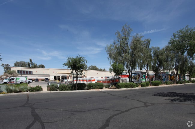
6190 W Chandler Blvd
Phoenix-Mesa-Scottsdale, AZ
Chandler Business Center
301-68-955
CHANDLER BUSINESS CENTER MCR 574-30
Publicstorage
Maricopa
X
Arizona
04013C2715L
1
2025
6 AC
2025
South Tempe/Ahwatukee
810400
Phoenix
108,188 SF
DEMOGRAPHICS near 6190 W Chandler Blvd
1 Mile
3 Mile
5 Mile
2024 Total Population
8,404
76,771
193,326
2029 Population
9,023
82,480
207,867
Pop Growth 2024-2029
+ 7.37%
+ 7.44%
+ 7.52%
Average Age
40
39
39
2024 Total Households
3,409
30,999
78,100
HH Growth 2024-2029
+ 7.42%
+ 7.54%
+ 7.63%
Median Household Inc
$92,856
$96,277
$91,892
Avg Household Size
2.40
2.40
2.40
2024 Avg HH Vehicles
2.00
2.00
2.00
Median Home Value
$392,022
$415,018
$405,766
Median Year Built
1991
1992
1989
Nearby Places
Map Layers
Map Styles
 Street
 Aerial
- Restaurants
- Banks
- Shops
- Fitness
- Groceries
PUBLIC TRANSPORTATION
AIRPORT
Phoenix Sky Harbor International
DRIVE
WALK
Distance
Phoenix Sky Harbor International
20 min
13.0 mi
Phoenix-Mesa Gateway
DRIVE
WALK
Distance
Phoenix-Mesa Gateway
28 min
18.8 mi
Freight Ports
Port of San Diego
DRIVE
WALK
Distance
Port of San Diego
393 min
359.5 mi
Nearby Properties
Address
Land Use
TOTAL SIZE
Lot Size
Zoning
Address
Land Use
TOTAL SIZE
Lot Size
Zoning
47,945 SF
8.35 AC
C-C
Address
Land Use
TOTAL SIZE
Lot Size
Zoning
724,125 SF
41.62 AC
PAD
Address
Land Use
TOTAL SIZE
Lot Size
Zoning
1,149,733 SF
70.56 AC
PAD
Address
Land Use
TOTAL SIZE
Lot Size
Zoning
724,125 SF
39.23 AC
Address
Land Use
TOTAL SIZE
Lot Size
Zoning
14.98 AC
I-1
Address
Land Use
TOTAL SIZE
Lot Size
Zoning
656,241 SF
29.09 AC
PAD
Address
Land Use
TOTAL SIZE
Lot Size
Zoning
1,085,359 SF
74.95 AC
PAD
Address
Land Use
TOTAL SIZE
Lot Size
Zoning
390,410 SF
47.65 AC
R-35
Address
Land Use
TOTAL SIZE
Lot Size
Zoning
442,642 SF
35.15 AC
GID
Address
Land Use
TOTAL SIZE
Lot Size
Zoning
393,258 SF
49.79 AC
AG
Address
Land Use
TOTAL SIZE
Lot Size
Zoning
412,062 SF
21.84 AC
C-C
Address
Land Use
TOTAL SIZE
Lot Size
Zoning
415,228 SF
19.48 AC
I-1
Address
Land Use
TOTAL SIZE
Lot Size
Zoning
713,461 SF
38.66 AC
I-1
Address
Land Use
TOTAL SIZE
Lot Size
Zoning
283,782 SF
25.29 AC
I-1
Address
Land Use
TOTAL SIZE
Lot Size
Zoning
409,148 SF
29.15 AC
I-1
Address
Land Use
TOTAL SIZE
Lot Size
Zoning
230,853 SF
23.41 AC
C-R
Address
Land Use
TOTAL SIZE
Lot Size
Zoning
301,597 SF
10.79 AC
PAD
Address
Land Use
TOTAL SIZE
Lot Size
Zoning
244,900 SF
38.47 AC
PF
Address
Land Use
TOTAL SIZE
Lot Size
Zoning
300,965 SF
13.37 AC
PAD
Address
Land Use
TOTAL SIZE
Lot Size
Zoning
229,469 SF
23.78 AC
PAD
Address
Land Use
TOTAL SIZE
Lot Size
Zoning
313,144 SF
8.62 AC
PAD
Address
Land Use
TOTAL SIZE
Lot Size
Zoning
214,126 SF
11.42 AC
Address
Land Use
TOTAL SIZE
Lot Size
Zoning
240,814 SF
22.70 AC
C2
Address
Land Use
TOTAL SIZE
Lot Size
Zoning
422,759 SF
22.23 AC
M-H
Address
Land Use
TOTAL SIZE
Lot Size
Zoning
480,044 SF
20.47 AC
R-3A
Address
Land Use
TOTAL SIZE
Lot Size
Zoning
252,379 SF
24.58 AC
PAD
Address
Land Use
TOTAL SIZE
Lot Size
Zoning
329,605 SF
8.05 AC
PAD
Address
Land Use
TOTAL SIZE
Lot Size
Zoning
13,636 SF
32.62 AC
R-35
Address
Land Use
TOTAL SIZE
Lot Size
Zoning
306,300 SF
16.54 AC
PAD
Address
Land Use
TOTAL SIZE
Lot Size
Zoning
215,895 SF
17.49 AC
C-C
The World's #1 Commercial Real Estate Marketplace
Connect with us
© 2026 CoStar Group
The information above has been obtained from sources believed reliable. While we do not doubt its accuracy we have not verified it and make no guarantee, warranty or representation about it. It is your responsibility to independently confirm its accuracy and completeness. Any projections, opinions, assumptions, or estimates used are for example only and do not represent the current or future performance of the property. The value of this transaction to you depends on tax and other factors which should be evaluated by your tax, financial, and legal advisors. You and your advisors should conduct a careful, independent investigation of the property to determine to your satisfaction the suitability of the property for your needs.