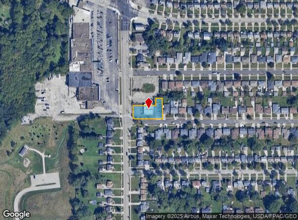
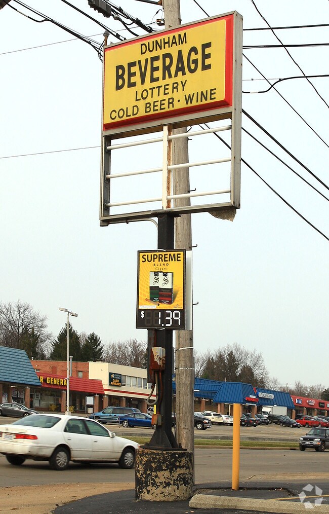
Property Record
6191 Dunham Rd, Maple Heights, OH 44137

NEARBY LISTINGS FOR SALE OR LEASE
Property Detail
6191 Dunham Rd
Cleveland-Elyria, OH
Home Park Land Cos Dunham-Turne
786-11-001
42 DUNTLEE S/L 367 TO 368 ALL 0366 ALL 78611002 78611184
Storebuilding
Cuyahoga
X
Ohio
39035C0214E
366
2024
0.37 AC
2024
South
171206
Cleveland
3,050 SF
DEMOGRAPHICS near 6191 Dunham Rd
1 Mile
3 Mile
5 Mile
2024 Total Population
11,808
59,383
164,820
2029 Population
11,721
58,136
160,984
Pop Growth 2024-2029
(0.74%)
(2.10%)
(2.33%)
Average Age
43
42
42
2024 Total Households
5,651
25,705
70,607
HH Growth 2024-2029
(0.65%)
(2.19%)
(2.49%)
Median Household Inc
$47,008
$49,528
$50,139
Avg Household Size
2.00
2.20
2.30
2024 Avg HH Vehicles
2.00
2.00
2.00
Median Home Value
$89,644
$84,377
$106,071
Median Year Built
1963
1956
1956
Nearby Places
Map Layers
Map Styles
 Street
 Aerial
- Restaurants
- Banks
- Shops
- Fitness
- Groceries
PUBLIC TRANSPORTATION
COMMUTER RAIL
DRIVE
WALK
Distance
7 min
2.9 mi
DRIVE
WALK
Distance
9 min
3.6 mi
AIRPORT
Cleveland-Hopkins International
DRIVE
WALK
Distance
Cleveland-Hopkins International
30 min
16.8 mi
Akron-Canton Regional
DRIVE
WALK
Distance
Akron-Canton Regional
54 min
39.0 mi
Nearby Properties
Address
Land Use
TOTAL SIZE
Lot Size
Zoning
Address
Land Use
TOTAL SIZE
Lot Size
Zoning
376,124 SF
71.73 AC
Address
Land Use
TOTAL SIZE
Lot Size
Zoning
186,275 SF
17.80 AC
U-8
Address
Land Use
TOTAL SIZE
Lot Size
Zoning
129,112 SF
24.11 AC
U-8
Address
Land Use
TOTAL SIZE
Lot Size
Zoning
289,009 SF
25.27 AC
I/O
Address
Land Use
TOTAL SIZE
Lot Size
Zoning
227,141 SF
23.76 AC
U-4
Address
Land Use
TOTAL SIZE
Lot Size
Zoning
11,808 SF
900.50 AC
1F-2
Address
Land Use
TOTAL SIZE
Lot Size
Zoning
205,724 SF
6.54 AC
U-8
Address
Land Use
TOTAL SIZE
Lot Size
Zoning
18.38 AC
R2
Address
Land Use
TOTAL SIZE
Lot Size
Zoning
32,400 SF
52.29 AC
U-4
Address
Land Use
TOTAL SIZE
Lot Size
Zoning
189,156 SF
24.49 AC
IG
Address
Land Use
TOTAL SIZE
Lot Size
Zoning
120,722 SF
20.55 AC
I/O
Address
Land Use
TOTAL SIZE
Lot Size
Zoning
14.95 AC
I-1
Address
Land Use
TOTAL SIZE
Lot Size
Zoning
260,000 SF
38.18 AC
U-5A
Address
Land Use
TOTAL SIZE
Lot Size
Zoning
137,795 SF
37.09 AC
R-4
Address
Land Use
TOTAL SIZE
Lot Size
Zoning
347,218 SF
0.23 AC
O/I
Address
Land Use
TOTAL SIZE
Lot Size
Zoning
65,108 SF
24.93 AC
I/O
Address
Land Use
TOTAL SIZE
Lot Size
Zoning
69,033 SF
8.85 AC
R-3
Address
Land Use
TOTAL SIZE
Lot Size
Zoning
133,913 SF
18.36 AC
U-11B
Address
Land Use
TOTAL SIZE
Lot Size
Zoning
350,592 SF
25.29 AC
O/I
Address
Land Use
TOTAL SIZE
Lot Size
Zoning
336,730 SF
38.51 AC
U-11A
Address
Land Use
TOTAL SIZE
Lot Size
Zoning
164,157 SF
6.29 AC
BP
Address
Land Use
TOTAL SIZE
Lot Size
Zoning
718,431 SF
18.75 AC
O/I
Address
Land Use
TOTAL SIZE
Lot Size
Zoning
192,371 SF
22.06 AC
B3
Address
Land Use
TOTAL SIZE
Lot Size
Zoning
173,110 SF
6.38 AC
U-8
Address
Land Use
TOTAL SIZE
Lot Size
Zoning
64,399 SF
1.82 AC
U-8
Address
Land Use
TOTAL SIZE
Lot Size
Zoning
127,224 SF
10 AC
IG
Address
Land Use
TOTAL SIZE
Lot Size
Zoning
96,029 SF
0.78 AC
U-8
Address
Land Use
TOTAL SIZE
Lot Size
Zoning
2.31 AC
I-1
Address
Land Use
TOTAL SIZE
Lot Size
Zoning
148,264 SF
13.20 AC
U-5A
Address
Land Use
TOTAL SIZE
Lot Size
Zoning
136,516 SF
19.64 AC
IG
The World's #1 Commercial Real Estate Marketplace
Connect with us
© 2026 CoStar Group
The information above has been obtained from sources believed reliable. While we do not doubt its accuracy we have not verified it and make no guarantee, warranty or representation about it. It is your responsibility to independently confirm its accuracy and completeness. Any projections, opinions, assumptions, or estimates used are for example only and do not represent the current or future performance of the property. The value of this transaction to you depends on tax and other factors which should be evaluated by your tax, financial, and legal advisors. You and your advisors should conduct a careful, independent investigation of the property to determine to your satisfaction the suitability of the property for your needs.