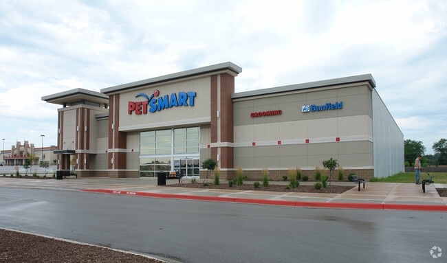
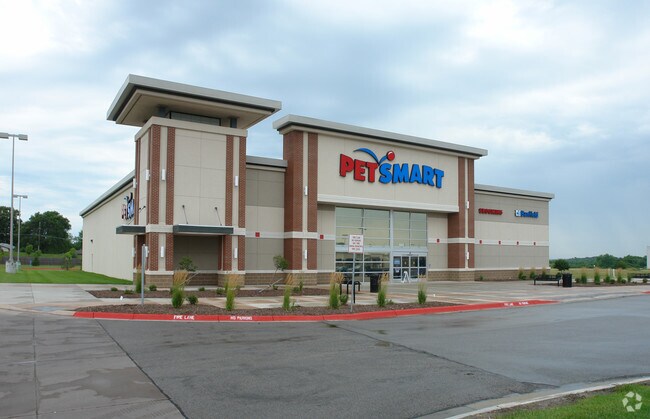
Property Record
6197 N 73 Plz, Omaha, NE 68134

NEARBY LISTINGS FOR SALE OR LEASE
Property Detail
6197 N 73 Plz
Omaha-Council Bluffs, NE-IA
Sorensen Park Plaza (A Cluster Sub)
3397-0007-22
SORENSEN PARK PLAZA (A CLUSTER SUB) LOT 2 BLOCK 0 LOT 2 28.077 AC
Storemultistory
Douglas
X
Nebraska
31055C0209H
2
2024
28.08 AC
2025
North Central Omaha
007436
Omaha/Council Bluffs
178,314 SF
DEMOGRAPHICS near 6197 N 73 Plz
1 Mile
3 Mile
5 Mile
2024 Total Population
9,052
84,767
206,165
2029 Population
9,217
85,875
209,577
Pop Growth 2024-2029
+ 1.82%
+ 1.31%
+ 1.65%
Average Age
40
37
37
2024 Total Households
3,412
33,269
84,191
HH Growth 2024-2029
+ 1.96%
+ 1.35%
+ 1.67%
Median Household Inc
$72,542
$57,430
$57,794
Avg Household Size
2.50
2.50
2.40
2024 Avg HH Vehicles
2.00
2.00
2.00
Median Home Value
$174,445
$164,185
$180,409
Median Year Built
1991
1968
1967
Nearby Places
Map Layers
Map Styles
 Street
 Aerial
- Restaurants
- Banks
- Shops
- Fitness
- Groceries
PUBLIC TRANSPORTATION
COMMUTER RAIL
DRIVE
WALK
Distance
18 min
9.2 mi
DRIVE
WALK
Distance
18 min
9.5 mi
AIRPORT
Eppley Airfield
DRIVE
WALK
Distance
Eppley Airfield
20 min
9.5 mi
Nearby Properties
Address
Land Use
TOTAL SIZE
Lot Size
Zoning
Address
Land Use
TOTAL SIZE
Lot Size
Zoning
548,510 SF
36.78 AC
Address
Land Use
TOTAL SIZE
Lot Size
Zoning
141,816 SF
24.91 AC
Address
Land Use
TOTAL SIZE
Lot Size
Zoning
301,341 SF
15.04 AC
R6
Address
Land Use
TOTAL SIZE
Lot Size
Zoning
251,394 SF
14.71 AC
Address
Land Use
TOTAL SIZE
Lot Size
Zoning
255,205 SF
9.41 AC
R6
Address
Land Use
TOTAL SIZE
Lot Size
Zoning
248,169 SF
10.39 AC
Address
Land Use
TOTAL SIZE
Lot Size
Zoning
125,945 SF
Address
Land Use
TOTAL SIZE
Lot Size
Zoning
216,823 SF
13.05 AC
Address
Land Use
TOTAL SIZE
Lot Size
Zoning
216,667 SF
8.13 AC
Address
Land Use
TOTAL SIZE
Lot Size
Zoning
186,710 SF
12.63 AC
R6
Address
Land Use
TOTAL SIZE
Lot Size
Zoning
149,539 SF
7.96 AC
R7
Address
Land Use
TOTAL SIZE
Lot Size
Zoning
228,860 SF
11.68 AC
Address
Land Use
TOTAL SIZE
Lot Size
Zoning
190,645 SF
17.99 AC
CC
Address
Land Use
TOTAL SIZE
Lot Size
Zoning
230,827 SF
15.11 AC
R6
Address
Land Use
TOTAL SIZE
Lot Size
Zoning
205,996 SF
23.01 AC
LI
Address
Land Use
TOTAL SIZE
Lot Size
Zoning
143,982 SF
6.93 AC
R6
Address
Land Use
TOTAL SIZE
Lot Size
Zoning
172,424 SF
2.88 AC
R7
Address
Land Use
TOTAL SIZE
Lot Size
Zoning
146,846 SF
8.67 AC
Address
Land Use
TOTAL SIZE
Lot Size
Zoning
109,605 SF
1.05 AC
Address
Land Use
TOTAL SIZE
Lot Size
Zoning
92,817 SF
5.68 AC
GO
Address
Land Use
TOTAL SIZE
Lot Size
Zoning
247,780 SF
12.15 AC
R6
Address
Land Use
TOTAL SIZE
Lot Size
Zoning
133,168 SF
2.09 AC
Address
Land Use
TOTAL SIZE
Lot Size
Zoning
120,839 SF
6.06 AC
Address
Land Use
TOTAL SIZE
Lot Size
Zoning
178,896 SF
16.92 AC
Address
Land Use
TOTAL SIZE
Lot Size
Zoning
80,668 SF
0.70 AC
GI
Address
Land Use
TOTAL SIZE
Lot Size
Zoning
208,469 SF
12.53 AC
Address
Land Use
TOTAL SIZE
Lot Size
Zoning
149,090 SF
7.34 AC
R6
Address
Land Use
TOTAL SIZE
Lot Size
Zoning
126,372 SF
11.81 AC
Address
Land Use
TOTAL SIZE
Lot Size
Zoning
61,867 SF
8.46 AC
MU
The World's #1 Commercial Real Estate Marketplace
Connect with us
© 2025 CoStar Group
The information above has been obtained from sources believed reliable. While we do not doubt its accuracy we have not verified it and make no guarantee, warranty or representation about it. It is your responsibility to independently confirm its accuracy and completeness. Any projections, opinions, assumptions, or estimates used are for example only and do not represent the current or future performance of the property. The value of this transaction to you depends on tax and other factors which should be evaluated by your tax, financial, and legal advisors. You and your advisors should conduct a careful, independent investigation of the property to determine to your satisfaction the suitability of the property for your needs.