Property Record
6198 Cypress St, West Monroe, LA 71291

Property Detail
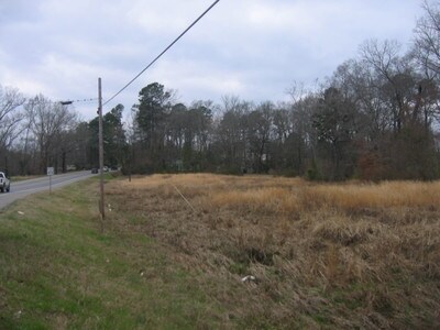
6198 Cypress St
Monroe, LA
LOT IN LOT 13 J D MCGEE'S SUB OF SEC 30 T18N R3E, BEG NW COR OF NE4 OF SW4 SEC 30 ALSO BEING NW COR LOT 13, S 1454.11 FT, NE
60801
OUACHITA
Officebuilding
Louisiana
A Areas with a 1% annual chance of flooding and a 26% chance of flooding over the life of a 30-year mortgage.
13
2025
1 AC
2025
Louisiana North Area
0053012015
Other Market Areas
NEARBY LISTINGS FOR SALE OR LEASE
DEMOGRAPHICS near 6198 Cypress St
1 mile
3 mile
5 mile
2025 Total Population
2,947
24,920
51,052
2030 Population
2,938
24,676
50,767
Pop Growth 2025-2030
(0.31%)
(0.98%)
(0.56%)
Average Age
39
40
40
2025 Total Households
1,152
10,183
20,999
HH Growth 2025-2030
(0.26%)
(1.00%)
(0.58%)
Median Household Inc
$88,366
$66,368
$63,474
Avg Household Size
2.50
2.40
2.40
2025 Avg HH Vehicles
2.00
2.00
2.00
Median Home Value
$249,640
$224,161
$216,238
Median Year Built
1995
1989
1985
Nearby Places
Map Layers
Map Styles
 Street
 Aerial
Layers
 Traffic
 Biking
Places
Listings with unknown addresses are not visible on the map
- Restaurants
- Banks
- Shops
- Fitness
- Groceries
PUBLIC TRANSPORTATION
AIRPORT
Monroe Regional
Drive
Walk
Distance
Monroe Regional
17 min
12.1 mi
Freight Ports
Port of Shreveport
Drive
Walk
Distance
Port of Shreveport
126 min
105.9 mi
Nearby Properties
Address
Land Use
TOTAL SIZE
Lot Size
Zoning
Address
Land Use
TOTAL SIZE
Lot Size
Zoning
38.56 AC
Address
Land Use
TOTAL SIZE
Lot Size
Zoning
Address
Land Use
TOTAL SIZE
Lot Size
Zoning
15.74 AC
Address
Land Use
TOTAL SIZE
Lot Size
Zoning
23.29 AC
Address
Land Use
TOTAL SIZE
Lot Size
Zoning
3.66 AC
Address
Land Use
TOTAL SIZE
Lot Size
Zoning
6.10 AC
Address
Land Use
TOTAL SIZE
Lot Size
Zoning
18.85 AC
Address
Land Use
TOTAL SIZE
Lot Size
Zoning
14.09 AC
Address
Land Use
TOTAL SIZE
Lot Size
Zoning
10.67 AC
Address
Land Use
TOTAL SIZE
Lot Size
Zoning
20.17 AC
Address
Land Use
TOTAL SIZE
Lot Size
Zoning
Address
Land Use
TOTAL SIZE
Lot Size
Zoning
Address
Land Use
TOTAL SIZE
Lot Size
Zoning
2.09 AC
Address
Land Use
TOTAL SIZE
Lot Size
Zoning
Address
Land Use
TOTAL SIZE
Lot Size
Zoning
8.05 AC
Address
Land Use
TOTAL SIZE
Lot Size
Zoning
Address
Land Use
TOTAL SIZE
Lot Size
Zoning
Address
Land Use
TOTAL SIZE
Lot Size
Zoning
4.43 AC
Address
Land Use
TOTAL SIZE
Lot Size
Zoning
5.86 AC
Address
Land Use
TOTAL SIZE
Lot Size
Zoning
Address
Land Use
TOTAL SIZE
Lot Size
Zoning
Address
Land Use
TOTAL SIZE
Lot Size
Zoning
Address
Land Use
TOTAL SIZE
Lot Size
Zoning
Address
Land Use
TOTAL SIZE
Lot Size
Zoning
38.96 AC
Address
Land Use
TOTAL SIZE
Lot Size
Zoning
Address
Land Use
TOTAL SIZE
Lot Size
Zoning
Address
Land Use
TOTAL SIZE
Lot Size
Zoning
0.87 AC
Address
Land Use
TOTAL SIZE
Lot Size
Zoning
Address
Land Use
TOTAL SIZE
Lot Size
Zoning
6.10 AC
Address
Land Use
TOTAL SIZE
Lot Size
Zoning
12.15 AC
The World's #1 Commercial Real Estate Marketplace
Connect with us
© 2026 CoStar Group
The information above has been obtained from sources believed reliable. While we do not doubt its accuracy we have not verified it and make no guarantee, warranty or representation about it. It is your responsibility to independently confirm its accuracy and completeness. Any projections, opinions, assumptions, or estimates used are for example only and do not represent the current or future performance of the property. The value of this transaction to you depends on tax and other factors which should be evaluated by your tax, financial, and legal advisors. You and your advisors should conduct a careful, independent investigation of the property to determine to your satisfaction the suitability of the property for your needs.