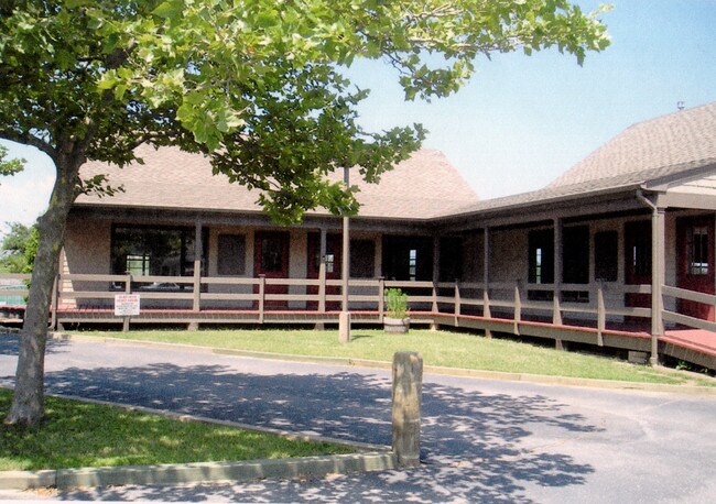
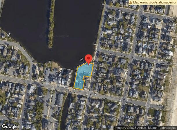
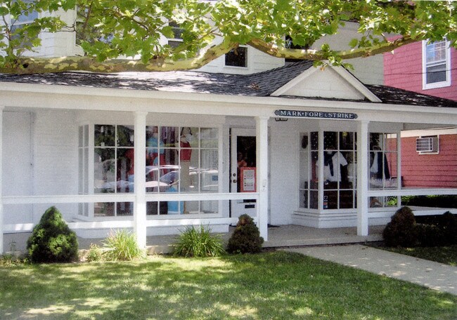
Property Record
62 Bridge Ave, Bay Head, NJ 08742
NEARBY LISTINGS FOR SALE OR LEASE
Property Detail
62 Bridge Ave
New York-Jersey City-White Plains, NY-NJ
Incl
03-00025-0000-00005-01
.73 AC
Commercialnec
Ocean
AE
New Jersey
34029C0208G
5.1
2024
0.73 AC
2025
Ocean County
739200
Northern New Jersey
3,195 SF
DEMOGRAPHICS near 62 Bridge Ave
1 Mile
3 Mile
5 Mile
2024 Total Population
6,910
41,781
105,179
2029 Population
7,717
44,929
111,797
Pop Growth 2024-2029
+ 11.68%
+ 7.53%
+ 6.29%
Average Age
46
43
44
2024 Total Households
3,028
16,833
42,233
HH Growth 2024-2029
+ 11.59%
+ 7.38%
+ 6.09%
Median Household Inc
$99,031
$110,673
$107,145
Avg Household Size
2.20
2.40
2.40
2024 Avg HH Vehicles
2.00
2.00
2.00
Median Home Value
$706,906
$482,180
$460,876
Median Year Built
1966
1965
1971
Nearby Places
- Restaurants
- Banks
- Shops
- Fitness
- Groceries
PUBLIC TRANSPORTATION
TRANSIT/SUBWAY
Bay Head (North Jersey Coast Line - NJ Transit Commuter Rail (NJ Transit))
DRIVE
WALK
Distance
Bay Head (North Jersey Coast Line - NJ Transit Commuter Rail (NJ Transit))
2 min
9 min
0.5 mi
COMMUTER RAIL
Bay Head (North Jersey Coast Line - NJ Transit Commuter Rail (NJ Transit))
DRIVE
WALK
Distance
Bay Head (North Jersey Coast Line - NJ Transit Commuter Rail (NJ Transit))
2 min
9 min
0.5 mi
Point Pleasant Beach (North Jersey Coast Line - NJ Transit Commuter Rail (NJ Transit))
DRIVE
WALK
Distance
Point Pleasant Beach (North Jersey Coast Line - NJ Transit Commuter Rail (NJ Transit))
3 min
1.7 mi
Freight Ports
New York Container Terminal
DRIVE
WALK
Distance
New York Container Terminal
67 min
51.3 mi
Nearby Properties
Address
Land Use
TOTAL SIZE
Lot Size
Zoning
Address
Land Use
TOTAL SIZE
Lot Size
Zoning
50.10 AC
C
Address
Land Use
TOTAL SIZE
Lot Size
Zoning
117 AC
RR1
Address
Land Use
TOTAL SIZE
Lot Size
Zoning
21,850 SF
30.98 AC
R-1A
Address
Land Use
TOTAL SIZE
Lot Size
Zoning
5,000 SF
22.50 AC
R-4
Address
Land Use
TOTAL SIZE
Lot Size
Zoning
34,337 SF
99.30 AC
R-1
Address
Land Use
TOTAL SIZE
Lot Size
Zoning
3,792 SF
7.64 AC
R-1A
Address
Land Use
TOTAL SIZE
Lot Size
Zoning
10.52 AC
R-5
Address
Land Use
TOTAL SIZE
Lot Size
Zoning
63,136 SF
10.31 AC
R-1A
Address
Land Use
TOTAL SIZE
Lot Size
Zoning
18,058 SF
6.09 AC
R-50
Address
Land Use
TOTAL SIZE
Lot Size
Zoning
2,408 SF
4.84 AC
B-2
Address
Land Use
TOTAL SIZE
Lot Size
Zoning
75,697 SF
12.46 AC
R-3
Address
Land Use
TOTAL SIZE
Lot Size
Zoning
21 AC
ROS
Address
Land Use
TOTAL SIZE
Lot Size
Zoning
5,798 SF
1.10 AC
RC
Address
Land Use
TOTAL SIZE
Lot Size
Zoning
2.73 AC
RC
Address
Land Use
TOTAL SIZE
Lot Size
Zoning
40.43 AC
R-1
Address
Land Use
TOTAL SIZE
Lot Size
Zoning
17,450 SF
7.50 AC
HR
Address
Land Use
TOTAL SIZE
Lot Size
Zoning
1,140 SF
14 AC
GC
Address
Land Use
TOTAL SIZE
Lot Size
Zoning
1,976 SF
8.42 AC
R50
Address
Land Use
TOTAL SIZE
Lot Size
Zoning
1,702 SF
2.90 AC
C
Address
Land Use
TOTAL SIZE
Lot Size
Zoning
23,964 SF
4.55 AC
W
Address
Land Use
TOTAL SIZE
Lot Size
Zoning
3.05 AC
HC
Address
Land Use
TOTAL SIZE
Lot Size
Zoning
86,484 SF
7.25 AC
GC
Address
Land Use
TOTAL SIZE
Lot Size
Zoning
3,506 SF
1.29 AC
RC
Address
Land Use
TOTAL SIZE
Lot Size
Zoning
1,677 SF
3 AC
R-3A
Address
Land Use
TOTAL SIZE
Lot Size
Zoning
13.76 AC
RC
Address
Land Use
TOTAL SIZE
Lot Size
Zoning
10,003 SF
0.32 AC
PU
Address
Land Use
TOTAL SIZE
Lot Size
Zoning
18,240 SF
1.51 AC
RR3
Address
Land Use
TOTAL SIZE
Lot Size
Zoning
2,335 SF
3.17 AC
RC
Address
Land Use
TOTAL SIZE
Lot Size
Zoning
2.10 AC
ROS
Address
Land Use
TOTAL SIZE
Lot Size
Zoning
19,248 SF
5.75 AC
W
The World's #1 Commercial Real Estate Marketplace
Connect with us
© 2025 CoStar Group
The information above has been obtained from sources believed reliable. While we do not doubt its accuracy we have not verified it and make no guarantee, warranty or representation about it. It is your responsibility to independently confirm its accuracy and completeness. Any projections, opinions, assumptions, or estimates used are for example only and do not represent the current or future performance of the property. The value of this transaction to you depends on tax and other factors which should be evaluated by your tax, financial, and legal advisors. You and your advisors should conduct a careful, independent investigation of the property to determine to your satisfaction the suitability of the property for your needs.