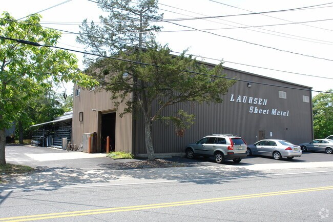
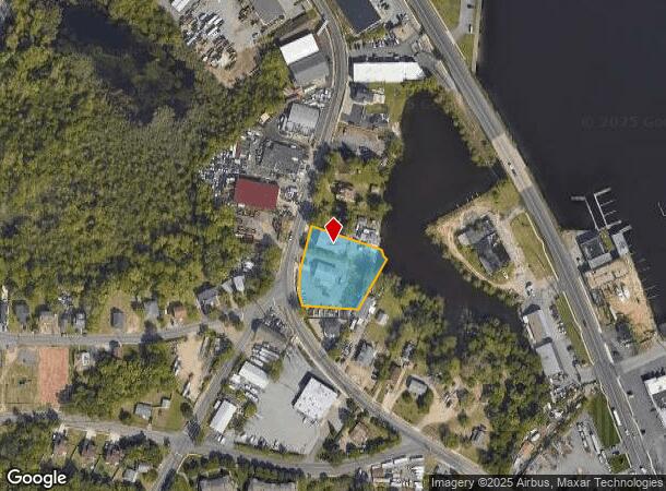
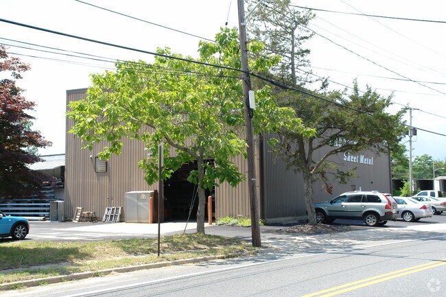
Property Record
62 Flint Rd, Toms River, NJ 08757
NEARBY LISTINGS FOR SALE OR LEASE
Property Detail
62 Flint Rd
Lakewood-New Brunswick, NJ
165X202
30-00004-0000-00012
Ocean
Commercialnec
New Jersey
AE
12
34029C0304F
0.77 AC
2024
Ocean County
2025
Northern New Jersey
724000
DEMOGRAPHICS near 62 Flint Rd
1 Mile
3 Mile
5 Mile
2024 Total Population
8,591
62,083
130,055
2029 Population
9,095
65,574
138,013
Pop Growth 2024-2029
+ 5.87%
+ 5.62%
+ 6.12%
Average Age
38
41
43
2024 Total Households
3,153
23,445
50,734
HH Growth 2024-2029
+ 5.36%
+ 5.16%
+ 5.68%
Median Household Inc
$83,039
$79,537
$75,084
Avg Household Size
2.60
2.50
2.40
2024 Avg HH Vehicles
2.00
2.00
2.00
Median Home Value
$270,313
$284,424
$285,701
Median Year Built
1969
1975
1977
Nearby Places
Map Layers
Map Styles
 Street
 Aerial
- Restaurants
- Banks
- Shops
- Fitness
- Groceries
PUBLIC TRANSPORTATION
AIRPORT
Atlantic City International
DRIVE
WALK
Distance
Atlantic City International
80 min
46.9 mi
Trenton Mercer
DRIVE
WALK
Distance
Trenton Mercer
73 min
49.0 mi
Freight Ports
South Jersey Port
DRIVE
WALK
Distance
South Jersey Port
77 min
53.4 mi
Nearby Properties
Address
Land Use
TOTAL SIZE
Lot Size
Zoning
Address
Land Use
TOTAL SIZE
Lot Size
Zoning
35,102 SF
139.33 AC
LI
Address
Land Use
TOTAL SIZE
Lot Size
Zoning
70.33 AC
RC
Address
Land Use
TOTAL SIZE
Lot Size
Zoning
14,748 SF
56.53 AC
MF8
Address
Land Use
TOTAL SIZE
Lot Size
Zoning
38.17 AC
HMS
Address
Land Use
TOTAL SIZE
Lot Size
Zoning
83.07 AC
R400
Address
Land Use
TOTAL SIZE
Lot Size
Zoning
15.67 AC
RC
Address
Land Use
TOTAL SIZE
Lot Size
Zoning
44,584 SF
11.85 AC
VO
Address
Land Use
TOTAL SIZE
Lot Size
Zoning
8,512 SF
25.67 AC
RC
Address
Land Use
TOTAL SIZE
Lot Size
Zoning
260 SF
326.26 AC
SPLT
Address
Land Use
TOTAL SIZE
Lot Size
Zoning
165,024 SF
22.43 AC
HB
Address
Land Use
TOTAL SIZE
Lot Size
Zoning
8.21 AC
VO
Address
Land Use
TOTAL SIZE
Lot Size
Zoning
8,968 SF
26.36 AC
RMF
Address
Land Use
TOTAL SIZE
Lot Size
Zoning
31,302 SF
13.76 AC
EM18
Address
Land Use
TOTAL SIZE
Lot Size
Zoning
18,890 SF
24.59 AC
SPLT
Address
Land Use
TOTAL SIZE
Lot Size
Zoning
11,304 SF
25.56 AC
MF8
Address
Land Use
TOTAL SIZE
Lot Size
Zoning
56,332 SF
8.85 AC
SPLT
Address
Land Use
TOTAL SIZE
Lot Size
Zoning
19,836 SF
13.03 AC
EM18
Address
Land Use
TOTAL SIZE
Lot Size
Zoning
7,436 SF
22.36 AC
MF8
Address
Land Use
TOTAL SIZE
Lot Size
Zoning
13,872 SF
22.96 AC
MF8
Address
Land Use
TOTAL SIZE
Lot Size
Zoning
15.68 AC
MF8
Address
Land Use
TOTAL SIZE
Lot Size
Zoning
2,549 SF
16.02 AC
RC
Address
Land Use
TOTAL SIZE
Lot Size
Zoning
3,997 SF
11.09 AC
RC
Address
Land Use
TOTAL SIZE
Lot Size
Zoning
35,800 SF
24.53 AC
RHB
Address
Land Use
TOTAL SIZE
Lot Size
Zoning
4,264 SF
189.71 AC
R400
Address
Land Use
TOTAL SIZE
Lot Size
Zoning
44,394 SF
7.66 AC
EM18
Address
Land Use
TOTAL SIZE
Lot Size
Zoning
15,243 SF
5.47 AC
HMS
Address
Land Use
TOTAL SIZE
Lot Size
Zoning
9,874 SF
15.17 AC
RC
Address
Land Use
TOTAL SIZE
Lot Size
Zoning
1.98 AC
HB
Address
Land Use
TOTAL SIZE
Lot Size
Zoning
115,528 SF
17.59 AC
SPLT
Address
Land Use
TOTAL SIZE
Lot Size
Zoning
8.82 AC
O15
The World's #1 Commercial Real Estate Marketplace
Connect with us
© 2026 CoStar Group
The information above has been obtained from sources believed reliable. While we do not doubt its accuracy we have not verified it and make no guarantee, warranty or representation about it. It is your responsibility to independently confirm its accuracy and completeness. Any projections, opinions, assumptions, or estimates used are for example only and do not represent the current or future performance of the property. The value of this transaction to you depends on tax and other factors which should be evaluated by your tax, financial, and legal advisors. You and your advisors should conduct a careful, independent investigation of the property to determine to your satisfaction the suitability of the property for your needs.