Property Record
62 Franklin Tpke, Allendale, NJ 07401

Property Detail
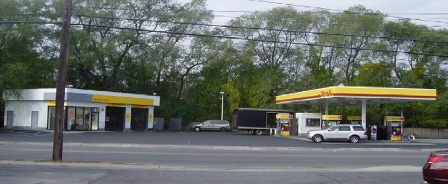
62 Franklin Tpke
New York-Jersey City-White Plains, NY-NJ
200X170 4LT 14.01 (31,1-B-4)
33-00068-0000-00014
Bergen
Commercialnec
New Jersey
GI200
14
B and X Area of moderate flood hazard, usually the area between the limits of the 100-year and 500-year floods.
0.78 AC
2024
North 17 Corridor
2025
Northern New Jersey
032202
NEARBY LISTINGS FOR SALE OR LEASE
DEMOGRAPHICS near 62 Franklin Tpke
1 mile
3 mile
5 mile
2025 Total Population
13,937
51,567
143,177
2030 Population
14,324
53,340
147,993
Pop Growth 2025-2030
+ 2.78%
+ 3.44%
+ 3.36%
Average Age
42
43
37
2025 Total Households
5,428
19,820
43,661
HH Growth 2025-2030
+ 2.82%
+ 3.46%
+ 3.51%
Median Household Inc
$110,009
$112,987
$108,999
Avg Household Size
2.50
2.50
3.10
2025 Avg HH Vehicles
2.00
2.00
2.00
Median Home Value
$435,847
$559,609
$719,272
Median Year Built
1968
1977
1975
Nearby Places
Map Layers
Map Styles
 Street
 Aerial
Layers
 Traffic
 Biking
Places
Listings with unknown addresses are not visible on the map
- Restaurants
- Banks
- Shops
- Fitness
- Groceries
PUBLIC TRANSPORTATION
COMMUTER RAIL
Waldwick (Bergen County/Port Jervis Line - NJ Transit Commuter Rail (NJ Transit), Main/Port Jervis Line - NJ Transit Commuter Rail (NJ Transit))
Drive
Walk
Distance
Waldwick (Bergen County/Port Jervis Line - NJ Transit Commuter Rail (NJ Transit), Main/Port Jervis Line - NJ Transit Commuter Rail (NJ Transit))
2 min
16 min
0.9 mi
Allendale (Bergen County/Port Jervis Line - NJ Transit Commuter Rail (NJ Transit), Main/Port Jervis Line - NJ Transit Commuter Rail (NJ Transit))
Drive
Walk
Distance
Allendale (Bergen County/Port Jervis Line - NJ Transit Commuter Rail (NJ Transit), Main/Port Jervis Line - NJ Transit Commuter Rail (NJ Transit))
2 min
17 min
0.9 mi
AIRPORT
LaGuardia
Drive
Walk
Distance
LaGuardia
43 min
27.1 mi
Newark Liberty International
Drive
Walk
Distance
Newark Liberty International
35 min
27.5 mi
Westchester County
Drive
Walk
Distance
Westchester County
51 min
33.3 mi
Freight Ports
Port Newark Container Terminal
Drive
Walk
Distance
Port Newark Container Terminal
42 min
29.1 mi
Nearby Properties
Address
Land Use
TOTAL SIZE
Lot Size
Zoning
Address
Land Use
TOTAL SIZE
Lot Size
Zoning
15.57 AC
H
Address
Land Use
TOTAL SIZE
Lot Size
Zoning
131,384 SF
65 AC
EO
Address
Land Use
TOTAL SIZE
Lot Size
Zoning
Address
Land Use
TOTAL SIZE
Lot Size
Zoning
2,252 SF
19.04 AC
Address
Land Use
TOTAL SIZE
Lot Size
Zoning
205,580 SF
21.18 AC
EO
Address
Land Use
TOTAL SIZE
Lot Size
Zoning
40.40 AC
PU
Address
Land Use
TOTAL SIZE
Lot Size
Zoning
2,379 SF
1.09 AC
LI
Address
Land Use
TOTAL SIZE
Lot Size
Zoning
Address
Land Use
TOTAL SIZE
Lot Size
Zoning
80.80 AC
Address
Land Use
TOTAL SIZE
Lot Size
Zoning
23.19 AC
R1
Address
Land Use
TOTAL SIZE
Lot Size
Zoning
13 AC
EAO
Address
Land Use
TOTAL SIZE
Lot Size
Zoning
16.02 AC
R3
Address
Land Use
TOTAL SIZE
Lot Size
Zoning
Address
Land Use
TOTAL SIZE
Lot Size
Zoning
20.30 AC
Address
Land Use
TOTAL SIZE
Lot Size
Zoning
3,165 SF
2.07 AC
VC2
Address
Land Use
TOTAL SIZE
Lot Size
Zoning
Address
Land Use
TOTAL SIZE
Lot Size
Zoning
38.65 AC
Address
Land Use
TOTAL SIZE
Lot Size
Zoning
10.64 AC
AAA
Address
Land Use
TOTAL SIZE
Lot Size
Zoning
2,374 SF
1.80 AC
SOII
Address
Land Use
TOTAL SIZE
Lot Size
Zoning
Address
Land Use
TOTAL SIZE
Lot Size
Zoning
124,528 SF
8.87 AC
EM
Address
Land Use
TOTAL SIZE
Lot Size
Zoning
3.63 AC
Address
Land Use
TOTAL SIZE
Lot Size
Zoning
Address
Land Use
TOTAL SIZE
Lot Size
Zoning
6.29 AC
B3
Address
Land Use
TOTAL SIZE
Lot Size
Zoning
99,832 SF
10.39 AC
E
Address
Land Use
TOTAL SIZE
Lot Size
Zoning
74,278 SF
6.91 AC
C2
Address
Land Use
TOTAL SIZE
Lot Size
Zoning
107,584 SF
9.19 AC
EM
Address
Land Use
TOTAL SIZE
Lot Size
Zoning
89,200 SF
8 AC
SOII
Address
Land Use
TOTAL SIZE
Lot Size
Zoning
2 AC
R110
Address
Land Use
TOTAL SIZE
Lot Size
Zoning
13.39 AC
R2
The World's #1 Commercial Real Estate Marketplace
Connect with us
© 2026 CoStar Group
The information above has been obtained from sources believed reliable. While we do not doubt its accuracy we have not verified it and make no guarantee, warranty or representation about it. It is your responsibility to independently confirm its accuracy and completeness. Any projections, opinions, assumptions, or estimates used are for example only and do not represent the current or future performance of the property. The value of this transaction to you depends on tax and other factors which should be evaluated by your tax, financial, and legal advisors. You and your advisors should conduct a careful, independent investigation of the property to determine to your satisfaction the suitability of the property for your needs.