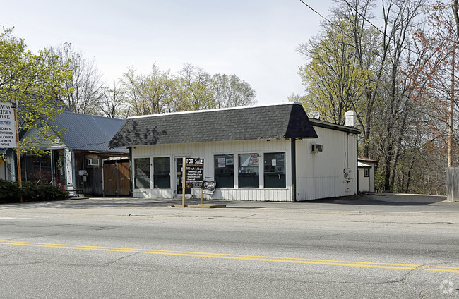
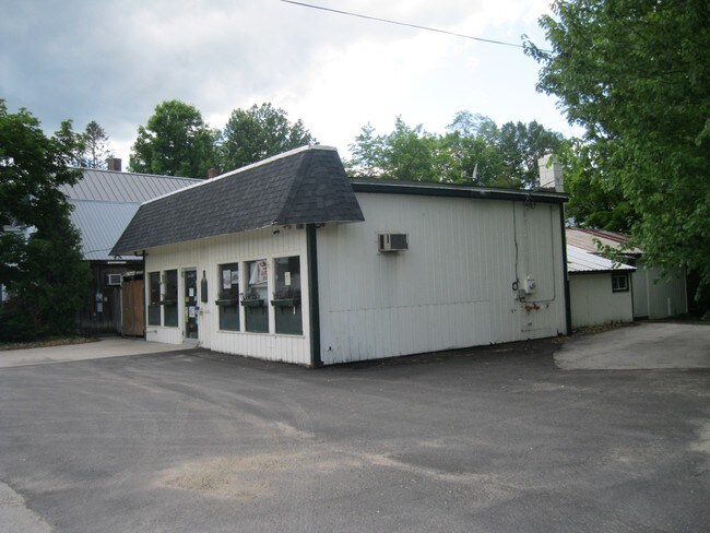
Property Record
62 Main St, Conway, NH 03818

Property Detail
62 Main St
Commercialacreage
CARROLL
VC
New Hampshire
AE The base floodplain where base flood elevations are provided. AE Zones are now used on new format FIRMs instead of A1-A30 Zones.
0.34 AC
2025
Concord/New Hampshire North Area
2025
Other Market Areas
955401
CNWY-000265-000000-000040
NEARBY LISTINGS FOR SALE OR LEASE
DEMOGRAPHICS near 62 Main St
1 mile
3 mile
5 mile
2025 Total Population
1,636
4,862
8,929
2030 Population
1,589
4,827
8,874
Pop Growth 2025-2030
(2.87%)
(0.72%)
(0.62%)
Average Age
46
47
47
2025 Total Households
733
2,210
4,069
HH Growth 2025-2030
(3.00%)
(0.90%)
(0.76%)
Median Household Inc
$80,610
$75,699
$73,228
Avg Household Size
2.10
2.10
2.10
2025 Avg HH Vehicles
2.00
2.00
2.00
Median Home Value
$320,789
$328,402
$343,814
Median Year Built
1978
1980
1981
Nearby Places
Map Layers
Map Styles
 Street
 Aerial
Layers
 Traffic
 Biking
Places
Listings with unknown addresses are not visible on the map
- Restaurants
- Banks
- Shops
- Fitness
- Groceries
SALE & LEASE HISTORY
LISTING DATE
SALE/LEASE

Sep 23, 2016
For Sale
Nearby Properties
Address
Land Use
TOTAL SIZE
Lot Size
Zoning
Address
Land Use
TOTAL SIZE
Lot Size
Zoning
2,295.68 AC
COMM/R
Address
Land Use
TOTAL SIZE
Lot Size
Zoning
31.40 AC
HC
Address
Land Use
TOTAL SIZE
Lot Size
Zoning
64.60 AC
RA
Address
Land Use
TOTAL SIZE
Lot Size
Zoning
11.26 AC
RA
Address
Land Use
TOTAL SIZE
Lot Size
Zoning
18.25 AC
HC
Address
Land Use
TOTAL SIZE
Lot Size
Zoning
190 AC
HC
Address
Land Use
TOTAL SIZE
Lot Size
Zoning
36 AC
VC
Address
Land Use
TOTAL SIZE
Lot Size
Zoning
8.06 AC
HC
Address
Land Use
TOTAL SIZE
Lot Size
Zoning
2.54 AC
HC
Address
Land Use
TOTAL SIZE
Lot Size
Zoning
1,096 SF
2,295.68 AC
RES-JO
Address
Land Use
TOTAL SIZE
Lot Size
Zoning
3.60 AC
RR
Address
Land Use
TOTAL SIZE
Lot Size
Zoning
Address
Land Use
TOTAL SIZE
Lot Size
Zoning
4.45 AC
HC
Address
Land Use
TOTAL SIZE
Lot Size
Zoning
5.27 AC
HC
Address
Land Use
TOTAL SIZE
Lot Size
Zoning
6.36 AC
HC
Address
Land Use
TOTAL SIZE
Lot Size
Zoning
6.53 AC
HC
Address
Land Use
TOTAL SIZE
Lot Size
Zoning
73.70 AC
RA
Address
Land Use
TOTAL SIZE
Lot Size
Zoning
4.50 AC
HC
Address
Land Use
TOTAL SIZE
Lot Size
Zoning
4.20 AC
HC
Address
Land Use
TOTAL SIZE
Lot Size
Zoning
18.96 AC
HC
Address
Land Use
TOTAL SIZE
Lot Size
Zoning
8.46 AC
HC
Address
Land Use
TOTAL SIZE
Lot Size
Zoning
115 AC
RR
Address
Land Use
TOTAL SIZE
Lot Size
Zoning
0.46 AC
HC
Address
Land Use
TOTAL SIZE
Lot Size
Zoning
4.44 AC
HC
Address
Land Use
TOTAL SIZE
Lot Size
Zoning
6.20 AC
SHR-SH
Address
Land Use
TOTAL SIZE
Lot Size
Zoning
6.47 AC
HC
Address
Land Use
TOTAL SIZE
Lot Size
Zoning
Address
Land Use
TOTAL SIZE
Lot Size
Zoning
RURAL
Address
Land Use
TOTAL SIZE
Lot Size
Zoning
44.59 AC
HC
Address
Land Use
TOTAL SIZE
Lot Size
Zoning
2.99 AC
HC
The World's #1 Commercial Real Estate Marketplace
Connect with us
© 2026 CoStar Group
The information above has been obtained from sources believed reliable. While we do not doubt its accuracy we have not verified it and make no guarantee, warranty or representation about it. It is your responsibility to independently confirm its accuracy and completeness. Any projections, opinions, assumptions, or estimates used are for example only and do not represent the current or future performance of the property. The value of this transaction to you depends on tax and other factors which should be evaluated by your tax, financial, and legal advisors. You and your advisors should conduct a careful, independent investigation of the property to determine to your satisfaction the suitability of the property for your needs.