Property Record
62 Maple Ave, Keene, NH 03431
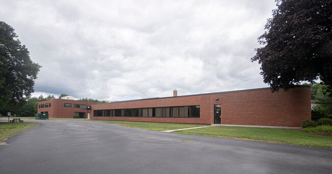

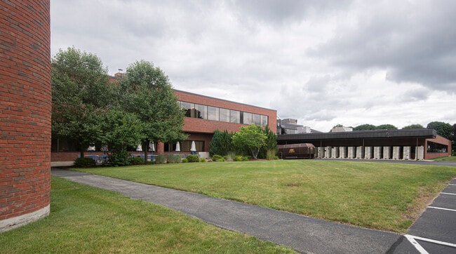
Property Detail
62 Maple Ave
KEEN-000913-000090-000330
Cheshire
Commercialnec
New Hampshire
IP
6
AE The base floodplain where base flood elevations are provided. AE Zones are now used on new format FIRMs instead of A1-A30 Zones.
50 AC
2024
Manchester/New Hampshire South Area
2024
Other Market Areas
971402
Keene, NH
142,790 SF
NEARBY LISTINGS FOR SALE OR LEASE
DEMOGRAPHICS near 62 Maple Ave
1 mile
3 mile
5 mile
2025 Total Population
4,652
20,500
27,112
2030 Population
4,756
20,854
27,530
Pop Growth 2025-2030
+ 2.24%
+ 1.73%
+ 1.54%
Average Age
46
42
42
2025 Total Households
1,964
8,568
11,403
HH Growth 2025-2030
+ 2.34%
+ 2.07%
+ 1.81%
Median Household Inc
$95,170
$85,678
$85,529
Avg Household Size
2.20
2.10
2.10
2025 Avg HH Vehicles
2.00
2.00
2.00
Median Home Value
$280,502
$283,179
$286,320
Median Year Built
1977
1964
1964
Nearby Places
Map Layers
Map Styles
 Street
 Aerial
Transit
 Traffic
 Biking
Places
Listings with unknown addresses are not visible on the map
- Restaurants
- Banks
- Shops
- Fitness
- Groceries
SALE & LEASE HISTORY
LISTING DATE
SALE/LEASE

Sep 30, 2020
For Lease
Oct 21, 2020
For Lease
Nearby Properties
Address
Land Use
TOTAL SIZE
Lot Size
Zoning
Address
Land Use
TOTAL SIZE
Lot Size
Zoning
Address
Land Use
TOTAL SIZE
Lot Size
Zoning
14.33 AC
HC
Address
Land Use
TOTAL SIZE
Lot Size
Zoning
52 AC
R
Address
Land Use
TOTAL SIZE
Lot Size
Zoning
36.26 AC
R
Address
Land Use
TOTAL SIZE
Lot Size
Zoning
25 AC
LD
Address
Land Use
TOTAL SIZE
Lot Size
Zoning
13.20 AC
COM
Address
Land Use
TOTAL SIZE
Lot Size
Zoning
195,466 SF
18.66 AC
COM
Address
Land Use
TOTAL SIZE
Lot Size
Zoning
4.95 AC
DT-C
Address
Land Use
TOTAL SIZE
Lot Size
Zoning
122,326 SF
10 AC
COM
Address
Land Use
TOTAL SIZE
Lot Size
Zoning
14.97 AC
COM
Address
Land Use
TOTAL SIZE
Lot Size
Zoning
66,098 SF
12.62 AC
R
Address
Land Use
TOTAL SIZE
Lot Size
Zoning
1,883 SF
99 AC
R
Address
Land Use
TOTAL SIZE
Lot Size
Zoning
6.49 AC
COM
Address
Land Use
TOTAL SIZE
Lot Size
Zoning
86,070 SF
HD
Address
Land Use
TOTAL SIZE
Lot Size
Zoning
54,874 SF
HD
Address
Land Use
TOTAL SIZE
Lot Size
Zoning
61,775 SF
HD
Address
Land Use
TOTAL SIZE
Lot Size
Zoning
84,905 SF
HD
Address
Land Use
TOTAL SIZE
Lot Size
Zoning
121,757 SF
5.20 AC
DT-G
Address
Land Use
TOTAL SIZE
Lot Size
Zoning
114,408 SF
11.86 AC
COM
Address
Land Use
TOTAL SIZE
Lot Size
Zoning
78,178 SF
HD
Address
Land Use
TOTAL SIZE
Lot Size
Zoning
10.12 AC
HD1
Address
Land Use
TOTAL SIZE
Lot Size
Zoning
85,136 SF
HD
Address
Land Use
TOTAL SIZE
Lot Size
Zoning
65,462 SF
1.01 AC
HD
Address
Land Use
TOTAL SIZE
Lot Size
Zoning
78,042 SF
9.18 AC
HC
Address
Land Use
TOTAL SIZE
Lot Size
Zoning
Address
Land Use
TOTAL SIZE
Lot Size
Zoning
66,189 SF
10.30 AC
LD
Address
Land Use
TOTAL SIZE
Lot Size
Zoning
72,808 SF
5.54 AC
COM
Address
Land Use
TOTAL SIZE
Lot Size
Zoning
48,530 SF
1.34 AC
LD
Address
Land Use
TOTAL SIZE
Lot Size
Zoning
77,191 SF
5.60 AC
COM
The World's #1 Commercial Real Estate Marketplace
Connect with us
© 2026 CoStar Group
The information above has been obtained from sources believed reliable. While we do not doubt its accuracy we have not verified it and make no guarantee, warranty or representation about it. It is your responsibility to independently confirm its accuracy and completeness. Any projections, opinions, assumptions, or estimates used are for example only and do not represent the current or future performance of the property. The value of this transaction to you depends on tax and other factors which should be evaluated by your tax, financial, and legal advisors. You and your advisors should conduct a careful, independent investigation of the property to determine to your satisfaction the suitability of the property for your needs.