Property Record
62 Us Route 1, Cumberland Foreside, ME 04110

NEARBY LISTINGS FOR SALE OR LEASE
-
-
View all Cumberland Foreside listings for sale on LoopNet.com
Property Detail
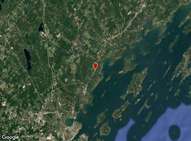
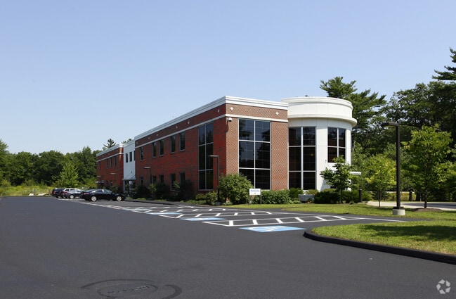
62 Us Route 1
CMBL-000001-R000000-000011-C000000
Cumberland
Commercialbuilding
Maine
X
11-c
23005C0703F
2.99 AC
2025
NE Cumberland County
2025
Portland/South Portland
004202
Portland-South Portland, ME
21,266 SF
DEMOGRAPHICS near 62 Us Route 1
1 mile
3 mile
5 mile
2024 Total Population
1,706
9,986
29,817
2029 Population
1,817
10,426
31,001
Pop Growth 2024-2029
+ 6.51%
+ 4.41%
+ 3.97%
Average Age
47
46
44
2024 Total Households
707
3,998
11,886
HH Growth 2024-2029
+ 6.65%
+ 4.50%
+ 4.05%
Median Household Inc
$136,458
$129,167
$112,027
Avg Household Size
2.30
2.40
2.40
2024 Avg HH Vehicles
2.00
2.00
2.00
Median Home Value
$664,590
$642,317
$550,971
Median Year Built
1975
1978
1976
Nearby Places
Map Layers
Map Styles
 Street
 Aerial
Transit
 Traffic
 Biking
Places
Listings with unknown addresses are not visible on the map
- Restaurants
- Banks
- Shops
- Fitness
- Groceries
PUBLIC TRANSPORTATION
COMMUTER RAIL
Portland (Downeaster - Amtrak)
Drive
Walk
Distance
Portland (Downeaster - Amtrak)
15 min
8.6 mi
Freeport Amtrak Station (Downeaster - Amtrak)
Drive
Walk
Distance
Freeport Amtrak Station (Downeaster - Amtrak)
15 min
9.4 mi
AIRPORT
Portland International Jetport
Drive
Walk
Distance
Portland International Jetport
20 min
10.8 mi
Freight Ports
Portland, ME
Drive
Walk
Distance
Portland, ME
14 min
7.8 mi
Nearby Properties
Address
Land Use
TOTAL SIZE
Lot Size
Zoning
Address
Land Use
TOTAL SIZE
Lot Size
Zoning
152,724 SF
46.80 AC
13
Address
Land Use
TOTAL SIZE
Lot Size
Zoning
220,494 SF
28.05 AC
SB
Address
Land Use
TOTAL SIZE
Lot Size
Zoning
117.24 AC
31
Address
Land Use
TOTAL SIZE
Lot Size
Zoning
187,437 SF
62.85 AC
23
Address
Land Use
TOTAL SIZE
Lot Size
Zoning
84,722 SF
22.38 AC
RB
Address
Land Use
TOTAL SIZE
Lot Size
Zoning
66.50 AC
RR2
Address
Land Use
TOTAL SIZE
Lot Size
Zoning
21.50 AC
13
Address
Land Use
TOTAL SIZE
Lot Size
Zoning
27,540 SF
6.92 AC
RB
Address
Land Use
TOTAL SIZE
Lot Size
Zoning
106,940 SF
13.96 AC
SB
Address
Land Use
TOTAL SIZE
Lot Size
Zoning
83,378 SF
42 AC
13
Address
Land Use
TOTAL SIZE
Lot Size
Zoning
6,246 SF
6 AC
SSB
Address
Land Use
TOTAL SIZE
Lot Size
Zoning
68,068 SF
6.02 AC
BP
Address
Land Use
TOTAL SIZE
Lot Size
Zoning
10,777 SF
13.27 AC
940
Address
Land Use
TOTAL SIZE
Lot Size
Zoning
43,700 SF
8.36 AC
RA
Address
Land Use
TOTAL SIZE
Lot Size
Zoning
16.06 AC
RB
Address
Land Use
TOTAL SIZE
Lot Size
Zoning
9,414 SF
8.30 AC
940
Address
Land Use
TOTAL SIZE
Lot Size
Zoning
23,811 SF
5.85 AC
RA
Address
Land Use
TOTAL SIZE
Lot Size
Zoning
1,896 SF
10.58 AC
LDR
Address
Land Use
TOTAL SIZE
Lot Size
Zoning
22,941 SF
7.11 AC
SB
Address
Land Use
TOTAL SIZE
Lot Size
Zoning
44,274 SF
17.70 AC
FF
Address
Land Use
TOTAL SIZE
Lot Size
Zoning
108.88 AC
RR1
Address
Land Use
TOTAL SIZE
Lot Size
Zoning
Address
Land Use
TOTAL SIZE
Lot Size
Zoning
6,829 SF
5.91 AC
940
Address
Land Use
TOTAL SIZE
Lot Size
Zoning
37,746 SF
3.16 AC
LDR
Address
Land Use
TOTAL SIZE
Lot Size
Zoning
4,828 SF
3.20 AC
940
Address
Land Use
TOTAL SIZE
Lot Size
Zoning
36,280 SF
1.21 AC
ESRD
Address
Land Use
TOTAL SIZE
Lot Size
Zoning
37,148 SF
3.30 AC
SB
Address
Land Use
TOTAL SIZE
Lot Size
Zoning
31,293 SF
7.20 AC
OC
Address
Land Use
TOTAL SIZE
Lot Size
Zoning
32,861 SF
RB
The World's #1 Commercial Real Estate Marketplace
Connect with us
© 2026 CoStar Group
The information above has been obtained from sources believed reliable. While we do not doubt its accuracy we have not verified it and make no guarantee, warranty or representation about it. It is your responsibility to independently confirm its accuracy and completeness. Any projections, opinions, assumptions, or estimates used are for example only and do not represent the current or future performance of the property. The value of this transaction to you depends on tax and other factors which should be evaluated by your tax, financial, and legal advisors. You and your advisors should conduct a careful, independent investigation of the property to determine to your satisfaction the suitability of the property for your needs.