Property Record
62 Wampus Way, Fairfield, CT 06825

Property Detail
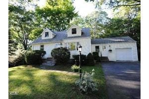
62 Wampus Way
Apartmenthouse5plusunits
Greater Bridgeport
R3
Connecticut
B and X Area of moderate flood hazard, usually the area between the limits of the 100-year and 500-year floods.
0.46 AC
2025
Outer Middle Fairfield County
2025
Westchester/So Connecticut
060300
Bridgeport-Stamford-Danbury, CT
1,797 SF
FAIR-000073-000000-000203
NEARBY LISTINGS FOR SALE OR LEASE
DEMOGRAPHICS near 62 Wampus Way
1 mile
3 mile
5 mile
2025 Total Population
5,939
90,187
230,084
2030 Population
6,118
92,842
236,785
Pop Growth 2025-2030
+ 3.01%
+ 2.94%
+ 2.91%
Average Age
43
40
39
2025 Total Households
2,061
30,603
80,905
HH Growth 2025-2030
+ 2.96%
+ 3.09%
+ 3.01%
Median Household Inc
$201,921
$104,234
$91,580
Avg Household Size
2.80
2.70
2.70
2025 Avg HH Vehicles
2.00
2.00
2.00
Median Home Value
$808,959
$520,031
$509,063
Median Year Built
1960
1958
1956
Nearby Places
Map Layers
Map Styles
 Street
 Aerial
Layers
 Traffic
 Biking
Places
Listings with unknown addresses are not visible on the map
- Restaurants
- Banks
- Shops
- Fitness
- Groceries
PUBLIC TRANSPORTATION
COMMUTER RAIL
Fairfield-Black Rock (New Haven - Metro-North Railroad)
Drive
Walk
Distance
Fairfield-Black Rock (New Haven - Metro-North Railroad)
8 min
3.8 mi
Fairfield Station (New Haven Line - Metro-North Commuter Railroad Company (Metro-North))
Drive
Walk
Distance
Fairfield Station (New Haven Line - Metro-North Commuter Railroad Company (Metro-North))
9 min
4.7 mi
AIRPORT
Tweed/New Haven
Drive
Walk
Distance
Tweed/New Haven
42 min
27.4 mi
Westchester County
Drive
Walk
Distance
Westchester County
45 min
31.6 mi
Long Island MacArthur
Drive
Walk
Distance
Long Island MacArthur
117 min
39.4 mi
Freight Ports
Port of New Haven
Drive
Walk
Distance
Port of New Haven
37 min
24.5 mi
Nearby Properties
Address
Land Use
TOTAL SIZE
Lot Size
Zoning
Address
Land Use
TOTAL SIZE
Lot Size
Zoning
77.74 AC
BC
Address
Land Use
TOTAL SIZE
Lot Size
Zoning
111,525 SF
Address
Land Use
TOTAL SIZE
Lot Size
Zoning
23.95 AC
RB
Address
Land Use
TOTAL SIZE
Lot Size
Zoning
356,837 SF
8.87 AC
RA
Address
Land Use
TOTAL SIZE
Lot Size
Zoning
120,955 SF
9.37 AC
RA
Address
Land Use
TOTAL SIZE
Lot Size
Zoning
335,633 SF
39.70 AC
R3
Address
Land Use
TOTAL SIZE
Lot Size
Zoning
1,183 SF
2.33 AC
DID
Address
Land Use
TOTAL SIZE
Lot Size
Zoning
97,554 SF
6.25 AC
DR
Address
Land Use
TOTAL SIZE
Lot Size
Zoning
10.28 AC
DID
Address
Land Use
TOTAL SIZE
Lot Size
Zoning
260,992 SF
4.19 AC
ILI
Address
Land Use
TOTAL SIZE
Lot Size
Zoning
43,489 SF
21.09 AC
AAA
Address
Land Use
TOTAL SIZE
Lot Size
Zoning
22.43 AC
R3
Address
Land Use
TOTAL SIZE
Lot Size
Zoning
115,006 SF
2.51 AC
DCD
Address
Land Use
TOTAL SIZE
Lot Size
Zoning
12.47 AC
AA
Address
Land Use
TOTAL SIZE
Lot Size
Zoning
13.15 AC
ORR
Address
Land Use
TOTAL SIZE
Lot Size
Zoning
3.77 AC
RA
Address
Land Use
TOTAL SIZE
Lot Size
Zoning
16.73 AC
DCD
Address
Land Use
TOTAL SIZE
Lot Size
Zoning
145,860 SF
2.41 AC
R3
Address
Land Use
TOTAL SIZE
Lot Size
Zoning
14.18 AC
RC
Address
Land Use
TOTAL SIZE
Lot Size
Zoning
6.43 AC
DCD
Address
Land Use
TOTAL SIZE
Lot Size
Zoning
109,800 SF
1.24 AC
RA
Address
Land Use
TOTAL SIZE
Lot Size
Zoning
11.87 AC
RA
Address
Land Use
TOTAL SIZE
Lot Size
Zoning
5.84 AC
DCD
Address
Land Use
TOTAL SIZE
Lot Size
Zoning
73,120 SF
22.33 AC
DID
Address
Land Use
TOTAL SIZE
Lot Size
Zoning
68,288 SF
15.36 AC
R3
Address
Land Use
TOTAL SIZE
Lot Size
Zoning
Address
Land Use
TOTAL SIZE
Lot Size
Zoning
9.63 AC
AA
Address
Land Use
TOTAL SIZE
Lot Size
Zoning
125 AC
RC
Address
Land Use
TOTAL SIZE
Lot Size
Zoning
69,918 SF
15.75 AC
AAA
Address
Land Use
TOTAL SIZE
Lot Size
Zoning
66,254 SF
22.74 AC
AA
The World's #1 Commercial Real Estate Marketplace
Connect with us
© 2026 CoStar Group
The information above has been obtained from sources believed reliable. While we do not doubt its accuracy we have not verified it and make no guarantee, warranty or representation about it. It is your responsibility to independently confirm its accuracy and completeness. Any projections, opinions, assumptions, or estimates used are for example only and do not represent the current or future performance of the property. The value of this transaction to you depends on tax and other factors which should be evaluated by your tax, financial, and legal advisors. You and your advisors should conduct a careful, independent investigation of the property to determine to your satisfaction the suitability of the property for your needs.