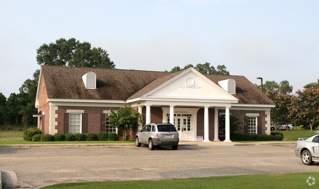
Property Record
62 Wheat St, Harpersville, AL 35078

NEARBY LISTINGS FOR SALE OR LEASE
Property Detail
62 Wheat St
07-8-33-1-001-007-005
COM NW COR NE1/4 E580.18 TO POB; NLY89.9 TO S ROW WHEAT ST ELY180 ALG ROW S200 W180 N110.1 TO POB.
Financialbuilding
Shelby
X
Alabama
01117C0283E
0.82 AC
2024
Chelsea/Harpersville
2024
Birmingham
030103
Birmingham, AL
3,160 SF
DEMOGRAPHICS near 62 Wheat St
1 Mile
3 Mile
5 Mile
2024 Total Population
723
2,305
4,283
2029 Population
795
2,530
4,688
Pop Growth 2024-2029
+ 9.96%
+ 9.76%
+ 9.46%
Average Age
44
44
44
2024 Total Households
288
917
1,710
HH Growth 2024-2029
+ 10.07%
+ 9.81%
+ 9.65%
Median Household Inc
$69,339
$68,486
$63,895
Avg Household Size
2.50
2.50
2.50
2024 Avg HH Vehicles
2.00
2.00
2.00
Median Home Value
$290,908
$278,971
$252,845
Median Year Built
1991
1990
1990
Nearby Places
Map Layers
Map Styles
 Street
 Aerial
- Restaurants
- Banks
- Shops
- Fitness
- Groceries
PUBLIC TRANSPORTATION
AIRPORT
Birmingham-Shuttlesworth International
DRIVE
WALK
Distance
Birmingham-Shuttlesworth International
47 min
33.2 mi
Nearby Properties
Address
Land Use
TOTAL SIZE
Lot Size
Zoning
Address
Land Use
TOTAL SIZE
Lot Size
Zoning
73,273 SF
24.92 AC
Address
Land Use
TOTAL SIZE
Lot Size
Zoning
110,000 SF
20 AC
Address
Land Use
TOTAL SIZE
Lot Size
Zoning
68,400 SF
10 AC
Address
Land Use
TOTAL SIZE
Lot Size
Zoning
3,484 SF
30 AC
Address
Land Use
TOTAL SIZE
Lot Size
Zoning
56,000 SF
18 AC
Address
Land Use
TOTAL SIZE
Lot Size
Zoning
18,662 SF
5 AC
Address
Land Use
TOTAL SIZE
Lot Size
Zoning
48,000 SF
5.18 AC
Address
Land Use
TOTAL SIZE
Lot Size
Zoning
3,402 SF
1.14 AC
Address
Land Use
TOTAL SIZE
Lot Size
Zoning
Address
Land Use
TOTAL SIZE
Lot Size
Zoning
3,844 SF
1.30 AC
Address
Land Use
TOTAL SIZE
Lot Size
Zoning
3,200 SF
6.55 AC
Address
Land Use
TOTAL SIZE
Lot Size
Zoning
5,040 SF
5.01 AC
Address
Land Use
TOTAL SIZE
Lot Size
Zoning
2,580 SF
1.02 AC
Address
Land Use
TOTAL SIZE
Lot Size
Zoning
4,064 SF
0.93 AC
Address
Land Use
TOTAL SIZE
Lot Size
Zoning
9,646 SF
1.01 AC
Address
Land Use
TOTAL SIZE
Lot Size
Zoning
20,944 SF
13.52 AC
Address
Land Use
TOTAL SIZE
Lot Size
Zoning
14,517 SF
0.72 AC
Address
Land Use
TOTAL SIZE
Lot Size
Zoning
36,500 SF
5.69 AC
Address
Land Use
TOTAL SIZE
Lot Size
Zoning
10,000 SF
1.22 AC
Address
Land Use
TOTAL SIZE
Lot Size
Zoning
2,720 SF
4.78 AC
Address
Land Use
TOTAL SIZE
Lot Size
Zoning
4,645 SF
2.44 AC
Address
Land Use
TOTAL SIZE
Lot Size
Zoning
2,900 SF
5 AC
Address
Land Use
TOTAL SIZE
Lot Size
Zoning
6,000 SF
2.35 AC
Address
Land Use
TOTAL SIZE
Lot Size
Zoning
3,280 SF
0.63 AC
Address
Land Use
TOTAL SIZE
Lot Size
Zoning
9,100 SF
1.13 AC
Address
Land Use
TOTAL SIZE
Lot Size
Zoning
15,000 SF
1.22 AC
Address
Land Use
TOTAL SIZE
Lot Size
Zoning
3,192 SF
1.40 AC
The World's #1 Commercial Real Estate Marketplace
Connect with us
© 2026 CoStar Group
The information above has been obtained from sources believed reliable. While we do not doubt its accuracy we have not verified it and make no guarantee, warranty or representation about it. It is your responsibility to independently confirm its accuracy and completeness. Any projections, opinions, assumptions, or estimates used are for example only and do not represent the current or future performance of the property. The value of this transaction to you depends on tax and other factors which should be evaluated by your tax, financial, and legal advisors. You and your advisors should conduct a careful, independent investigation of the property to determine to your satisfaction the suitability of the property for your needs.