Property Record
620 2Nd St, Kenyon, MN 55946


This Property Is For Sale
Property Detail
620 2Nd St
Red Wing, MN
ORIGINAL PLAT DOC#635181 E2/3 LOT 3 BLK 42 ID# 16-0100-04100
66.100.0400
Goodhue
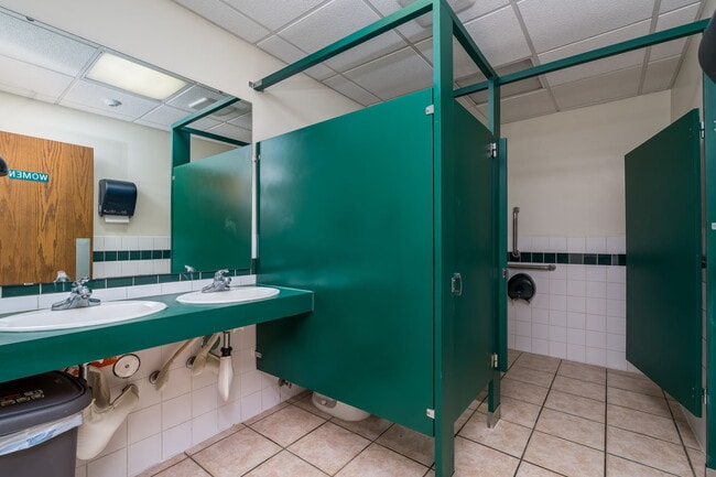
Restaurantbuilding
Minnesota
2025
3
2025
0.16 AC
080700
Minnesota South Area
7,500 SF
Other Market Areas
NEARBY LISTINGS FOR SALE OR LEASE
-
-
View all Kenyon listings for sale on LoopNet.com
DEMOGRAPHICS near 620 2Nd St
1 mile
3 mile
5 mile
2025 Total Population
2,055
2,283
2,713
2030 Population
2,078
2,299
2,715
Pop Growth 2025-2030
+ 1.12%
+ 0.70%
+ 0.07%
Average Age
41
42
42
2025 Total Households
876
966
1,133
HH Growth 2025-2030
+ 1.03%
+ 0.72%
+ 0.09%
Median Household Inc
$74,515
$75,180
$77,048
Avg Household Size
2.30
2.30
2.40
2025 Avg HH Vehicles
2.00
2.00
2.00
Median Home Value
$198,610
$207,759
$225,283
Median Year Built
1960
1960
1960
Nearby Places
Map Layers
Map Styles
 Street
 Aerial
Transit
 Traffic
 Biking
Places
Listings with unknown addresses are not visible on the map
- Restaurants
- Banks
- Shops
- Fitness
- Groceries
PUBLIC TRANSPORTATION
AIRPORT
Rochester International
Drive
Walk
Distance
Rochester International
60 min
47.6 mi
Nearby Properties
Address
Land Use
TOTAL SIZE
Lot Size
Zoning
Address
Land Use
TOTAL SIZE
Lot Size
Zoning
183,115 SF
19.70 AC
Address
Land Use
TOTAL SIZE
Lot Size
Zoning
59,890 SF
29.92 AC
Address
Land Use
TOTAL SIZE
Lot Size
Zoning
240 AC
Address
Land Use
TOTAL SIZE
Lot Size
Zoning
214.67 AC
Address
Land Use
TOTAL SIZE
Lot Size
Zoning
190.69 AC
Address
Land Use
TOTAL SIZE
Lot Size
Zoning
179,750 SF
24.59 AC
Address
Land Use
TOTAL SIZE
Lot Size
Zoning
134,332 SF
0.77 AC
Address
Land Use
TOTAL SIZE
Lot Size
Zoning
160 AC
Address
Land Use
TOTAL SIZE
Lot Size
Zoning
153.76 AC
Address
Land Use
TOTAL SIZE
Lot Size
Zoning
164.25 AC
Address
Land Use
TOTAL SIZE
Lot Size
Zoning
160 AC
Address
Land Use
TOTAL SIZE
Lot Size
Zoning
160 AC
Address
Land Use
TOTAL SIZE
Lot Size
Zoning
154.53 AC
Address
Land Use
TOTAL SIZE
Lot Size
Zoning
154.77 AC
Address
Land Use
TOTAL SIZE
Lot Size
Zoning
156.15 AC
Address
Land Use
TOTAL SIZE
Lot Size
Zoning
152.55 AC
Address
Land Use
TOTAL SIZE
Lot Size
Zoning
15,136 SF
5.99 AC
Address
Land Use
TOTAL SIZE
Lot Size
Zoning
154.84 AC
Address
Land Use
TOTAL SIZE
Lot Size
Zoning
158.80 AC
Address
Land Use
TOTAL SIZE
Lot Size
Zoning
147.57 AC
Address
Land Use
TOTAL SIZE
Lot Size
Zoning
Address
Land Use
TOTAL SIZE
Lot Size
Zoning
155.82 AC
Address
Land Use
TOTAL SIZE
Lot Size
Zoning
151.34 AC
Address
Land Use
TOTAL SIZE
Lot Size
Zoning
12,582 SF
4 AC
Address
Land Use
TOTAL SIZE
Lot Size
Zoning
Address
Land Use
TOTAL SIZE
Lot Size
Zoning
123.45 AC
Address
Land Use
TOTAL SIZE
Lot Size
Zoning
120 AC
Address
Land Use
TOTAL SIZE
Lot Size
Zoning
120.41 AC
Address
Land Use
TOTAL SIZE
Lot Size
Zoning
117.24 AC
The World's #1 Commercial Real Estate Marketplace
Connect with us
© 2026 CoStar Group
The information above has been obtained from sources believed reliable. While we do not doubt its accuracy we have not verified it and make no guarantee, warranty or representation about it. It is your responsibility to independently confirm its accuracy and completeness. Any projections, opinions, assumptions, or estimates used are for example only and do not represent the current or future performance of the property. The value of this transaction to you depends on tax and other factors which should be evaluated by your tax, financial, and legal advisors. You and your advisors should conduct a careful, independent investigation of the property to determine to your satisfaction the suitability of the property for your needs.