Property Record
620 E Main St, Lehi, UT 84043
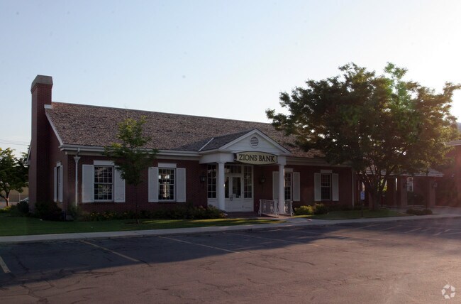

Property Detail
620 E Main St
Provo-Orem-Lehi, UT
COM S 1338.89 FT & E 32.59 FT GRID DISTANCES, FR N1/4 COR SEC 16, T5S, R1E, SLM; N88-2325E 185.16 FT; S 4416W 185.16 FT; S 88-2325W 185.16 FT; N 4416E 185.16 FT TO BEG. AREA .79 AC.
13-012-0011
Utah
Financialbuilding
Utah
2024
0.79 AC
2025
Utah County
000103
Salt Lake City
6,248 SF
NEARBY LISTINGS FOR SALE OR LEASE
DEMOGRAPHICS near 620 E Main St
1 mile
3 mile
5 mile
2025 Total Population
9,804
88,745
195,290
2030 Population
10,791
98,026
216,730
Pop Growth 2025-2030
+ 10.07%
+ 10.46%
+ 10.98%
Average Age
34
32
31
2025 Total Households
3,037
23,974
54,456
HH Growth 2025-2030
+ 11.10%
+ 11.19%
+ 11.75%
Median Household Inc
$91,290
$126,321
$124,156
Avg Household Size
3.20
3.70
3.60
2025 Avg HH Vehicles
2.00
3.00
2.00
Median Home Value
$617,538
$664,792
$667,450
Median Year Built
1994
2003
2008
Nearby Places
Map Layers
Map Styles
 Street
 Aerial
Transit
 Traffic
 Biking
Places
Listings with unknown addresses are not visible on the map
- Restaurants
- Banks
- Shops
- Fitness
- Groceries
PUBLIC TRANSPORTATION
COMMUTER RAIL
Drive
Walk
Distance
5 min
2.1 mi
Drive
Walk
Distance
10 min
5.7 mi
AIRPORT
Provo Municipal
Drive
Walk
Distance
Provo Municipal
22 min
17.2 mi
Salt Lake City International
Drive
Walk
Distance
Salt Lake City International
40 min
33.7 mi
Nearby Properties
Address
Land Use
TOTAL SIZE
Lot Size
Zoning
Address
Land Use
TOTAL SIZE
Lot Size
Zoning
359,445 SF
6.46 AC
Address
Land Use
TOTAL SIZE
Lot Size
Zoning
131,961 SF
7.57 AC
Address
Land Use
TOTAL SIZE
Lot Size
Zoning
305,553 SF
13.08 AC
Address
Land Use
TOTAL SIZE
Lot Size
Zoning
181,908 SF
1.43 AC
Address
Land Use
TOTAL SIZE
Lot Size
Zoning
147,368 SF
6.91 AC
Address
Land Use
TOTAL SIZE
Lot Size
Zoning
304,991 SF
7.05 AC
Address
Land Use
TOTAL SIZE
Lot Size
Zoning
227,030 SF
21.91 AC
Address
Land Use
TOTAL SIZE
Lot Size
Zoning
165,821 SF
12.29 AC
Address
Land Use
TOTAL SIZE
Lot Size
Zoning
201,838 SF
8.83 AC
Address
Land Use
TOTAL SIZE
Lot Size
Zoning
149,937 SF
13.49 AC
Address
Land Use
TOTAL SIZE
Lot Size
Zoning
100,814 SF
8.22 AC
Address
Land Use
TOTAL SIZE
Lot Size
Zoning
62,104 SF
8.97 AC
Address
Land Use
TOTAL SIZE
Lot Size
Zoning
110,561 SF
6.47 AC
Address
Land Use
TOTAL SIZE
Lot Size
Zoning
1,121 SF
4.07 AC
Address
Land Use
TOTAL SIZE
Lot Size
Zoning
137,193 SF
12.45 AC
Address
Land Use
TOTAL SIZE
Lot Size
Zoning
90,049 SF
5.99 AC
Address
Land Use
TOTAL SIZE
Lot Size
Zoning
111,292 SF
5.36 AC
Address
Land Use
TOTAL SIZE
Lot Size
Zoning
100,973 SF
5.71 AC
Address
Land Use
TOTAL SIZE
Lot Size
Zoning
120,431 SF
7.92 AC
Address
Land Use
TOTAL SIZE
Lot Size
Zoning
76,420 SF
3.94 AC
Address
Land Use
TOTAL SIZE
Lot Size
Zoning
91,812 SF
6.99 AC
Address
Land Use
TOTAL SIZE
Lot Size
Zoning
124,836 SF
8.74 AC
Address
Land Use
TOTAL SIZE
Lot Size
Zoning
65,449 SF
2.27 AC
Address
Land Use
TOTAL SIZE
Lot Size
Zoning
96,361 SF
7.86 AC
Address
Land Use
TOTAL SIZE
Lot Size
Zoning
107,722 SF
5.65 AC
Address
Land Use
TOTAL SIZE
Lot Size
Zoning
105,188 SF
10.64 AC
Address
Land Use
TOTAL SIZE
Lot Size
Zoning
97,088 SF
3.88 AC
Address
Land Use
TOTAL SIZE
Lot Size
Zoning
95,683 SF
9.32 AC
Address
Land Use
TOTAL SIZE
Lot Size
Zoning
58,277 SF
7.49 AC
Address
Land Use
TOTAL SIZE
Lot Size
Zoning
51,230 SF
5.19 AC
The World's #1 Commercial Real Estate Marketplace
Connect with us
© 2026 CoStar Group
The information above has been obtained from sources believed reliable. While we do not doubt its accuracy we have not verified it and make no guarantee, warranty or representation about it. It is your responsibility to independently confirm its accuracy and completeness. Any projections, opinions, assumptions, or estimates used are for example only and do not represent the current or future performance of the property. The value of this transaction to you depends on tax and other factors which should be evaluated by your tax, financial, and legal advisors. You and your advisors should conduct a careful, independent investigation of the property to determine to your satisfaction the suitability of the property for your needs.