Property Record
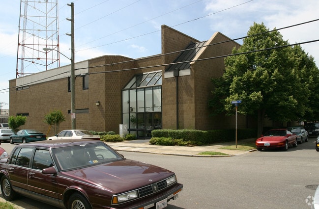
620 Front St, Norfolk, VA 23510

Property Detail
620 Front St
35532020
5,6 & 7 BLK 6 & PT UNAMED LANE CLO
Radioortvstationcommunications
NORFOLK CITY
D5
Virginia
AE The base floodplain where base flood elevations are provided. AE Zones are now used on new format FIRMs instead of A1-A30 Zones.
0.23 AC
2025
Norfolk-ODU/Ghent
2025
Hampton Roads
004900
Virginia Beach-Chesapeake-Norfolk, VA-NC
1,500 SF
NEARBY LISTINGS FOR SALE OR LEASE
DEMOGRAPHICS near 620 Front St
1 mile
3 mile
5 mile
2025 Total Population
13,898
104,676
248,110
2030 Population
13,710
103,863
245,720
Pop Growth 2025-2030
(1.35%)
(0.78%)
(0.96%)
Average Age
39
36
37
2025 Total Households
7,867
42,921
99,736
HH Growth 2025-2030
(1.33%)
(0.94%)
(1.11%)
Median Household Inc
$87,274
$57,676
$60,672
Avg Household Size
1.70
2.20
2.30
2025 Avg HH Vehicles
1.00
1.00
2.00
Median Home Value
$540,785
$298,356
$278,417
Median Year Built
1963
1963
1964
Nearby Places
Map Layers
Map Styles
 Street
 Aerial
Transit
 Traffic
 Biking
Places
Listings with unknown addresses are not visible on the map
- Restaurants
- Banks
- Shops
- Fitness
- Groceries
PUBLIC TRANSPORTATION
TRANSIT/SUBWAY
Evmc/Ft. Norfolk (Tide Light Rail - Hampton Roads Transit (HRT))
Drive
Walk
Distance
Evmc/Ft. Norfolk (Tide Light Rail - Hampton Roads Transit (HRT))
1 min
5 min
0.3 mi
York Street / Freemason (Tide Light Rail - Hampton Roads Transit (HRT))
Drive
Walk
Distance
York Street / Freemason (Tide Light Rail - Hampton Roads Transit (HRT))
2 min
13 min
0.6 mi
Monticello (LIGHT RAIL TIDE - Hampton Roads Transit (HRT))
Drive
Walk
Distance
Monticello (LIGHT RAIL TIDE - Hampton Roads Transit (HRT))
3 min
20 min
1.1 mi
COMMUTER RAIL
Norfolk (Northeast Regional - Amtrak)
Drive
Walk
Distance
Norfolk (Northeast Regional - Amtrak)
6 min
2.5 mi
AIRPORT
Norfolk International
Drive
Walk
Distance
Norfolk International
16 min
7.6 mi
Newport News/Williamsburg International
Drive
Walk
Distance
Newport News/Williamsburg International
44 min
29.0 mi
Freight Ports
Virginia Port Authority - Portsmouth
Drive
Walk
Distance
Virginia Port Authority - Portsmouth
10 min
3.7 mi
Nearby Properties
Address
Land Use
TOTAL SIZE
Lot Size
Zoning
Address
Land Use
TOTAL SIZE
Lot Size
Zoning
331,760 SF
24.97 AC
Address
Land Use
TOTAL SIZE
Lot Size
Zoning
5,704 SF
4.67 AC
D2
Address
Land Use
TOTAL SIZE
Lot Size
Zoning
85,756 SF
3.59 AC
D5
Address
Land Use
TOTAL SIZE
Lot Size
Zoning
421,540 SF
2.37 AC
Address
Land Use
TOTAL SIZE
Lot Size
Zoning
192,422 SF
10.70 AC
D4
Address
Land Use
TOTAL SIZE
Lot Size
Zoning
250,766 SF
31.14 AC
NMU
Address
Land Use
TOTAL SIZE
Lot Size
Zoning
390,960 SF
4.43 AC
Address
Land Use
TOTAL SIZE
Lot Size
Zoning
390,960 SF
4.43 AC
Address
Land Use
TOTAL SIZE
Lot Size
Zoning
73,136 SF
5.34 AC
IN2
Address
Land Use
TOTAL SIZE
Lot Size
Zoning
55.11 AC
IN2
Address
Land Use
TOTAL SIZE
Lot Size
Zoning
92.17 AC
OSP
Address
Land Use
TOTAL SIZE
Lot Size
Zoning
421,856 SF
2.64 AC
D1
Address
Land Use
TOTAL SIZE
Lot Size
Zoning
971,654 SF
6.01 AC
D2
Address
Land Use
TOTAL SIZE
Lot Size
Zoning
310,912 SF
3.94 AC
Address
Land Use
TOTAL SIZE
Lot Size
Zoning
473,072 SF
9.72 AC
SD
Address
Land Use
TOTAL SIZE
Lot Size
Zoning
68,643 SF
24.68 AC
Address
Land Use
TOTAL SIZE
Lot Size
Zoning
192,270 SF
1.99 AC
D2
Address
Land Use
TOTAL SIZE
Lot Size
Zoning
126,088 SF
4.91 AC
C2
Address
Land Use
TOTAL SIZE
Lot Size
Zoning
363,974 SF
1.49 AC
Address
Land Use
TOTAL SIZE
Lot Size
Zoning
66,718 SF
4.09 AC
D5
Address
Land Use
TOTAL SIZE
Lot Size
Zoning
4.92 AC
IN1
Address
Land Use
TOTAL SIZE
Lot Size
Zoning
356,598 SF
1.84 AC
D2
Address
Land Use
TOTAL SIZE
Lot Size
Zoning
160,677 SF
29.47 AC
IN
Address
Land Use
TOTAL SIZE
Lot Size
Zoning
50,384 SF
0.74 AC
Address
Land Use
TOTAL SIZE
Lot Size
Zoning
291,748 SF
3.40 AC
G1
Address
Land Use
TOTAL SIZE
Lot Size
Zoning
91,982 SF
22.78 AC
IN1
Address
Land Use
TOTAL SIZE
Lot Size
Zoning
406,344 SF
8.45 AC
GMU
Address
Land Use
TOTAL SIZE
Lot Size
Zoning
79,577 SF
3.04 AC
C2
Address
Land Use
TOTAL SIZE
Lot Size
Zoning
35,091 SF
0.71 AC
Address
Land Use
TOTAL SIZE
Lot Size
Zoning
197,074 SF
6.69 AC
The World's #1 Commercial Real Estate Marketplace
Connect with us
© 2026 CoStar Group
The information above has been obtained from sources believed reliable. While we do not doubt its accuracy we have not verified it and make no guarantee, warranty or representation about it. It is your responsibility to independently confirm its accuracy and completeness. Any projections, opinions, assumptions, or estimates used are for example only and do not represent the current or future performance of the property. The value of this transaction to you depends on tax and other factors which should be evaluated by your tax, financial, and legal advisors. You and your advisors should conduct a careful, independent investigation of the property to determine to your satisfaction the suitability of the property for your needs.