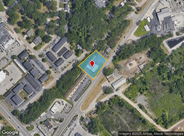
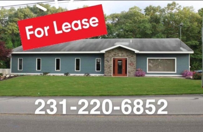
Property Record
620 Holton Rd, Muskegon, MI 49445

NEARBY LISTINGS FOR SALE OR LEASE
Property Detail
620 Holton Rd
Muskegon, MI
Orth
23-168-049-0002-00
PART LOT 2&4
Commercialnec
Muskegon
X
Michigan
26121C0163E
2,4,16
2024
0.84 AC
2025
Northern Muskegon County
001500
West Michigan
4,589 SF
DEMOGRAPHICS near 620 Holton Rd
1 Mile
3 Mile
5 Mile
2024 Total Population
2,240
27,681
76,703
2029 Population
2,238
27,977
77,433
Pop Growth 2024-2029
(0.09%)
+ 1.07%
+ 0.95%
Average Age
42
39
40
2024 Total Households
936
11,183
29,555
HH Growth 2024-2029
(0.11%)
+ 1.08%
+ 0.93%
Median Household Inc
$70,397
$49,717
$47,353
Avg Household Size
2.30
2.30
2.40
2024 Avg HH Vehicles
2.00
2.00
2.00
Median Home Value
$171,406
$153,884
$130,465
Median Year Built
1972
1962
1956
Nearby Places
Map Layers
Map Styles
 Street
 Aerial
- Restaurants
- Banks
- Shops
- Fitness
- Groceries
SALE & LEASE HISTORY
LISTING DATE
SALE/LEASE

Feb 03, 2023
For Lease
Nearby Properties
Address
Land Use
TOTAL SIZE
Lot Size
Zoning
Address
Land Use
TOTAL SIZE
Lot Size
Zoning
Address
Land Use
TOTAL SIZE
Lot Size
Zoning
183,891 SF
391.21 AC
IP
Address
Land Use
TOTAL SIZE
Lot Size
Zoning
191,930 SF
37.12 AC
C2
Address
Land Use
TOTAL SIZE
Lot Size
Zoning
446,688 SF
29.50 AC
RM-2
Address
Land Use
TOTAL SIZE
Lot Size
Zoning
892,516 SF
57.88 AC
I
Address
Land Use
TOTAL SIZE
Lot Size
Zoning
59,396 SF
Address
Land Use
TOTAL SIZE
Lot Size
Zoning
79,321 SF
4.28 AC
B-3
Address
Land Use
TOTAL SIZE
Lot Size
Zoning
184,130 SF
3.16 AC
FBC-MS
Address
Land Use
TOTAL SIZE
Lot Size
Zoning
116,657 SF
1.60 AC
FBC-UR
Address
Land Use
TOTAL SIZE
Lot Size
Zoning
79,321 SF
5 AC
FBC-MS
Address
Land Use
TOTAL SIZE
Lot Size
Zoning
142,000 SF
1.60 AC
FBC-DT
Address
Land Use
TOTAL SIZE
Lot Size
Zoning
2,044 SF
4.10 AC
RT
Address
Land Use
TOTAL SIZE
Lot Size
Zoning
191,930 SF
35 AC
C2
Address
Land Use
TOTAL SIZE
Lot Size
Zoning
163,658 SF
14.70 AC
RM-1
Address
Land Use
TOTAL SIZE
Lot Size
Zoning
33,750 SF
R
Address
Land Use
TOTAL SIZE
Lot Size
Zoning
180,144 SF
3.29 AC
RM-1
Address
Land Use
TOTAL SIZE
Lot Size
Zoning
325,640 SF
49 AC
WM
Address
Land Use
TOTAL SIZE
Lot Size
Zoning
42,888 SF
2.10 AC
R
Address
Land Use
TOTAL SIZE
Lot Size
Zoning
212,648 SF
9.20 AC
B-2, PUD
Address
Land Use
TOTAL SIZE
Lot Size
Zoning
14,022 SF
13 AC
LI
Address
Land Use
TOTAL SIZE
Lot Size
Zoning
103,364 SF
4.35 AC
R-3HIGH
Address
Land Use
TOTAL SIZE
Lot Size
Zoning
79,321 SF
4.28 AC
B-3
Address
Land Use
TOTAL SIZE
Lot Size
Zoning
18,844 SF
99.10 AC
WI-PUD
Address
Land Use
TOTAL SIZE
Lot Size
Zoning
69,532 SF
4.38 AC
PUD
Address
Land Use
TOTAL SIZE
Lot Size
Zoning
37,872 SF
36.61 AC
RMH
Address
Land Use
TOTAL SIZE
Lot Size
Zoning
4,420 SF
5.30 AC
R-1
Address
Land Use
TOTAL SIZE
Lot Size
Zoning
40,819 SF
6.80 AC
FBC-NC
Address
Land Use
TOTAL SIZE
Lot Size
Zoning
76,250 SF
4.64 AC
R-3
Address
Land Use
TOTAL SIZE
Lot Size
Zoning
14,619 SF
8.58 AC
FBC-DT
Address
Land Use
TOTAL SIZE
Lot Size
Zoning
17,698 SF
8.57 AC
B3
The World's #1 Commercial Real Estate Marketplace
Connect with us
© 2025 CoStar Group
The information above has been obtained from sources believed reliable. While we do not doubt its accuracy we have not verified it and make no guarantee, warranty or representation about it. It is your responsibility to independently confirm its accuracy and completeness. Any projections, opinions, assumptions, or estimates used are for example only and do not represent the current or future performance of the property. The value of this transaction to you depends on tax and other factors which should be evaluated by your tax, financial, and legal advisors. You and your advisors should conduct a careful, independent investigation of the property to determine to your satisfaction the suitability of the property for your needs.