Property Record
620 Middle Tpke E, Manchester, CT 06040

Property Detail
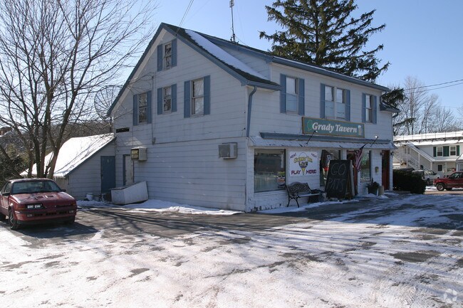
620 Middle Tpke E
MANC-000122-003950-000620
Capitol
Commercialbuilding
Connecticut
SDC
620
B and X Area of moderate flood hazard, usually the area between the limits of the 100-year and 500-year floods.
0.32 AC
2025
Manchester
2025
Hartford
515000
Hartford-West Hartford-East Hartford, CT
2,146 SF
NEARBY LISTINGS FOR SALE OR LEASE
DEMOGRAPHICS near 620 Middle Tpke E
1 mile
3 mile
5 mile
2025 Total Population
8,124
57,513
103,834
2030 Population
8,277
58,574
105,863
Pop Growth 2025-2030
+ 1.88%
+ 1.84%
+ 1.95%
Average Age
42
40
41
2025 Total Households
3,276
24,185
43,047
HH Growth 2025-2030
+ 1.86%
+ 1.86%
+ 1.99%
Median Household Inc
$108,055
$88,443
$95,783
Avg Household Size
2.40
2.30
2.30
2025 Avg HH Vehicles
2.00
2.00
2.00
Median Home Value
$260,133
$260,756
$292,920
Median Year Built
1955
1961
1968
Nearby Places
Map Layers
Map Styles
 Street
 Aerial
Transit
 Traffic
 Biking
Places
Listings with unknown addresses are not visible on the map
- Restaurants
- Banks
- Shops
- Fitness
- Groceries
PUBLIC TRANSPORTATION
AIRPORT
Bradley International
Drive
Walk
Distance
Bradley International
41 min
22.7 mi
Freight Ports
Port of New Haven
Drive
Walk
Distance
Port of New Haven
63 min
47.9 mi
SALE & LEASE HISTORY
LISTING DATE
SALE/LEASE

Feb 06, 2024
For Sale
Dec 19, 2022
For Sale
Nearby Properties
Address
Land Use
TOTAL SIZE
Lot Size
Zoning
Address
Land Use
TOTAL SIZE
Lot Size
Zoning
12.54 AC
Address
Land Use
TOTAL SIZE
Lot Size
Zoning
467,349 SF
13.83 AC
CUD
Address
Land Use
TOTAL SIZE
Lot Size
Zoning
20,384 SF
40 AC
PRD
Address
Land Use
TOTAL SIZE
Lot Size
Zoning
28,608 SF
25.37 AC
CUD
Address
Land Use
TOTAL SIZE
Lot Size
Zoning
43.60 AC
PRD
Address
Land Use
TOTAL SIZE
Lot Size
Zoning
12,068 SF
21.79 AC
CUD
Address
Land Use
TOTAL SIZE
Lot Size
Zoning
29,744 SF
29.50 AC
PRD
Address
Land Use
TOTAL SIZE
Lot Size
Zoning
24.02 AC
COMMER
Address
Land Use
TOTAL SIZE
Lot Size
Zoning
53.59 AC
RA
Address
Land Use
TOTAL SIZE
Lot Size
Zoning
219,479 SF
9.32 AC
H
Address
Land Use
TOTAL SIZE
Lot Size
Zoning
22.12 AC
FBZ
Address
Land Use
TOTAL SIZE
Lot Size
Zoning
68,988 SF
9.17 AC
GB
Address
Land Use
TOTAL SIZE
Lot Size
Zoning
6.38 AC
CBD
Address
Land Use
TOTAL SIZE
Lot Size
Zoning
79,198 SF
10.47 AC
RA
Address
Land Use
TOTAL SIZE
Lot Size
Zoning
195,772 SF
3.17 AC
H
Address
Land Use
TOTAL SIZE
Lot Size
Zoning
13.01 AC
B5
Address
Land Use
TOTAL SIZE
Lot Size
Zoning
7.11 AC
CUD
Address
Land Use
TOTAL SIZE
Lot Size
Zoning
144,679 SF
16.39 AC
CUD
Address
Land Use
TOTAL SIZE
Lot Size
Zoning
6.80 AC
H
Address
Land Use
TOTAL SIZE
Lot Size
Zoning
16 AC
RA
Address
Land Use
TOTAL SIZE
Lot Size
Zoning
19.72 AC
GB
Address
Land Use
TOTAL SIZE
Lot Size
Zoning
116,406 SF
10.64 AC
RA
Address
Land Use
TOTAL SIZE
Lot Size
Zoning
54,012 SF
16.64 AC
RA
Address
Land Use
TOTAL SIZE
Lot Size
Zoning
16.23 AC
CUD
Address
Land Use
TOTAL SIZE
Lot Size
Zoning
249,244 SF
27.23 AC
IND
Address
Land Use
TOTAL SIZE
Lot Size
Zoning
6.76 AC
B5
Address
Land Use
TOTAL SIZE
Lot Size
Zoning
106,866 SF
7.63 AC
GB
Address
Land Use
TOTAL SIZE
Lot Size
Zoning
5.80 AC
SDC
Address
Land Use
TOTAL SIZE
Lot Size
Zoning
129,700 SF
3.60 AC
H
Address
Land Use
TOTAL SIZE
Lot Size
Zoning
78,559 SF
25.70 AC
R-1
The World's #1 Commercial Real Estate Marketplace
Connect with us
© 2026 CoStar Group
The information above has been obtained from sources believed reliable. While we do not doubt its accuracy we have not verified it and make no guarantee, warranty or representation about it. It is your responsibility to independently confirm its accuracy and completeness. Any projections, opinions, assumptions, or estimates used are for example only and do not represent the current or future performance of the property. The value of this transaction to you depends on tax and other factors which should be evaluated by your tax, financial, and legal advisors. You and your advisors should conduct a careful, independent investigation of the property to determine to your satisfaction the suitability of the property for your needs.