Property Record
620 Piper Ln, Prospect Heights, IL 60070


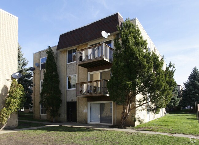
Property Detail
620 Piper Ln
03-24-200-041-0000
Cook
Apartment
Illinois
B and X Area of moderate flood hazard, usually the area between the limits of the 100-year and 500-year floods.
0.11 AC
2023
Des Plaines/Arlington Hts Corridor
2025
Chicago
802505
Chicago-Naperville-Elgin, IL-IN
5,796 SF
NEARBY LISTINGS FOR SALE OR LEASE
-
-
View all Prospect Heights listings for sale on LoopNet.com
DEMOGRAPHICS near 620 Piper Ln
1 mile
3 mile
5 mile
2025 Total Population
10,864
90,751
309,476
2030 Population
10,915
91,746
312,405
Pop Growth 2025-2030
+ 0.47%
+ 1.10%
+ 0.95%
Average Age
39
44
44
2025 Total Households
4,147
34,774
119,523
HH Growth 2025-2030
+ 0.27%
+ 0.92%
+ 0.81%
Median Household Inc
$80,560
$105,794
$107,234
Avg Household Size
2.60
2.50
2.50
2025 Avg HH Vehicles
2.00
2.00
2.00
Median Home Value
$211,830
$417,742
$400,798
Median Year Built
1972
1975
1974
Nearby Places
Map Layers
Map Styles
 Street
 Aerial
Layers
 Traffic
 Biking
Places
Listings with unknown addresses are not visible on the map
- Restaurants
- Banks
- Shops
- Fitness
- Groceries
PUBLIC TRANSPORTATION
COMMUTER RAIL
Prospect Heights Station (North Central Service - Northeast Illinois Regional Commuter Railroad (Metra))
Drive
Walk
Distance
Prospect Heights Station (North Central Service - Northeast Illinois Regional Commuter Railroad (Metra))
5 min
1.7 mi
Wheeling Station (North Central Service - Northeast Illinois Regional Commuter Railroad (Metra))
Drive
Walk
Distance
Wheeling Station (North Central Service - Northeast Illinois Regional Commuter Railroad (Metra))
8 min
4.1 mi
AIRPORT
Chicago O'Hare International
Drive
Walk
Distance
Chicago O'Hare International
19 min
12.3 mi
Chicago Midway International
Drive
Walk
Distance
Chicago Midway International
46 min
25.7 mi
Nearby Properties
Address
Land Use
TOTAL SIZE
Lot Size
Zoning
Address
Land Use
TOTAL SIZE
Lot Size
Zoning
78,600 SF
9.20 AC
Address
Land Use
TOTAL SIZE
Lot Size
Zoning
Address
Land Use
TOTAL SIZE
Lot Size
Zoning
22.72 AC
Address
Land Use
TOTAL SIZE
Lot Size
Zoning
20.79 AC
Address
Land Use
TOTAL SIZE
Lot Size
Zoning
206,160 SF
9.44 AC
Address
Land Use
TOTAL SIZE
Lot Size
Zoning
443,916 SF
5.61 AC
Address
Land Use
TOTAL SIZE
Lot Size
Zoning
552,862 SF
45.76 AC
Address
Land Use
TOTAL SIZE
Lot Size
Zoning
142,300 SF
13.16 AC
Address
Land Use
TOTAL SIZE
Lot Size
Zoning
690,195 SF
39.48 AC
Address
Land Use
TOTAL SIZE
Lot Size
Zoning
510,569 SF
3.55 AC
Address
Land Use
TOTAL SIZE
Lot Size
Zoning
20.95 AC
Address
Land Use
TOTAL SIZE
Lot Size
Zoning
234,337 SF
23.59 AC
Address
Land Use
TOTAL SIZE
Lot Size
Zoning
449,568 SF
22.73 AC
Address
Land Use
TOTAL SIZE
Lot Size
Zoning
143,087 SF
11.20 AC
Address
Land Use
TOTAL SIZE
Lot Size
Zoning
146,650 SF
8.98 AC
Address
Land Use
TOTAL SIZE
Lot Size
Zoning
262,533 SF
32.21 AC
Address
Land Use
TOTAL SIZE
Lot Size
Zoning
72,916 SF
5.69 AC
Address
Land Use
TOTAL SIZE
Lot Size
Zoning
Address
Land Use
TOTAL SIZE
Lot Size
Zoning
65,401 SF
5.05 AC
Address
Land Use
TOTAL SIZE
Lot Size
Zoning
89,080 SF
6.81 AC
Address
Land Use
TOTAL SIZE
Lot Size
Zoning
Address
Land Use
TOTAL SIZE
Lot Size
Zoning
186,173 SF
5.86 AC
Address
Land Use
TOTAL SIZE
Lot Size
Zoning
12.53 AC
Address
Land Use
TOTAL SIZE
Lot Size
Zoning
197,191 SF
7.20 AC
Address
Land Use
TOTAL SIZE
Lot Size
Zoning
31.61 AC
Address
Land Use
TOTAL SIZE
Lot Size
Zoning
Address
Land Use
TOTAL SIZE
Lot Size
Zoning
161,035 SF
13.57 AC
Address
Land Use
TOTAL SIZE
Lot Size
Zoning
Address
Land Use
TOTAL SIZE
Lot Size
Zoning
Address
Land Use
TOTAL SIZE
Lot Size
Zoning
271,629 SF
16.29 AC
The World's #1 Commercial Real Estate Marketplace
Connect with us
© 2026 CoStar Group
The information above has been obtained from sources believed reliable. While we do not doubt its accuracy we have not verified it and make no guarantee, warranty or representation about it. It is your responsibility to independently confirm its accuracy and completeness. Any projections, opinions, assumptions, or estimates used are for example only and do not represent the current or future performance of the property. The value of this transaction to you depends on tax and other factors which should be evaluated by your tax, financial, and legal advisors. You and your advisors should conduct a careful, independent investigation of the property to determine to your satisfaction the suitability of the property for your needs.