Property Record
620 Ridgewood Dr, Akron, OH 44333


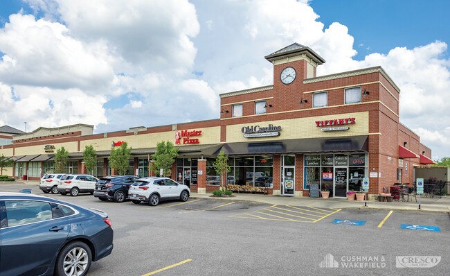
Property Detail
620 Ridgewood Dr
Akron, OH
RIDGEWOOD CROSSING NO 2 REPLAT BLOCK A ALL RN 55883116
15-08267
SUMMIT
Commercialacreage
Ohio
AE The base floodplain where base flood elevations are provided. AE Zones are now used on new format FIRMs instead of A1-A30 Zones.
1.31 AC
2023
Akron
2025
Cleveland
532302
NEARBY LISTINGS FOR SALE OR LEASE
DEMOGRAPHICS near 620 Ridgewood Dr
1 mile
3 mile
5 mile
2025 Total Population
5,901
43,513
104,749
2030 Population
5,872
43,430
104,969
Pop Growth 2025-2030
(0.49%)
(0.19%)
+ 0.21%
Average Age
43
44
42
2025 Total Households
2,587
19,525
46,559
HH Growth 2025-2030
(0.54%)
(0.22%)
+ 0.21%
Median Household Inc
$98,925
$94,234
$70,556
Avg Household Size
2.20
2.20
2.20
2025 Avg HH Vehicles
2.00
2.00
2.00
Median Home Value
$297,807
$254,716
$237,149
Median Year Built
1971
1966
1962
Nearby Places
Map Layers
Map Styles
 Street
 Aerial
Layers
 Traffic
 Biking
Places
Listings with unknown addresses are not visible on the map
- Restaurants
- Banks
- Shops
- Fitness
- Groceries
PUBLIC TRANSPORTATION
COMMUTER RAIL
Botzum (National Park Scenic Railway - Cuyahoga Valley Scenic Railroad)
Drive
Walk
Distance
Botzum (National Park Scenic Railway - Cuyahoga Valley Scenic Railroad)
13 min
6.1 mi
Big Bend (National Park Scenic Railway - Cuyahoga Valley Scenic Railroad)
Drive
Walk
Distance
Big Bend (National Park Scenic Railway - Cuyahoga Valley Scenic Railroad)
14 min
6.4 mi
AIRPORT
Akron-Canton Regional
Drive
Walk
Distance
Akron-Canton Regional
27 min
19.9 mi
Cleveland-Hopkins International
Drive
Walk
Distance
Cleveland-Hopkins International
47 min
33.9 mi
Freight Ports
Port of Toledo
Drive
Walk
Distance
Port of Toledo
151 min
129.1 mi
SALE & LEASE HISTORY
LISTING DATE
SALE/LEASE

Apr 26, 2019
For Sale
Nearby Properties
Address
Land Use
TOTAL SIZE
Lot Size
Zoning
Address
Land Use
TOTAL SIZE
Lot Size
Zoning
Address
Land Use
TOTAL SIZE
Lot Size
Zoning
282,490 SF
20.76 AC
Address
Land Use
TOTAL SIZE
Lot Size
Zoning
12.92 AC
Address
Land Use
TOTAL SIZE
Lot Size
Zoning
676,403 SF
39.06 AC
Address
Land Use
TOTAL SIZE
Lot Size
Zoning
Address
Land Use
TOTAL SIZE
Lot Size
Zoning
324,548 SF
64.18 AC
Address
Land Use
TOTAL SIZE
Lot Size
Zoning
194,508 SF
30.87 AC
Address
Land Use
TOTAL SIZE
Lot Size
Zoning
91,104 SF
17.30 AC
Address
Land Use
TOTAL SIZE
Lot Size
Zoning
311,093 SF
32.53 AC
Address
Land Use
TOTAL SIZE
Lot Size
Zoning
72,026 SF
7.92 AC
Address
Land Use
TOTAL SIZE
Lot Size
Zoning
192,658 SF
15.34 AC
Address
Land Use
TOTAL SIZE
Lot Size
Zoning
411,220 SF
54.72 AC
Address
Land Use
TOTAL SIZE
Lot Size
Zoning
439,456 SF
26.40 AC
Address
Land Use
TOTAL SIZE
Lot Size
Zoning
164,214 SF
12.92 AC
Address
Land Use
TOTAL SIZE
Lot Size
Zoning
214,600 SF
14.12 AC
Address
Land Use
TOTAL SIZE
Lot Size
Zoning
135,300 SF
6.75 AC
Address
Land Use
TOTAL SIZE
Lot Size
Zoning
226,341 SF
18.81 AC
Address
Land Use
TOTAL SIZE
Lot Size
Zoning
77,096 SF
6.21 AC
Address
Land Use
TOTAL SIZE
Lot Size
Zoning
Address
Land Use
TOTAL SIZE
Lot Size
Zoning
231,968 SF
29.14 AC
Address
Land Use
TOTAL SIZE
Lot Size
Zoning
10 AC
Address
Land Use
TOTAL SIZE
Lot Size
Zoning
87,071 SF
18.03 AC
Address
Land Use
TOTAL SIZE
Lot Size
Zoning
148,292 SF
18.43 AC
Address
Land Use
TOTAL SIZE
Lot Size
Zoning
Address
Land Use
TOTAL SIZE
Lot Size
Zoning
12.46 AC
Address
Land Use
TOTAL SIZE
Lot Size
Zoning
73,301 SF
5.55 AC
Address
Land Use
TOTAL SIZE
Lot Size
Zoning
147,635 SF
15.14 AC
Address
Land Use
TOTAL SIZE
Lot Size
Zoning
76,560 SF
6.07 AC
Address
Land Use
TOTAL SIZE
Lot Size
Zoning
36,716 SF
4.37 AC
Address
Land Use
TOTAL SIZE
Lot Size
Zoning
129,308 SF
19.02 AC
The World's #1 Commercial Real Estate Marketplace
Connect with us
© 2026 CoStar Group
The information above has been obtained from sources believed reliable. While we do not doubt its accuracy we have not verified it and make no guarantee, warranty or representation about it. It is your responsibility to independently confirm its accuracy and completeness. Any projections, opinions, assumptions, or estimates used are for example only and do not represent the current or future performance of the property. The value of this transaction to you depends on tax and other factors which should be evaluated by your tax, financial, and legal advisors. You and your advisors should conduct a careful, independent investigation of the property to determine to your satisfaction the suitability of the property for your needs.