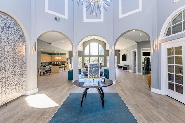
Property Record
620 S Vance St, Lakewood, CO 80226


NEARBY LISTINGS FOR SALE OR LEASE
-
-
-
-
No Photo
-
-
-
-
View all Lakewood listings for sale on LoopNet.com
Property Detail
620 S Vance St
Denver-Aurora-Centennial, CO
Waterside West Flg # 1
49-141-04-001
SECTION 14 TOWNSHIP 04 RANGE 69 QTR SE SUBDIVISIONCD 801705 SUBDIVISIONNAME WATERSIDE WEST FLG # 5 BLOCK 00A LOT SIZE: 24809 TRACT VALUE: .570
Multifamilydwelling
Jefferson
2023
Colorado
2024
6.51 AC
011808
Belmar
223,205 SF
Denver
DEMOGRAPHICS near 620 S Vance St
1 Mile
3 Mile
5 Mile
2024 Total Population
17,985
148,452
359,832
2029 Population
17,883
147,617
359,413
Pop Growth 2024-2029
(0.57%)
(0.56%)
(0.12%)
Average Age
40
39
39
2024 Total Households
7,956
57,441
149,359
HH Growth 2024-2029
(0.54%)
(0.68%)
(0.11%)
Median Household Inc
$68,902
$67,760
$74,386
Avg Household Size
2.20
2.40
2.30
2024 Avg HH Vehicles
2.00
2.00
2.00
Median Home Value
$457,285
$449,604
$484,072
Median Year Built
1975
1967
1971
Nearby Places
Map Layers
Map Styles
 Street
 Aerial
- Restaurants
- Banks
- Shops
- Fitness
- Groceries
PUBLIC TRANSPORTATION
COMMUTER RAIL
Union Station: Lodo-Coors Field-16Th Street Mall (C Line - Denver Regional Transportation District Light Rail (TheRide), E Line - Denver Regional Transportation District Light Rail (TheRide), W Line - Denver Regional Transportation District Light Rail (TheRide))
DRIVE
WALK
Distance
Union Station: Lodo-Coors Field-16Th Street Mall (C Line - Denver Regional Transportation District Light Rail (TheRide), E Line - Denver Regional Transportation District Light Rail (TheRide), W Line - Denver Regional Transportation District Light Rail (TheRide))
13 min
7.6 mi
Denver (California Zephyr - Amtrak)
DRIVE
WALK
Distance
Denver (California Zephyr - Amtrak)
14 min
7.8 mi
AIRPORT
Denver International
DRIVE
WALK
Distance
Denver International
43 min
31.9 mi
Freight Ports
Tulsa Port Of Catoosa
DRIVE
WALK
Distance
Tulsa Port Of Catoosa
740 min
717.4 mi
Nearby Properties
Address
Land Use
TOTAL SIZE
Lot Size
Zoning
Address
Land Use
TOTAL SIZE
Lot Size
Zoning
943,179 SF
23.96 AC
Address
Land Use
TOTAL SIZE
Lot Size
Zoning
3,195,026 SF
562.97 AC
Address
Land Use
TOTAL SIZE
Lot Size
Zoning
198,081 SF
Address
Land Use
TOTAL SIZE
Lot Size
Zoning
304,560 SF
23.94 AC
S-SU-F
Address
Land Use
TOTAL SIZE
Lot Size
Zoning
232,678 SF
27.50 AC
Address
Land Use
TOTAL SIZE
Lot Size
Zoning
233,688 SF
22.37 AC
Address
Land Use
TOTAL SIZE
Lot Size
Zoning
199,685 SF
27.73 AC
Address
Land Use
TOTAL SIZE
Lot Size
Zoning
238,452 SF
8.03 AC
Address
Land Use
TOTAL SIZE
Lot Size
Zoning
135,372 SF
11.66 AC
Address
Land Use
TOTAL SIZE
Lot Size
Zoning
100,615 SF
2.28 AC
Address
Land Use
TOTAL SIZE
Lot Size
Zoning
82,756 SF
14.95 AC
Address
Land Use
TOTAL SIZE
Lot Size
Zoning
319,365 SF
11.60 AC
Address
Land Use
TOTAL SIZE
Lot Size
Zoning
311,200 SF
0.85 AC
Address
Land Use
TOTAL SIZE
Lot Size
Zoning
138,204 SF
3.68 AC
Address
Land Use
TOTAL SIZE
Lot Size
Zoning
146,133 SF
3.75 AC
Address
Land Use
TOTAL SIZE
Lot Size
Zoning
7,826 SF
0.48 AC
Address
Land Use
TOTAL SIZE
Lot Size
Zoning
80,616 SF
2.21 AC
Address
Land Use
TOTAL SIZE
Lot Size
Zoning
223,668 SF
7.61 AC
Address
Land Use
TOTAL SIZE
Lot Size
Zoning
54,353 SF
2.73 AC
Address
Land Use
TOTAL SIZE
Lot Size
Zoning
112,908 SF
5.62 AC
Address
Land Use
TOTAL SIZE
Lot Size
Zoning
157,469 SF
13.02 AC
S-SU-D
Address
Land Use
TOTAL SIZE
Lot Size
Zoning
68,758 SF
8.15 AC
E-SU-D1X
Address
Land Use
TOTAL SIZE
Lot Size
Zoning
165,567 SF
7.39 AC
S-SU-D
Address
Land Use
TOTAL SIZE
Lot Size
Zoning
101,208 SF
8.08 AC
Address
Land Use
TOTAL SIZE
Lot Size
Zoning
197,686 SF
1.46 AC
Address
Land Use
TOTAL SIZE
Lot Size
Zoning
260,591 SF
11.59 AC
Address
Land Use
TOTAL SIZE
Lot Size
Zoning
108,040 SF
7.04 AC
E-MX-3
Address
Land Use
TOTAL SIZE
Lot Size
Zoning
147,445 SF
15.53 AC
Address
Land Use
TOTAL SIZE
Lot Size
Zoning
208,794 SF
7.37 AC
The World's #1 Commercial Real Estate Marketplace
Connect with us
© 2026 CoStar Group
The information above has been obtained from sources believed reliable. While we do not doubt its accuracy we have not verified it and make no guarantee, warranty or representation about it. It is your responsibility to independently confirm its accuracy and completeness. Any projections, opinions, assumptions, or estimates used are for example only and do not represent the current or future performance of the property. The value of this transaction to you depends on tax and other factors which should be evaluated by your tax, financial, and legal advisors. You and your advisors should conduct a careful, independent investigation of the property to determine to your satisfaction the suitability of the property for your needs.