Property Record
6200 Johnson Rd, Galloway, OH 43119


Property Detail
6200 Johnson Rd
240-000227
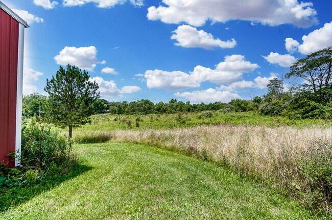
6200 JOHNSON RD ENTRY 1436 83.064 ACRES
Farms
Franklin
AE The base floodplain where base flood elevations are provided. AE Zones are now used on new format FIRMs instead of A1-A30 Zones.
Ohio
2024
83.06 AC
2025
Southwest
008167
Columbus
2,008 SF
Columbus, OH
NEARBY LISTINGS FOR SALE OR LEASE
DEMOGRAPHICS near 6200 Johnson Rd
1 mile
3 mile
5 mile
2025 Total Population
953
26,200
113,070
2030 Population
972
26,868
116,153
Pop Growth 2025-2030
+ 1.99%
+ 2.55%
+ 2.73%
Average Age
41
38
37
2025 Total Households
336
9,806
43,097
HH Growth 2025-2030
+ 2.08%
+ 2.60%
+ 2.80%
Median Household Inc
$117,187
$78,477
$68,662
Avg Household Size
2.80
2.60
2.50
2025 Avg HH Vehicles
3.00
2.00
2.00
Median Home Value
$400,943
$272,923
$257,048
Median Year Built
1984
1992
1983
Nearby Places
Map Layers
Map Styles
 Street
 Aerial
Layers
 Traffic
 Biking
Places
Listings with unknown addresses are not visible on the map
- Restaurants
- Banks
- Shops
- Fitness
- Groceries
PUBLIC TRANSPORTATION
AIRPORT
Rickenbacker International
Drive
Walk
Distance
Rickenbacker International
28 min
18.3 mi
John Glenn Columbus International
Drive
Walk
Distance
John Glenn Columbus International
30 min
20.9 mi
SALE & LEASE HISTORY
LISTING DATE
SALE/LEASE

Jul 15, 2021
For Sale
Nearby Properties
Address
Land Use
TOTAL SIZE
Lot Size
Zoning
Address
Land Use
TOTAL SIZE
Lot Size
Zoning
470,659 SF
101.09 AC
Address
Land Use
TOTAL SIZE
Lot Size
Zoning
210,724 SF
43.38 AC
Address
Land Use
TOTAL SIZE
Lot Size
Zoning
1,178,014 SF
152.63 AC
Address
Land Use
TOTAL SIZE
Lot Size
Zoning
472,671 SF
70.36 AC
Address
Land Use
TOTAL SIZE
Lot Size
Zoning
1,011,597 SF
49.94 AC
Address
Land Use
TOTAL SIZE
Lot Size
Zoning
247,354 SF
30.38 AC
Address
Land Use
TOTAL SIZE
Lot Size
Zoning
110,590 SF
13.44 AC
Address
Land Use
TOTAL SIZE
Lot Size
Zoning
332,176 SF
24.52 AC
Address
Land Use
TOTAL SIZE
Lot Size
Zoning
122,159 SF
2.77 AC
Address
Land Use
TOTAL SIZE
Lot Size
Zoning
117,389 SF
177.98 AC
Address
Land Use
TOTAL SIZE
Lot Size
Zoning
52,283 SF
19.41 AC
Address
Land Use
TOTAL SIZE
Lot Size
Zoning
108,574 SF
17.04 AC
Address
Land Use
TOTAL SIZE
Lot Size
Zoning
35,828 SF
0.17 AC
Address
Land Use
TOTAL SIZE
Lot Size
Zoning
98,674 SF
4.95 AC
Address
Land Use
TOTAL SIZE
Lot Size
Zoning
55,028 SF
19.88 AC
Address
Land Use
TOTAL SIZE
Lot Size
Zoning
68,039 SF
9.08 AC
Address
Land Use
TOTAL SIZE
Lot Size
Zoning
305,458 SF
65.48 AC
Address
Land Use
TOTAL SIZE
Lot Size
Zoning
202,500 SF
12.79 AC
Address
Land Use
TOTAL SIZE
Lot Size
Zoning
56,350 SF
5.30 AC
Address
Land Use
TOTAL SIZE
Lot Size
Zoning
13,431 SF
18.99 AC
Address
Land Use
TOTAL SIZE
Lot Size
Zoning
24,864 SF
13.80 AC
Address
Land Use
TOTAL SIZE
Lot Size
Zoning
51,216 SF
12.60 AC
Address
Land Use
TOTAL SIZE
Lot Size
Zoning
126,568 SF
39.63 AC
Address
Land Use
TOTAL SIZE
Lot Size
Zoning
201,032 SF
14.28 AC
Address
Land Use
TOTAL SIZE
Lot Size
Zoning
141,600 SF
13 AC
Address
Land Use
TOTAL SIZE
Lot Size
Zoning
30,617 SF
3.35 AC
Address
Land Use
TOTAL SIZE
Lot Size
Zoning
46,056 SF
21.12 AC
Address
Land Use
TOTAL SIZE
Lot Size
Zoning
34,588 SF
4.95 AC
Address
Land Use
TOTAL SIZE
Lot Size
Zoning
19,218 SF
14.85 AC
Address
Land Use
TOTAL SIZE
Lot Size
Zoning
100,338 SF
9.12 AC
The World's #1 Commercial Real Estate Marketplace
Connect with us
© 2026 CoStar Group
The information above has been obtained from sources believed reliable. While we do not doubt its accuracy we have not verified it and make no guarantee, warranty or representation about it. It is your responsibility to independently confirm its accuracy and completeness. Any projections, opinions, assumptions, or estimates used are for example only and do not represent the current or future performance of the property. The value of this transaction to you depends on tax and other factors which should be evaluated by your tax, financial, and legal advisors. You and your advisors should conduct a careful, independent investigation of the property to determine to your satisfaction the suitability of the property for your needs.