Property Record
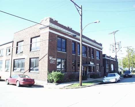
6200 Maple Ave, Saint Louis, MO 63130

Property Detail
6200 Maple Ave
18H-44-3453
CUNNINGHAM INDUSTRIAL PARK PLAT NO 2 LOTS M-20 & M-21 & DELMAR AVENUE ADDITION BLK 6 LOTS 26 THRU 54 & VAC ALLEY PT & MAPLE ST VAC PT (8025-1828 & 6390-008)
Industrialgeneral
Saint Louis
57IC
Missouri
C and X Area of minimal flood hazard, usually depicted on FIRMs as above the 500-year flood level.
m
2024
4.75 AC
2025
Innerbelt E of 170
216102
St. Louis
96,757 SF
St. Louis, MO-IL
NEARBY LISTINGS FOR SALE OR LEASE
DEMOGRAPHICS near 6200 Maple Ave
1 mile
3 mile
5 mile
2025 Total Population
20,283
135,047
321,589
2030 Population
20,373
134,732
317,926
Pop Growth 2025-2030
+ 0.44%
(0.23%)
(1.14%)
Average Age
36
39
40
2025 Total Households
8,830
60,855
144,835
HH Growth 2025-2030
+ 0.18%
(0.83%)
(1.67%)
Median Household Inc
$58,179
$64,863
$62,193
Avg Household Size
2.10
2.00
2.10
2025 Avg HH Vehicles
1.00
1.00
1.00
Median Home Value
$288,715
$253,861
$216,109
Median Year Built
1949
1948
1949
Nearby Places
Map Layers
Map Styles
 Street
 Aerial
Layers
 Traffic
 Biking
Places
Listings with unknown addresses are not visible on the map
- Restaurants
- Banks
- Shops
- Fitness
- Groceries
PUBLIC TRANSPORTATION
COMMUTER RAIL
Delmar Loop (Lambert Airport Shiloh-Scott - St. Louis MetroLink (MetroLink))
Drive
Walk
Distance
Delmar Loop (Lambert Airport Shiloh-Scott - St. Louis MetroLink (MetroLink))
1 min
12 min
0.6 mi
Wellston (Lambert Airport Shiloh-Scott - St. Louis MetroLink (MetroLink))
Drive
Walk
Distance
Wellston (Lambert Airport Shiloh-Scott - St. Louis MetroLink (MetroLink))
2 min
16 min
0.9 mi
AIRPORT
St Louis Lambert International
Drive
Walk
Distance
St Louis Lambert International
14 min
8.6 mi
Scott AFB/Midamerica St Louis
Drive
Walk
Distance
Scott AFB/Midamerica St Louis
50 min
33.5 mi
Freight Ports
Port Milwaukee
Drive
Walk
Distance
Port Milwaukee
429 min
377.8 mi
Nearby Properties
Address
Land Use
TOTAL SIZE
Lot Size
Zoning
Address
Land Use
TOTAL SIZE
Lot Size
Zoning
684,846 SF
90.65 AC
R6
Address
Land Use
TOTAL SIZE
Lot Size
Zoning
Address
Land Use
TOTAL SIZE
Lot Size
Zoning
136.92 AC
AI
Address
Land Use
TOTAL SIZE
Lot Size
Zoning
124.96 AC
J
Address
Land Use
TOTAL SIZE
Lot Size
Zoning
558,158 SF
45.66 AC
14R-2
Address
Land Use
TOTAL SIZE
Lot Size
Zoning
833,982 SF
18.70 AC
GB
Address
Land Use
TOTAL SIZE
Lot Size
Zoning
5,898 SF
21.62 AC
R2
Address
Land Use
TOTAL SIZE
Lot Size
Zoning
152.07 AC
L
Address
Land Use
TOTAL SIZE
Lot Size
Zoning
52,556 SF
68.80 AC
14R-2
Address
Land Use
TOTAL SIZE
Lot Size
Zoning
516,414 SF
2.61 AC
14C-2
Address
Land Use
TOTAL SIZE
Lot Size
Zoning
1,361,485 SF
5.45 AC
E
Address
Land Use
TOTAL SIZE
Lot Size
Zoning
361,357 SF
2.99 AC
14HDC
Address
Land Use
TOTAL SIZE
Lot Size
Zoning
238,035 SF
3.23 AC
14HDC
Address
Land Use
TOTAL SIZE
Lot Size
Zoning
5,551 SF
0.72 AC
14HDC
Address
Land Use
TOTAL SIZE
Lot Size
Zoning
501,837 SF
21.52 AC
14PUD
Address
Land Use
TOTAL SIZE
Lot Size
Zoning
390,010 SF
13.25 AC
R6
Address
Land Use
TOTAL SIZE
Lot Size
Zoning
361,605 SF
1.75 AC
14HDC
Address
Land Use
TOTAL SIZE
Lot Size
Zoning
385,676 SF
3.04 AC
C4
Address
Land Use
TOTAL SIZE
Lot Size
Zoning
7,780 SF
15.61 AC
14R-2
Address
Land Use
TOTAL SIZE
Lot Size
Zoning
354,868 SF
2.04 AC
14HDC
Address
Land Use
TOTAL SIZE
Lot Size
Zoning
7.94 AC
D
Address
Land Use
TOTAL SIZE
Lot Size
Zoning
272,933 SF
0.82 AC
14PUD
Address
Land Use
TOTAL SIZE
Lot Size
Zoning
311,264 SF
1.40 AC
14HDC
Address
Land Use
TOTAL SIZE
Lot Size
Zoning
476,403 SF
1.40 AC
14HDC
Address
Land Use
TOTAL SIZE
Lot Size
Zoning
277,568 SF
0.68 AC
14HDC
Address
Land Use
TOTAL SIZE
Lot Size
Zoning
330,896 SF
2.68 AC
14HDC
Address
Land Use
TOTAL SIZE
Lot Size
Zoning
272,940 SF
0.87 AC
14PUD
Address
Land Use
TOTAL SIZE
Lot Size
Zoning
1.33 AC
C4
Address
Land Use
TOTAL SIZE
Lot Size
Zoning
316,517 SF
3.28 AC
14C-1
Address
Land Use
TOTAL SIZE
Lot Size
Zoning
33,004 SF
1.53 AC
14HDC
The World's #1 Commercial Real Estate Marketplace
Connect with us
© 2026 CoStar Group
The information above has been obtained from sources believed reliable. While we do not doubt its accuracy we have not verified it and make no guarantee, warranty or representation about it. It is your responsibility to independently confirm its accuracy and completeness. Any projections, opinions, assumptions, or estimates used are for example only and do not represent the current or future performance of the property. The value of this transaction to you depends on tax and other factors which should be evaluated by your tax, financial, and legal advisors. You and your advisors should conduct a careful, independent investigation of the property to determine to your satisfaction the suitability of the property for your needs.