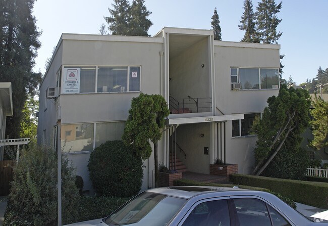
Property Record
6200 Merced Ave, Oakland, CA 94611


NEARBY LISTINGS FOR SALE OR LEASE
Property Detail
6200 Merced Ave
048F-7351-014-02
LOT: 00002 BLK: 0014 AR: 048F PAGE: 7351
Quadruplex
Alameda
X
California
06001C0080G
0.13 AC
2024
Oakland-North
2025
East Bay/Oakland
404502
Oakland-Fremont-Berkeley, CA
3,672 SF
DEMOGRAPHICS near 6200 Merced Ave
1 mile
3 mile
5 mile
2024 Total Population
12,677
178,328
521,133
2029 Population
12,212
172,592
506,505
Pop Growth 2024-2029
(3.67%)
(3.22%)
(2.81%)
Average Age
46
42
40
2024 Total Households
4,881
74,724
205,016
HH Growth 2024-2029
(3.91%)
(3.33%)
(2.85%)
Median Household Inc
$224,838
$114,223
$96,351
Avg Household Size
2.60
2.30
2.30
2024 Avg HH Vehicles
2.00
2.00
1.00
Median Home Value
$1,124,588
$1,060,120
$1,031,912
Median Year Built
1954
1950
1954
Nearby Places
Map Layers
Map Styles
 Street
 Aerial
Transit
 Traffic
 Biking
Places
Listings with unknown addresses are not visible on the map
- Restaurants
- Banks
- Shops
- Fitness
- Groceries
PUBLIC TRANSPORTATION
COMMUTER RAIL
Drive
Walk
Distance
13 min
6.3 mi
Drive
Walk
Distance
12 min
8.0 mi
AIRPORT
Metro Oakland International
Drive
Walk
Distance
Metro Oakland International
18 min
10.6 mi
San Francisco International
Drive
Walk
Distance
San Francisco International
41 min
26.8 mi
Norman Y Mineta San Jose International
Drive
Walk
Distance
Norman Y Mineta San Jose International
52 min
40.7 mi
Freight Ports
Port of Oakland
Drive
Walk
Distance
Port of Oakland
12 min
7.7 mi
Nearby Properties
Address
Land Use
TOTAL SIZE
Lot Size
Zoning
Address
Land Use
TOTAL SIZE
Lot Size
Zoning
250,642 SF
17.05 AC
Address
Land Use
TOTAL SIZE
Lot Size
Zoning
703,758 SF
3.44 AC
Address
Land Use
TOTAL SIZE
Lot Size
Zoning
280,484 SF
0.76 AC
Address
Land Use
TOTAL SIZE
Lot Size
Zoning
131,862 SF
1.19 AC
Address
Land Use
TOTAL SIZE
Lot Size
Zoning
111,710 SF
15.47 AC
Address
Land Use
TOTAL SIZE
Lot Size
Zoning
134,608 SF
1.15 AC
Address
Land Use
TOTAL SIZE
Lot Size
Zoning
420,858 SF
6.58 AC
Address
Land Use
TOTAL SIZE
Lot Size
Zoning
133,636 SF
5.46 AC
Address
Land Use
TOTAL SIZE
Lot Size
Zoning
320,001 SF
37.56 AC
Address
Land Use
TOTAL SIZE
Lot Size
Zoning
99,124 SF
1.08 AC
Address
Land Use
TOTAL SIZE
Lot Size
Zoning
273,364 SF
1.20 AC
Address
Land Use
TOTAL SIZE
Lot Size
Zoning
45,500 SF
1.79 AC
Address
Land Use
TOTAL SIZE
Lot Size
Zoning
148,298 SF
0.81 AC
Address
Land Use
TOTAL SIZE
Lot Size
Zoning
57,218 SF
2.18 AC
Address
Land Use
TOTAL SIZE
Lot Size
Zoning
37,280 SF
1.91 AC
Address
Land Use
TOTAL SIZE
Lot Size
Zoning
163 SF
0.53 AC
Address
Land Use
TOTAL SIZE
Lot Size
Zoning
0.94 AC
Address
Land Use
TOTAL SIZE
Lot Size
Zoning
58,235 SF
0.56 AC
Address
Land Use
TOTAL SIZE
Lot Size
Zoning
112,675 SF
2.07 AC
Address
Land Use
TOTAL SIZE
Lot Size
Zoning
64,421 SF
3.49 AC
Address
Land Use
TOTAL SIZE
Lot Size
Zoning
1,320 SF
27.04 AC
Address
Land Use
TOTAL SIZE
Lot Size
Zoning
74,101 SF
0.58 AC
C2
Address
Land Use
TOTAL SIZE
Lot Size
Zoning
73,100 SF
0.84 AC
Address
Land Use
TOTAL SIZE
Lot Size
Zoning
61,270 SF
1.21 AC
Address
Land Use
TOTAL SIZE
Lot Size
Zoning
54,936 SF
1.25 AC
Address
Land Use
TOTAL SIZE
Lot Size
Zoning
49,170 SF
4.64 AC
Address
Land Use
TOTAL SIZE
Lot Size
Zoning
49,865 SF
0.42 AC
C20
Address
Land Use
TOTAL SIZE
Lot Size
Zoning
56,043 SF
3.83 AC
Address
Land Use
TOTAL SIZE
Lot Size
Zoning
8,625 SF
1.51 AC
Address
Land Use
TOTAL SIZE
Lot Size
Zoning
43,172 SF
0.30 AC
The World's #1 Commercial Real Estate Marketplace
Connect with us
© 2026 CoStar Group
The information above has been obtained from sources believed reliable. While we do not doubt its accuracy we have not verified it and make no guarantee, warranty or representation about it. It is your responsibility to independently confirm its accuracy and completeness. Any projections, opinions, assumptions, or estimates used are for example only and do not represent the current or future performance of the property. The value of this transaction to you depends on tax and other factors which should be evaluated by your tax, financial, and legal advisors. You and your advisors should conduct a careful, independent investigation of the property to determine to your satisfaction the suitability of the property for your needs.