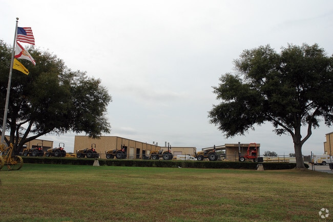
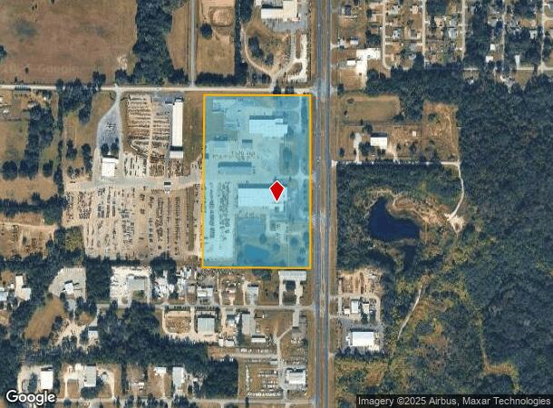
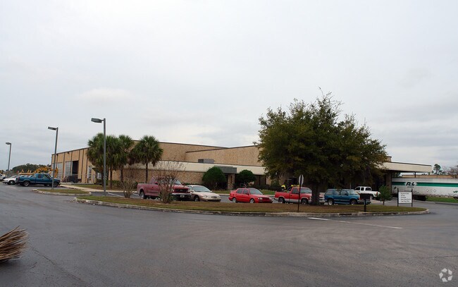
Property Record
6200 N Us Highway 441, Ocala, FL 34475
NEARBY LISTINGS FOR SALE OR LEASE
Property Detail
6200 N Us Highway 441
13358-001-00
SEC 25 TWP 14 RGE 21 E 900 FT OF NE 1/4 OF NE 1/4 EXC E 100 FT EXC N 25 FT FOR RD ROW
Storebuilding
Marion
X
Florida
12083C0319D
23.78 AC
2025
Outlying Marion County
2025
Ocala
001500
Ocala, FL
126,596 SF
DEMOGRAPHICS near 6200 N Us Highway 441
1 Mile
3 Mile
5 Mile
2024 Total Population
1,579
14,764
53,244
2029 Population
1,781
16,658
60,007
Pop Growth 2024-2029
+ 12.79%
+ 12.83%
+ 12.70%
Average Age
40
39
42
2024 Total Households
616
5,757
21,097
HH Growth 2024-2029
+ 12.82%
+ 12.80%
+ 12.90%
Median Household Inc
$36,389
$44,282
$44,917
Avg Household Size
2.50
2.50
2.30
2024 Avg HH Vehicles
2.00
2.00
2.00
Median Home Value
$215,441
$200,127
$169,938
Median Year Built
1988
1985
1984
Nearby Places
Map Layers
Map Styles
 Street
 Aerial
- Restaurants
- Banks
- Shops
- Fitness
- Groceries
Nearby Properties
Address
Land Use
TOTAL SIZE
Lot Size
Zoning
Address
Land Use
TOTAL SIZE
Lot Size
Zoning
612,196 SF
50.06 AC
M1
Address
Land Use
TOTAL SIZE
Lot Size
Zoning
617,520 SF
46.08 AC
M2
Address
Land Use
TOTAL SIZE
Lot Size
Zoning
441,040 SF
150.01 AC
M1
Address
Land Use
TOTAL SIZE
Lot Size
Zoning
135,945 SF
22.30 AC
PD
Address
Land Use
TOTAL SIZE
Lot Size
Zoning
444,381 SF
60 AC
M1
Address
Land Use
TOTAL SIZE
Lot Size
Zoning
350,895 SF
27.85 AC
M1
Address
Land Use
TOTAL SIZE
Lot Size
Zoning
140,920 SF
28.09 AC
M2
Address
Land Use
TOTAL SIZE
Lot Size
Zoning
384,930 SF
17.76 AC
M1
Address
Land Use
TOTAL SIZE
Lot Size
Zoning
73,129 SF
17.98 AC
B4
Address
Land Use
TOTAL SIZE
Lot Size
Zoning
116,876 SF
23.78 AC
M2
Address
Land Use
TOTAL SIZE
Lot Size
Zoning
47,984 SF
486.37 AC
PUD
Address
Land Use
TOTAL SIZE
Lot Size
Zoning
73,361 SF
23.20 AC
GU
Address
Land Use
TOTAL SIZE
Lot Size
Zoning
66,531 SF
26.96 AC
B2
Address
Land Use
TOTAL SIZE
Lot Size
Zoning
30,082 SF
7.92 AC
PUD
Address
Land Use
TOTAL SIZE
Lot Size
Zoning
Address
Land Use
TOTAL SIZE
Lot Size
Zoning
79,249 SF
14.46 AC
R3
Address
Land Use
TOTAL SIZE
Lot Size
Zoning
89,640 SF
33.21 AC
B5
Address
Land Use
TOTAL SIZE
Lot Size
Zoning
44,100 SF
9.60 AC
R3
Address
Land Use
TOTAL SIZE
Lot Size
Zoning
72,855 SF
47.31 AC
B2
Address
Land Use
TOTAL SIZE
Lot Size
Zoning
36,888 SF
4.81 AC
R3
Address
Land Use
TOTAL SIZE
Lot Size
Zoning
57,558 SF
9.18 AC
B4
Address
Land Use
TOTAL SIZE
Lot Size
Zoning
42,901 SF
17.03 AC
GU
Address
Land Use
TOTAL SIZE
Lot Size
Zoning
58,133 SF
29.25 AC
INST
Address
Land Use
TOTAL SIZE
Lot Size
Zoning
47,900 SF
10.29 AC
B5
Address
Land Use
TOTAL SIZE
Lot Size
Zoning
115,909 SF
11.09 AC
RPUD
Address
Land Use
TOTAL SIZE
Lot Size
Zoning
41,195 SF
4 AC
B5
Address
Land Use
TOTAL SIZE
Lot Size
Zoning
31,259 SF
5.06 AC
PD
Address
Land Use
TOTAL SIZE
Lot Size
Zoning
103,208 SF
17.91 AC
INST
Address
Land Use
TOTAL SIZE
Lot Size
Zoning
16,430 SF
59.07 AC
A3
Address
Land Use
TOTAL SIZE
Lot Size
Zoning
43,737 SF
4.02 AC
B4
The World's #1 Commercial Real Estate Marketplace
Connect with us
© 2026 CoStar Group
The information above has been obtained from sources believed reliable. While we do not doubt its accuracy we have not verified it and make no guarantee, warranty or representation about it. It is your responsibility to independently confirm its accuracy and completeness. Any projections, opinions, assumptions, or estimates used are for example only and do not represent the current or future performance of the property. The value of this transaction to you depends on tax and other factors which should be evaluated by your tax, financial, and legal advisors. You and your advisors should conduct a careful, independent investigation of the property to determine to your satisfaction the suitability of the property for your needs.