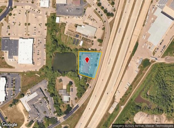
Property Record
6200 Nesbitt Rd, Fitchburg, WI 53719
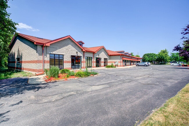
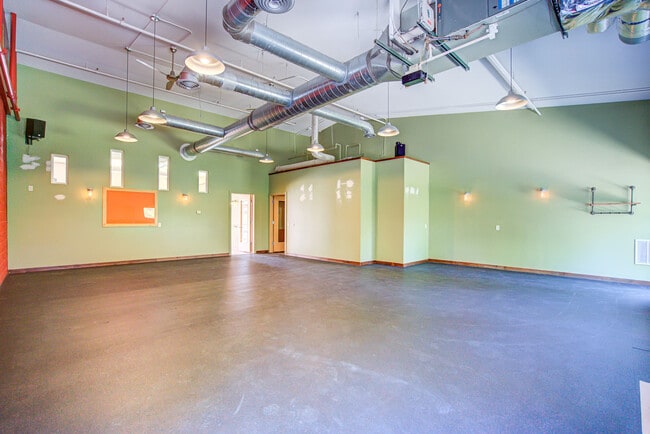
This Property Is For Sale
Current Lease Availabilities
NEARBY LISTINGS FOR SALE OR LEASE
Property Detail
6200 Nesbitt Rd
Madison, WI
Transportation Project 12
0609-072-8415-2
SEC 7-6-9 PRT E1/2 NW1/4 & NW1/4 NE1/4 COM N1/4 COR SEC 7 TH S89DEG09E 477.2 FT TO C/L USH 18 TH S20DEG10W 1043.3 FT TO POB TH N89DEG09W 226.2 FT TH S1DEG51 E 61.0 FT TH S73DEG32E 190.9 FT TO C/L USH 18 TH NELY ALG C/L 119.7 FT TO POB S UBJ TO RD & A
Commercialnec
Dane
X
Wisconsin
55025C0413G
15
2024
1.18 AC
2024
Southwest Madison
010702
Milwaukee/Madison
DEMOGRAPHICS near 6200 Nesbitt Rd
1 Mile
3 Mile
5 Mile
2024 Total Population
7,483
68,738
164,965
2029 Population
7,733
71,191
171,429
Pop Growth 2024-2029
+ 3.34%
+ 3.57%
+ 3.92%
Average Age
35
38
38
2024 Total Households
3,060
29,103
73,791
HH Growth 2024-2029
+ 3.40%
+ 3.72%
+ 4.10%
Median Household Inc
$81,960
$87,408
$82,887
Avg Household Size
2.40
2.30
2.20
2024 Avg HH Vehicles
2.00
2.00
2.00
Median Home Value
$308,370
$336,847
$366,191
Median Year Built
1990
1989
1987
Nearby Places
Map Layers
Map Styles
 Street
 Aerial
- Restaurants
- Banks
- Shops
- Fitness
- Groceries
PUBLIC TRANSPORTATION
AIRPORT
Dane County Regional/Truax Field
DRIVE
WALK
Distance
Dane County Regional/Truax Field
26 min
11.9 mi
Freight Ports
Port Milwaukee
DRIVE
WALK
Distance
Port Milwaukee
107 min
88.6 mi
Nearby Properties
Address
Land Use
TOTAL SIZE
Lot Size
Zoning
Address
Land Use
TOTAL SIZE
Lot Size
Zoning
82,796 SF
9.26 AC
SE
Address
Land Use
TOTAL SIZE
Lot Size
Zoning
21.49 AC
Address
Land Use
TOTAL SIZE
Lot Size
Zoning
56,000 SF
23.87 AC
SE
Address
Land Use
TOTAL SIZE
Lot Size
Zoning
89.21 AC
Address
Land Use
TOTAL SIZE
Lot Size
Zoning
16.45 AC
Address
Land Use
TOTAL SIZE
Lot Size
Zoning
18.97 AC
Address
Land Use
TOTAL SIZE
Lot Size
Zoning
77,296 SF
4.84 AC
TR-U1
Address
Land Use
TOTAL SIZE
Lot Size
Zoning
11.20 AC
SE
Address
Land Use
TOTAL SIZE
Lot Size
Zoning
311,672 SF
4.59 AC
PD
Address
Land Use
TOTAL SIZE
Lot Size
Zoning
17.80 AC
Address
Land Use
TOTAL SIZE
Lot Size
Zoning
324,920 SF
8.47 AC
PD
Address
Land Use
TOTAL SIZE
Lot Size
Zoning
24.62 AC
Address
Land Use
TOTAL SIZE
Lot Size
Zoning
6.39 AC
Address
Land Use
TOTAL SIZE
Lot Size
Zoning
13.98 AC
Address
Land Use
TOTAL SIZE
Lot Size
Zoning
237,225 SF
1.84 AC
PD
Address
Land Use
TOTAL SIZE
Lot Size
Zoning
Address
Land Use
TOTAL SIZE
Lot Size
Zoning
8.10 AC
Address
Land Use
TOTAL SIZE
Lot Size
Zoning
244,074 SF
7.96 AC
SR-V2
Address
Land Use
TOTAL SIZE
Lot Size
Zoning
329,670 SF
11.12 AC
SR-V2
Address
Land Use
TOTAL SIZE
Lot Size
Zoning
13.87 AC
Address
Land Use
TOTAL SIZE
Lot Size
Zoning
70,258 SF
14.37 AC
PD
Address
Land Use
TOTAL SIZE
Lot Size
Zoning
22.54 AC
Address
Land Use
TOTAL SIZE
Lot Size
Zoning
9.97 AC
Address
Land Use
TOTAL SIZE
Lot Size
Zoning
91,810 SF
6.76 AC
CC
Address
Land Use
TOTAL SIZE
Lot Size
Zoning
19.21 AC
Address
Land Use
TOTAL SIZE
Lot Size
Zoning
15.20 AC
Address
Land Use
TOTAL SIZE
Lot Size
Zoning
3.45 AC
SR-V2
Address
Land Use
TOTAL SIZE
Lot Size
Zoning
236,626 SF
5.63 AC
PD
Address
Land Use
TOTAL SIZE
Lot Size
Zoning
Address
Land Use
TOTAL SIZE
Lot Size
Zoning
12.50 AC
The World's #1 Commercial Real Estate Marketplace
Connect with us
© 2026 CoStar Group
The information above has been obtained from sources believed reliable. While we do not doubt its accuracy we have not verified it and make no guarantee, warranty or representation about it. It is your responsibility to independently confirm its accuracy and completeness. Any projections, opinions, assumptions, or estimates used are for example only and do not represent the current or future performance of the property. The value of this transaction to you depends on tax and other factors which should be evaluated by your tax, financial, and legal advisors. You and your advisors should conduct a careful, independent investigation of the property to determine to your satisfaction the suitability of the property for your needs.