Property Record
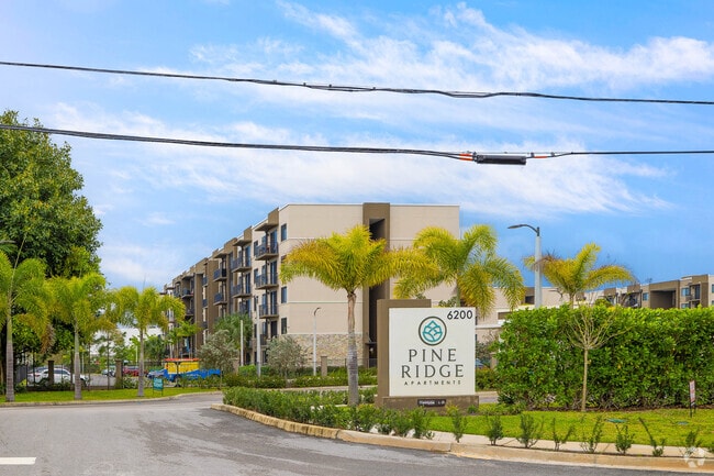
6200 Wallis Rd, West Palm Beach, FL 33413


NEARBY LISTINGS FOR SALE OR LEASE
-
-
View all West Palm Beach listings for sale on LoopNet.com
Property Detail
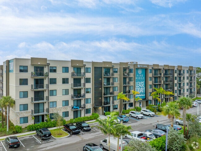
6200 Wallis Rd
West Palm Beach-Boca Raton-Delray Beach, FL
Ahs Pine Ridge Pud Par A
00-42-43-34-16-001-0000
AHS PINE RIDGE PUD PAR A K/A DEVELOPMENT
Multifamilydwelling
Palm Beach
2024
Florida
2025
11.18 AC
003201
Outer Greenacres
210,445 SF
South Florida
DEMOGRAPHICS near 6200 Wallis Rd
1 Mile
3 Mile
5 Mile
2024 Total Population
10,325
112,608
293,402
2029 Population
10,683
116,003
302,677
Pop Growth 2024-2029
+ 3.47%
+ 3.01%
+ 3.16%
Average Age
37
40
40
2024 Total Households
3,065
41,783
110,170
HH Growth 2024-2029
+ 2.84%
+ 2.89%
+ 2.92%
Median Household Inc
$79,673
$49,761
$53,925
Avg Household Size
3.10
2.60
2.50
2024 Avg HH Vehicles
2.00
2.00
2.00
Median Home Value
$334,845
$204,334
$235,083
Median Year Built
1986
1983
1984
Nearby Places
Map Layers
Map Styles
 Street
 Aerial
- Restaurants
- Banks
- Shops
- Fitness
- Groceries
PUBLIC TRANSPORTATION
COMMUTER RAIL
West Palm Beach (Tri-County Commuter - South Florida Regional Transportation Authority (Tri-Rail))
DRIVE
WALK
Distance
West Palm Beach (Tri-County Commuter - South Florida Regional Transportation Authority (Tri-Rail))
14 min
7.6 mi
West Palm Beach (Mainline - Brightline)
DRIVE
WALK
Distance
West Palm Beach (Mainline - Brightline)
16 min
7.9 mi
AIRPORT
Palm Beach International
DRIVE
WALK
Distance
Palm Beach International
9 min
3.8 mi
Freight Ports
Port of Palm Beach
DRIVE
WALK
Distance
Port of Palm Beach
24 min
11.8 mi
Nearby Properties
Address
Land Use
TOTAL SIZE
Lot Size
Zoning
Address
Land Use
TOTAL SIZE
Lot Size
Zoning
644,690 SF
44.88 AC
MUPD
Address
Land Use
TOTAL SIZE
Lot Size
Zoning
490,757 SF
12.11 AC
PIPD
Address
Land Use
TOTAL SIZE
Lot Size
Zoning
199,032 SF
769.86 AC
PO
Address
Land Use
TOTAL SIZE
Lot Size
Zoning
428,659 SF
26.16 AC
MUPD
Address
Land Use
TOTAL SIZE
Lot Size
Zoning
404,222 SF
36.71 AC
RH
Address
Land Use
TOTAL SIZE
Lot Size
Zoning
561,484 SF
21.86 AC
PO
Address
Land Use
TOTAL SIZE
Lot Size
Zoning
314,116 SF
10.25 AC
MF20
Address
Land Use
TOTAL SIZE
Lot Size
Zoning
347,853 SF
46.24 AC
PIPD
Address
Land Use
TOTAL SIZE
Lot Size
Zoning
150,344 SF
203.77 AC
PO
Address
Land Use
TOTAL SIZE
Lot Size
Zoning
379,598 SF
17.06 AC
RM-2
Address
Land Use
TOTAL SIZE
Lot Size
Zoning
379,598 SF
17.02 AC
RM-2
Address
Land Use
TOTAL SIZE
Lot Size
Zoning
52,656 SF
849.42 AC
PO
Address
Land Use
TOTAL SIZE
Lot Size
Zoning
328,512 SF
15.27 AC
PUD
Address
Land Use
TOTAL SIZE
Lot Size
Zoning
334,396 SF
19.54 AC
PO
Address
Land Use
TOTAL SIZE
Lot Size
Zoning
294,321 SF
109.37 AC
PO
Address
Land Use
TOTAL SIZE
Lot Size
Zoning
324,453 SF
25.47 AC
IL
Address
Land Use
TOTAL SIZE
Lot Size
Zoning
178,614 SF
10.42 AC
PUD
Address
Land Use
TOTAL SIZE
Lot Size
Zoning
261,118 SF
58.77 AC
IPF
Address
Land Use
TOTAL SIZE
Lot Size
Zoning
273,023 SF
12.61 AC
RM-2
Address
Land Use
TOTAL SIZE
Lot Size
Zoning
196,683 SF
8.97 AC
RPD
Address
Land Use
TOTAL SIZE
Lot Size
Zoning
275,703 SF
27.32 AC
PO
Address
Land Use
TOTAL SIZE
Lot Size
Zoning
226,094 SF
27.47 AC
CI
Address
Land Use
TOTAL SIZE
Lot Size
Zoning
209,824 SF
73.38 AC
PO
Address
Land Use
TOTAL SIZE
Lot Size
Zoning
225,393 SF
22.54 AC
MUPD
Address
Land Use
TOTAL SIZE
Lot Size
Zoning
262,228 SF
21.44 AC
CG
Address
Land Use
TOTAL SIZE
Lot Size
Zoning
118,728 SF
13.94 AC
MUPD
Address
Land Use
TOTAL SIZE
Lot Size
Zoning
192,622 SF
17.97 AC
MUPD
Address
Land Use
TOTAL SIZE
Lot Size
Zoning
147,763 SF
9.78 AC
PIPD
Address
Land Use
TOTAL SIZE
Lot Size
Zoning
122,316 SF
29.96 AC
MUPD
The World's #1 Commercial Real Estate Marketplace
Connect with us
© 2025 CoStar Group
The information above has been obtained from sources believed reliable. While we do not doubt its accuracy we have not verified it and make no guarantee, warranty or representation about it. It is your responsibility to independently confirm its accuracy and completeness. Any projections, opinions, assumptions, or estimates used are for example only and do not represent the current or future performance of the property. The value of this transaction to you depends on tax and other factors which should be evaluated by your tax, financial, and legal advisors. You and your advisors should conduct a careful, independent investigation of the property to determine to your satisfaction the suitability of the property for your needs.