Property Record
6201 Us Highway 431, Alexandria, AL 36250
NEARBY LISTINGS FOR SALE OR LEASE
-
-
View all Alexandria listings for sale on LoopNet.com
Property Detail
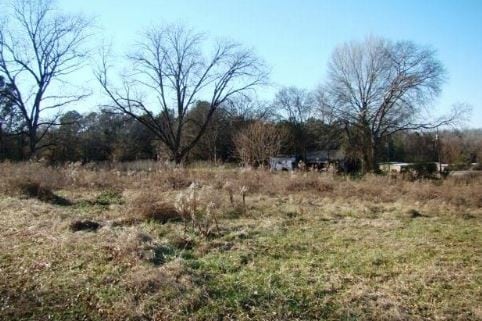
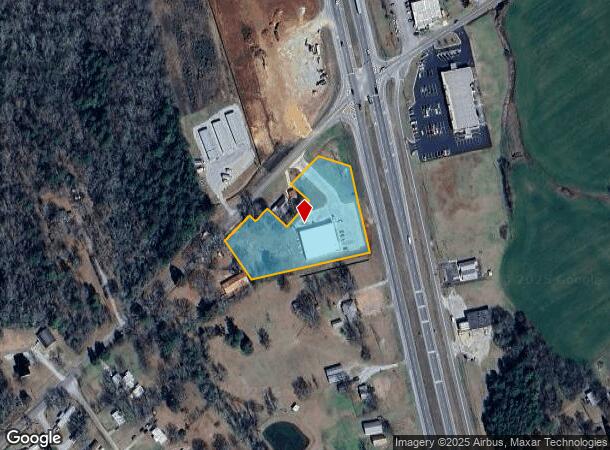
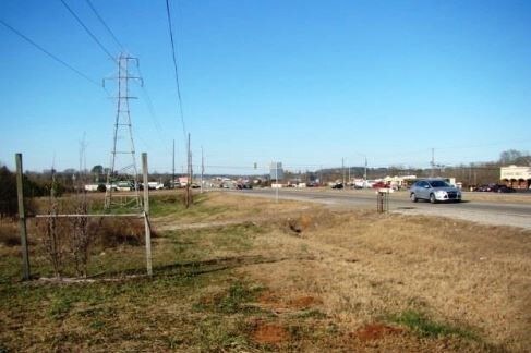
6201 Us Highway 431
13-08-34-0-002-055.000
SEC 34 TSP 14S R 7E BEG SW INT GATE 5 RD & US HWY 431 TH SW 151 SE 75 SW 110 NW 75 SW ALG ROW 57 NW ALG ROW 25 SW ALG ROW 113
Storesoffices
Calhoun
X
Alabama
01015C0145E
2.26 AC
2025
Gadsden/Anniston Area
2025
Other Market Areas
002504
Anniston-Oxford-Jacksonville, AL
10,672 SF
DEMOGRAPHICS near 6201 Us Highway 431
1 Mile
3 Mile
5 Mile
2024 Total Population
1,256
5,770
17,985
2029 Population
1,212
5,577
17,502
Pop Growth 2024-2029
(3.50%)
(3.34%)
(2.69%)
Average Age
41
41
41
2024 Total Households
483
2,240
7,107
HH Growth 2024-2029
(3.52%)
(3.44%)
(2.76%)
Median Household Inc
$82,310
$78,068
$65,183
Avg Household Size
2.50
2.50
2.50
2024 Avg HH Vehicles
2.00
3.00
2.00
Median Home Value
$165,929
$157,443
$135,269
Median Year Built
1982
1983
1979
Nearby Places
- Restaurants
- Banks
- Shops
- Fitness
- Groceries
PUBLIC TRANSPORTATION
COMMUTER RAIL
Anniston Amtrak Station (Crescent - Amtrak)
DRIVE
WALK
Distance
Anniston Amtrak Station (Crescent - Amtrak)
15 min
9.7 mi
Freight Ports
Port of Mobile
DRIVE
WALK
Distance
Port of Mobile
325 min
283.8 mi
SALE & LEASE HISTORY
LISTING DATE
SALE/LEASE

Nov 01, 2018
For Sale
Nearby Properties
Address
Land Use
TOTAL SIZE
Lot Size
Zoning
Address
Land Use
TOTAL SIZE
Lot Size
Zoning
2,313 SF
19 AC
Address
Land Use
TOTAL SIZE
Lot Size
Zoning
6,610 SF
23 AC
Address
Land Use
TOTAL SIZE
Lot Size
Zoning
39,064 SF
6 AC
Address
Land Use
TOTAL SIZE
Lot Size
Zoning
3,400 SF
12.28 AC
Address
Land Use
TOTAL SIZE
Lot Size
Zoning
9,519 SF
17 AC
Address
Land Use
TOTAL SIZE
Lot Size
Zoning
26,956 SF
4.05 AC
Address
Land Use
TOTAL SIZE
Lot Size
Zoning
6,000 SF
35 AC
Address
Land Use
TOTAL SIZE
Lot Size
Zoning
14,708 SF
4.78 AC
Address
Land Use
TOTAL SIZE
Lot Size
Zoning
19,080 SF
3 AC
Address
Land Use
TOTAL SIZE
Lot Size
Zoning
7,724 SF
4.83 AC
Address
Land Use
TOTAL SIZE
Lot Size
Zoning
32,000 SF
16.60 AC
Address
Land Use
TOTAL SIZE
Lot Size
Zoning
11,078 SF
24.05 AC
Address
Land Use
TOTAL SIZE
Lot Size
Zoning
8,665 SF
8 AC
Address
Land Use
TOTAL SIZE
Lot Size
Zoning
3,857 SF
4.10 AC
Address
Land Use
TOTAL SIZE
Lot Size
Zoning
51,800 SF
4.09 AC
Address
Land Use
TOTAL SIZE
Lot Size
Zoning
3,320 SF
2.60 AC
Address
Land Use
TOTAL SIZE
Lot Size
Zoning
4,000 SF
2.82 AC
Address
Land Use
TOTAL SIZE
Lot Size
Zoning
3,752 SF
2.98 AC
Address
Land Use
TOTAL SIZE
Lot Size
Zoning
17,270 SF
2.11 AC
Address
Land Use
TOTAL SIZE
Lot Size
Zoning
3,553 SF
1.17 AC
Address
Land Use
TOTAL SIZE
Lot Size
Zoning
16,492 SF
1.46 AC
Address
Land Use
TOTAL SIZE
Lot Size
Zoning
10,632 SF
3.04 AC
Address
Land Use
TOTAL SIZE
Lot Size
Zoning
17,351 SF
2.49 AC
Address
Land Use
TOTAL SIZE
Lot Size
Zoning
10,500 SF
8.10 AC
Address
Land Use
TOTAL SIZE
Lot Size
Zoning
5,084 SF
2.12 AC
Address
Land Use
TOTAL SIZE
Lot Size
Zoning
3,318 SF
0.93 AC
Address
Land Use
TOTAL SIZE
Lot Size
Zoning
3.20 AC
Address
Land Use
TOTAL SIZE
Lot Size
Zoning
6,068 SF
4.75 AC
Address
Land Use
TOTAL SIZE
Lot Size
Zoning
10,636 SF
1.82 AC
The World's #1 Commercial Real Estate Marketplace
Connect with us
© 2025 CoStar Group
The information above has been obtained from sources believed reliable. While we do not doubt its accuracy we have not verified it and make no guarantee, warranty or representation about it. It is your responsibility to independently confirm its accuracy and completeness. Any projections, opinions, assumptions, or estimates used are for example only and do not represent the current or future performance of the property. The value of this transaction to you depends on tax and other factors which should be evaluated by your tax, financial, and legal advisors. You and your advisors should conduct a careful, independent investigation of the property to determine to your satisfaction the suitability of the property for your needs.