Property Record
6201 W Maple Rd, West Bloomfield, MI 48322


NEARBY LISTINGS FOR SALE OR LEASE
Property Detail
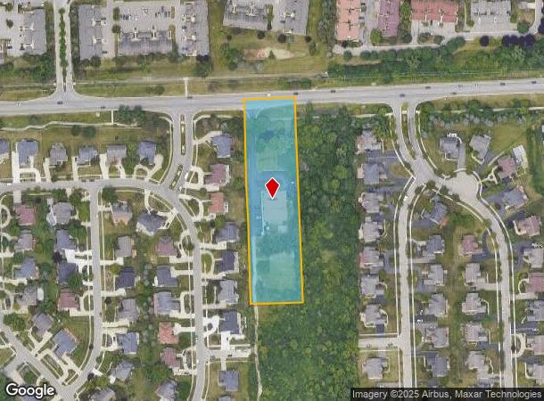
6201 W Maple Rd
18-33-200-004
T2N, R9E, SEC 33 PART OF NE 1/4 BEG AT PT DIST E 991.37 FT FROM N 1/4 COR, TH S 663 FT, TH E 164.25 FT, TH N 663 FT, TH W 164.25 FT TO BEG 2.50 A
Daycare
Oakland
X
Michigan
26125C0492F
2.50 AC
2024
Bloomfield West
2024
Detroit
157700
Detroit-Warren-Dearborn, MI
6,489 SF
DEMOGRAPHICS near 6201 W Maple Rd
1 Mile
3 Mile
5 Mile
2024 Total Population
6,621
58,102
151,669
2029 Population
6,537
57,458
150,283
Pop Growth 2024-2029
(1.27%)
(1.11%)
(0.91%)
Average Age
44
45
45
2024 Total Households
2,427
22,256
60,997
HH Growth 2024-2029
(1.28%)
(1.03%)
(0.84%)
Median Household Inc
$125,332
$123,547
$110,184
Avg Household Size
2.70
2.50
2.40
2024 Avg HH Vehicles
2.00
2.00
2.00
Median Home Value
$326,570
$386,842
$394,733
Median Year Built
1966
1974
1975
Nearby Places
Map Layers
Map Styles
 Street
 Aerial
- Restaurants
- Banks
- Shops
- Fitness
- Groceries
PUBLIC TRANSPORTATION
COMMUTER RAIL
Pontiac Amtrak Station (Wolverine - Amtrak)
DRIVE
WALK
Distance
Pontiac Amtrak Station (Wolverine - Amtrak)
19 min
10.0 mi
AIRPORT
Detroit Metro Wayne County
DRIVE
WALK
Distance
Detroit Metro Wayne County
41 min
32.8 mi
Windsor International
DRIVE
WALK
Distance
Windsor International
58 min
34.3 mi
Freight Ports
Port of Toledo
DRIVE
WALK
Distance
Port of Toledo
91 min
74.4 mi
Nearby Properties
Address
Land Use
TOTAL SIZE
Lot Size
Zoning
Address
Land Use
TOTAL SIZE
Lot Size
Zoning
308,794 SF
76.30 AC
RI
Address
Land Use
TOTAL SIZE
Lot Size
Zoning
659,897 SF
53.96 AC
AI
Address
Land Use
TOTAL SIZE
Lot Size
Zoning
315,206 SF
3.85 AC
AI
Address
Land Use
TOTAL SIZE
Lot Size
Zoning
121,382 SF
10.84 AC
BI
Address
Land Use
TOTAL SIZE
Lot Size
Zoning
427,062 SF
31.20 AC
AI
Address
Land Use
TOTAL SIZE
Lot Size
Zoning
411,118 SF
43.95 AC
AI
Address
Land Use
TOTAL SIZE
Lot Size
Zoning
204,652 SF
9.62 AC
BI
Address
Land Use
TOTAL SIZE
Lot Size
Zoning
367,354 SF
62.73 AC
AI
Address
Land Use
TOTAL SIZE
Lot Size
Zoning
188,643 SF
12.81 AC
IV
Address
Land Use
TOTAL SIZE
Lot Size
Zoning
271,650 SF
12.88 AC
BI
Address
Land Use
TOTAL SIZE
Lot Size
Zoning
352,098 SF
28.94 AC
BI
Address
Land Use
TOTAL SIZE
Lot Size
Zoning
269,975 SF
23.88 AC
AI
Address
Land Use
TOTAL SIZE
Lot Size
Zoning
287,023 SF
22.20 AC
Address
Land Use
TOTAL SIZE
Lot Size
Zoning
Address
Land Use
TOTAL SIZE
Lot Size
Zoning
226,834 SF
21.59 AC
AI
Address
Land Use
TOTAL SIZE
Lot Size
Zoning
246,695 SF
18.46 AC
BI
Address
Land Use
TOTAL SIZE
Lot Size
Zoning
249,084 SF
19.65 AC
AI
Address
Land Use
TOTAL SIZE
Lot Size
Zoning
115,400 SF
9.38 AC
BI
Address
Land Use
TOTAL SIZE
Lot Size
Zoning
260,330 SF
21.04 AC
AI
Address
Land Use
TOTAL SIZE
Lot Size
Zoning
276,825 SF
19.05 AC
AI
Address
Land Use
TOTAL SIZE
Lot Size
Zoning
142,043 SF
17.87 AC
AI
Address
Land Use
TOTAL SIZE
Lot Size
Zoning
244,500 SF
7.80 AC
AI
Address
Land Use
TOTAL SIZE
Lot Size
Zoning
158,279 SF
3.63 AC
BI
Address
Land Use
TOTAL SIZE
Lot Size
Zoning
274,691 SF
19.57 AC
AI
Address
Land Use
TOTAL SIZE
Lot Size
Zoning
167,790 SF
13.33 AC
BI
Address
Land Use
TOTAL SIZE
Lot Size
Zoning
89,878 SF
11.31 AC
BI
Address
Land Use
TOTAL SIZE
Lot Size
Zoning
243,820 SF
19.71 AC
AI
Address
Land Use
TOTAL SIZE
Lot Size
Zoning
45,893 SF
5.62 AC
AI
Address
Land Use
TOTAL SIZE
Lot Size
Zoning
253,037 SF
16.97 AC
AI
Address
Land Use
TOTAL SIZE
Lot Size
Zoning
139,227 SF
13.13 AC
BI
The World's #1 Commercial Real Estate Marketplace
Connect with us
© 2025 CoStar Group
The information above has been obtained from sources believed reliable. While we do not doubt its accuracy we have not verified it and make no guarantee, warranty or representation about it. It is your responsibility to independently confirm its accuracy and completeness. Any projections, opinions, assumptions, or estimates used are for example only and do not represent the current or future performance of the property. The value of this transaction to you depends on tax and other factors which should be evaluated by your tax, financial, and legal advisors. You and your advisors should conduct a careful, independent investigation of the property to determine to your satisfaction the suitability of the property for your needs.