Property Record
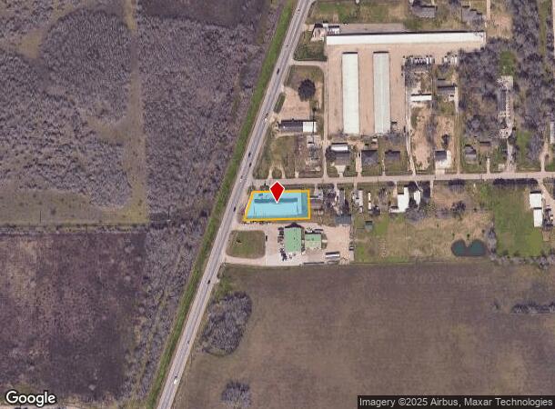
6209 Fm 521 Rd, Rosharon, TX 77583

NEARBY LISTINGS FOR SALE OR LEASE
Property Detail
6209 Fm 521 Rd
Houston-Pasadena-The Woodlands, TX
M Escalero
0170-00-000-1101-907
0170 M ESCALERO, ACRES 0.4696, BLOCK 1, KERALA PLAZA FM 521 DEVELOPMENT, COMMERCIAL RESERVE
Commercialnec
Fort Bend
X
Texas
48039C0105K
1
2023
0.47 AC
2025
Far South
674506
Houston
900 SF
DEMOGRAPHICS near 6209 Fm 521 Rd
1 Mile
3 Mile
5 Mile
2024 Total Population
3,290
51,470
123,647
2029 Population
4,141
61,827
147,297
Pop Growth 2024-2029
+ 25.87%
+ 20.12%
+ 19.13%
Average Age
33
34
35
2024 Total Households
955
15,572
37,917
HH Growth 2024-2029
+ 26.28%
+ 20.56%
+ 19.57%
Median Household Inc
$75,442
$89,699
$101,998
Avg Household Size
3.40
3.30
3.20
2024 Avg HH Vehicles
2.00
2.00
2.00
Median Home Value
$175,489
$256,632
$306,747
Median Year Built
2007
2007
2010
Nearby Places
Map Layers
Map Styles
 Street
 Aerial
- Restaurants
- Banks
- Shops
- Fitness
- Groceries
PUBLIC TRANSPORTATION
AIRPORT
William P Hobby
DRIVE
WALK
Distance
William P Hobby
35 min
20.0 mi
Freight Ports
Port of Houston
DRIVE
WALK
Distance
Port of Houston
40 min
24.6 mi
SALE & LEASE HISTORY
LISTING DATE
SALE/LEASE

May 15, 2024
For Lease
Aug 25, 2022
For Lease
Nearby Properties
Address
Land Use
TOTAL SIZE
Lot Size
Zoning
Address
Land Use
TOTAL SIZE
Lot Size
Zoning
Address
Land Use
TOTAL SIZE
Lot Size
Zoning
359,733 SF
62.50 AC
Address
Land Use
TOTAL SIZE
Lot Size
Zoning
1,764 SF
39.64 AC
ST
Address
Land Use
TOTAL SIZE
Lot Size
Zoning
123,079 SF
14.99 AC
Address
Land Use
TOTAL SIZE
Lot Size
Zoning
82,400 SF
10.85 AC
I
Address
Land Use
TOTAL SIZE
Lot Size
Zoning
537.89 AC
Address
Land Use
TOTAL SIZE
Lot Size
Zoning
127,500 SF
7.60 AC
Address
Land Use
TOTAL SIZE
Lot Size
Zoning
105,790 SF
12.82 AC
X
Address
Land Use
TOTAL SIZE
Lot Size
Zoning
13.85 AC
Address
Land Use
TOTAL SIZE
Lot Size
Zoning
70,000 SF
64.91 AC
Address
Land Use
TOTAL SIZE
Lot Size
Zoning
21,410 SF
16 AC
Address
Land Use
TOTAL SIZE
Lot Size
Zoning
2,000 SF
24.85 AC
Address
Land Use
TOTAL SIZE
Lot Size
Zoning
28,633 SF
9.36 AC
Address
Land Use
TOTAL SIZE
Lot Size
Zoning
224.26 AC
Address
Land Use
TOTAL SIZE
Lot Size
Zoning
4.30 AC
Address
Land Use
TOTAL SIZE
Lot Size
Zoning
17,481 SF
12.54 AC
Address
Land Use
TOTAL SIZE
Lot Size
Zoning
37,000 SF
6.06 AC
0218
Address
Land Use
TOTAL SIZE
Lot Size
Zoning
274.73 AC
Address
Land Use
TOTAL SIZE
Lot Size
Zoning
Address
Land Use
TOTAL SIZE
Lot Size
Zoning
114,723 SF
20.13 AC
0007
Address
Land Use
TOTAL SIZE
Lot Size
Zoning
2.92 AC
Address
Land Use
TOTAL SIZE
Lot Size
Zoning
19.05 AC
Address
Land Use
TOTAL SIZE
Lot Size
Zoning
91.43 AC
SQ
Address
Land Use
TOTAL SIZE
Lot Size
Zoning
2.31 AC
S
Address
Land Use
TOTAL SIZE
Lot Size
Zoning
7.86 AC
SN
Address
Land Use
TOTAL SIZE
Lot Size
Zoning
13,134 SF
2.08 AC
Address
Land Use
TOTAL SIZE
Lot Size
Zoning
70,260 SF
4.41 AC
SY
Address
Land Use
TOTAL SIZE
Lot Size
Zoning
16,512 SF
3.04 AC
Address
Land Use
TOTAL SIZE
Lot Size
Zoning
Address
Land Use
TOTAL SIZE
Lot Size
Zoning
20,770 SF
2.93 AC
XY
The World's #1 Commercial Real Estate Marketplace
Connect with us
© 2026 CoStar Group
The information above has been obtained from sources believed reliable. While we do not doubt its accuracy we have not verified it and make no guarantee, warranty or representation about it. It is your responsibility to independently confirm its accuracy and completeness. Any projections, opinions, assumptions, or estimates used are for example only and do not represent the current or future performance of the property. The value of this transaction to you depends on tax and other factors which should be evaluated by your tax, financial, and legal advisors. You and your advisors should conduct a careful, independent investigation of the property to determine to your satisfaction the suitability of the property for your needs.